Unleash the explorer within you with the latest breakthrough in remote sensing technology: Backpack Mounted LiDAR. This revolutionary tool is transforming the way fieldwork is conducted, enabling researchers and professionals to obtain high-resolution, accurate data like never before. Say goodbye to the limitations of traditional LiDAR and embrace the freedom to explore even the most inaccessible terrains. In this comprehensive guide, we’ll dive into the benefits and applications of Backpack Mounted LiDAR, and how you can harness its power to elevate your fieldwork experience.
What is Backpack Mounted LiDAR?
Backpack Mounted LiDAR, also known as wearable LiDAR, is an innovative remote sensing technology that combines a portable LiDAR (Light Detection and Ranging) system with a backpack carrier. This allows users to collect high-resolution, 3D spatial data while walking through various terrains. The LiDAR system, which uses laser pulses to measure distances and generate detailed point clouds, is mounted on a lightweight, ergonomic backpack, making it easy to transport and operate in the field.
How Does Backpack Mounted LiDAR Work?
The operation of Backpack Mounted LiDAR is based on the principles of traditional LiDAR technology. It emits laser pulses that travel to the target and reflect back to the LiDAR sensor. By measuring the time it takes for the laser pulses to return, the system calculates the distance between the sensor and the target. This process is repeated thousands of times per second, resulting in a dense point cloud that represents the surveyed environment in three dimensions.
In addition to the LiDAR sensor, Backpack Mounted LiDAR systems typically include a GPS receiver and an Inertial Measurement Unit (IMU). The GPS receiver provides accurate positioning data, while the IMU measures the user’s movement, orientation, and acceleration. By integrating these components, the system can produce precise, georeferenced point clouds even in challenging conditions, such as dense vegetation or rough terrain.
Advantages of Backpack Mounted LiDAR in Mapping
Backpack Mounted LiDAR offers numerous advantages over traditional, vehicle-mounted or airborne LiDAR systems, particularly for mapping applications.
Mobility and Accessibility
One of the key benefits of Backpack Mounted LiDAR is its unparalleled mobility. The portable design allows users to access remote or hard-to-reach locations that would be difficult or impossible to survey using traditional methods. This opens up new possibilities for mapping projects in challenging environments, such as dense forests, steep slopes, or urban areas with narrow alleyways.
Enhanced Data Collection
Backpack Mounted LiDAR systems can collect high-resolution, 3D data at a rapid pace, often providing more detailed and accurate results than other surveying methods. With a high point density and the ability to capture complex, multi-layered environments, Backpack Mounted LiDAR is especially well-suited for mapping vegetation, infrastructure, or archaeological sites.
Time and Cost Efficiency
By allowing users to survey large areas on foot, Backpack Mounted LiDAR can significantly reduce the time and cost associated with traditional surveying methods. There’s no need for expensive equipment rentals, such as helicopters or specialized vehicles, and the streamlined data collection process can save valuable hours in the field.
Improved Safety
In many cases, Backpack Mounted LiDAR can help improve safety for fieldworkers. The wearable design eliminates the need for potentially hazardous equipment setups or working in close proximity to moving vehicles. Additionally, the LiDAR system can be operated from a safe distance, reducing the risk of injury in unstable or dangerous environments.
Environmental Impact Reduction
Finally, the use of Backpack Mounted LiDAR can minimize the environmental impact of mapping projects. With no need for heavy vehicles or extensive site preparation, this method can preserve delicate ecosystems and reduce carbon emissions.
Different Types of Backpack Mounted LiDAR
There are several types of Backpack Mounted LiDAR systems available, each with its own set of features and capabilities. These systems can be broadly categorized into two main types:
Single-Beam Backpack Mounted LiDAR
Single-beam systems use a single laser emitter and detector to collect data. This type of Backpack Mounted LiDAR is generally more affordable and lightweight, making it suitable for smaller projects or users with limited budgets. However, the data collection rate and point density may be lower compared to multi-beam systems, which could affect the level of detail and accuracy in the resulting point cloud.
Multi-Beam Backpack Mounted LiDAR
Multi-beam systems use multiple laser emitters and detectors to collect data simultaneously. This allows for a faster data collection rate and higher point density, resulting in more detailed and accurate point clouds. Multi-beam Backpack Mounted LiDAR systems are generally more expensive and heavier than single-beam systems, but they can provide superior performance for larger, more complex projects.
When choosing a Backpack Mounted LiDAR system, it’s important to consider factors such as the specific requirements of your project, your budget, and the desired level of detail in the final point cloud.
Limitations of Backpack Mounted LiDAR
While Backpack Mounted LiDAR offers numerous advantages for fieldwork and mapping applications, it is important to be aware of some limitations inherent to this technology:
Line of Sight
LiDAR technology relies on direct line of sight between the sensor and the target. This means that objects or features that are obscured by vegetation, buildings, or other obstructions may not be accurately represented in the point cloud. In some cases, multiple surveys from different angles or supplementary data collection methods may be necessary to fill in gaps or verify results.
Accuracy
Although Backpack Mounted LiDAR systems can produce high-resolution, accurate data, the level of accuracy may be affected by factors such as the quality of the GPS signal, the performance of the IMU, or the specific LiDAR sensor used. In some cases, additional ground control points or post-processing techniques may be required to improve the accuracy of the final point cloud.
Weather Conditions
LiDAR data collection can be impacted by adverse weather conditions, such as heavy rain, fog, or high winds. These conditions can affect the accuracy and quality of the data, and may require rescheduling or repeating surveys in more favorable conditions.
Battery Life
Battery life can be a limiting factor for Backpack Mounted LiDAR systems, especially during long surveys or in remote locations. Users should be prepared to carry spare batteries or plan their surveys accordingly to ensure they can complete their work without interruptions due to battery depletion.
Despite these limitations, Backpack Mounted LiDAR remains a powerful and versatile tool for mapping and fieldwork applications. By understanding and addressing these challenges, users can maximize the benefits of this technology and achieve high-quality results in a wide range of scenarios.
Applications of Backpack Mounted LiDAR in Various Fields
Backpack Mounted LiDAR technology has found numerous applications across a wide range of industries, thanks to its unique combination of mobility, accuracy, and versatility. Here are some of the most prominent use cases:
Forest Mapping
In forestry, Backpack Mounted LiDAR can be used to measure tree heights, canopy density, and biomass, as well as to identify individual tree species. This information is crucial for forest management, conservation efforts, and monitoring the health of ecosystems. By providing detailed, accurate data on forest structure, Backpack Mounted LiDAR can help foresters make informed decisions and optimize their management practices.
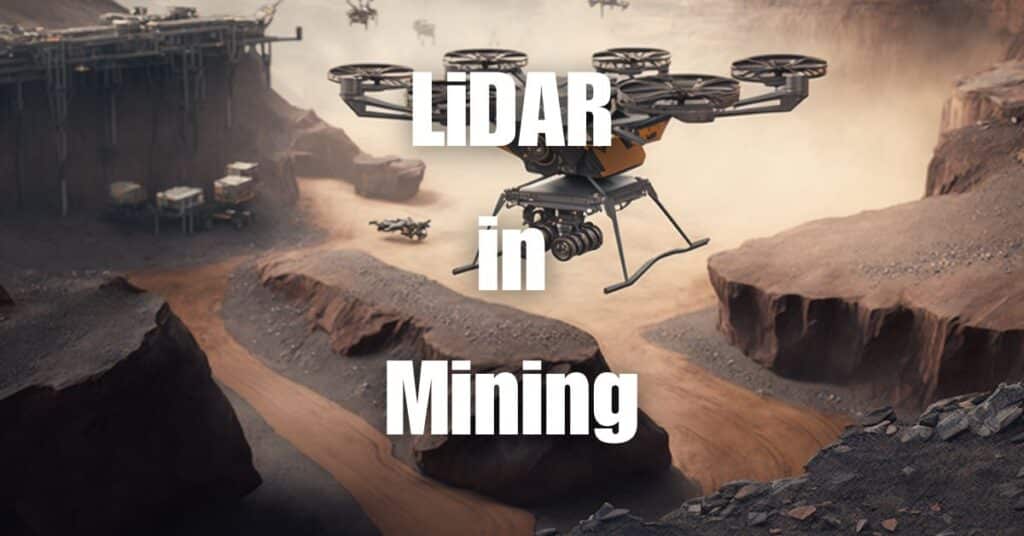
Mining Exploration
Backpack Mounted LiDAR is an invaluable tool for mining exploration, as it enables geologists and surveyors to quickly and accurately map complex terrains, identify potential mineral deposits, and assess the stability of mine structures. With its ability to penetrate dense vegetation and provide detailed topographic data, Backpack Mounted LiDAR can significantly improve the efficiency and safety of mining operations.
Agriculture Mapping
In agriculture, Backpack Mounted LiDAR can be used to create high-resolution topographic maps, assess crop health, and monitor soil conditions. This data can help farmers optimize their irrigation systems, monitor crop growth, and detect potential issues before they become critical. By providing precise, up-to-date information on their fields, Backpack Mounted LiDAR can help farmers improve their yields and reduce the environmental impact of their operations.
Archaeology
Archaeologists have adopted Backpack Mounted LiDAR to uncover hidden archaeological features, such as ancient structures, settlements, or burial sites, that may be obscured by vegetation or soil. By providing high-resolution, 3D data on the landscape, this technology can help archaeologists identify potential excavation sites, plan their fieldwork, and reconstruct the history of the area.
Infrastructure Inspection
Backpack Mounted LiDAR can also be used to inspect and monitor infrastructure, such as bridges, dams, or power lines. By providing detailed, accurate data on the condition of these structures, this technology can help engineers identify potential issues, plan maintenance work, and ensure the safety and longevity of critical infrastructure.
How to Choose the Right Backpack Mounted LiDAR for Your Project
Selecting the right Backpack Mounted LiDAR system for your project is crucial to ensure optimal results and return on investment. Here are some factors to consider when choosing a system:
Project Requirements
First and foremost, consider the specific requirements of your project. What level of detail and accuracy do you need? What are the environmental conditions and terrain of the survey area? Understanding your project’s unique needs will help you narrow down the options and choose a system that meets your expectations.
Budget
Backpack Mounted LiDAR systems can vary significantly in price, depending on factors such as the type of LiDAR sensor, the number of beams, and additional features like GPS or IMU integration. Determine your budget and select a system that provides the best value for your money.
Ease of Use
Consider the ease of use and user-friendliness of the Backpack Mounted LiDAR system. Look for features such as ergonomic design, intuitive software, and comprehensive training and support to ensure that you can operate the system efficiently and effectively.
Data Quality
The quality of the data collected by the Backpack Mounted LiDAR system is paramount. Research the performance specifications of the LiDAR sensor, such as range, accuracy, and point density, and choose a system that meets or exceeds your project’s requirements.
Compatibility
Ensure that the Backpack Mounted LiDAR system is compatible with your existing software and hardware, or be prepared to invest in the necessary upgrades or additional tools. Compatibility is crucial for smooth data processing, analysis, and integration with your workflow.
Top Backpack Mounted LiDAR Solutions for Agriculture Mapping
Agriculture mapping requires high-resolution, accurate data to optimize crop management and monitor field conditions. Several Backpack Mounted LiDAR systems have proven to be particularly effective for this application. Here are some top solutions to consider:
1. Leica Geosystems Pegasus:Backpack
The Pegasus:Backpack from Leica Geosystems is a versatile and lightweight solution that combines LiDAR, GPS, and IMU technology. With its high-performance sensor, it offers excellent point density and accuracy, making it suitable for agriculture mapping applications.
2. Velodyne Puck LITE
The Velodyne Puck LITE is a compact, lightweight LiDAR sensor that can be easily integrated into a backpack system. Its 360-degree field of view and high data rate make it an excellent choice for mapping agricultural fields and capturing detailed information on crop conditions.
3. RIEGL VZ-2000i
The RIEGL VZ-2000i is a high-performance, long-range LiDAR sensor that can be adapted for backpack use. Its high point density and superior accuracy make it ideal for mapping complex agricultural environments and assessing crop health.
When selecting a Backpack Mounted LiDAR system for agriculture mapping, consider factors such as the sensor’s performance specifications, compatibility with your existing workflow, and the availability of training and support.
Backpack Mounted LiDAR for Archaeology: What You Need to Know
Backpack Mounted LiDAR has become an indispensable tool in archaeological research, allowing researchers to uncover hidden structures and features that may be buried beneath vegetation or soil. Here’s what you need to know about using Backpack Mounted LiDAR in archaeological projects:
Rapid Data Collection
Backpack Mounted LiDAR enables archaeologists to quickly and accurately survey large areas, providing high-resolution, 3D data that can be used to identify potential excavation sites and plan fieldwork. This technology can significantly reduce the time and effort required to map archaeological sites and analyze the landscape.
Non-Invasive Surveying
One of the key advantages of Backpack Mounted LiDAR in archaeology is its non-invasive nature. Unlike traditional excavation techniques, LiDAR does not require physical contact with the ground or disturbance of the site, preserving the integrity of the archaeological record and minimizing the risk of damage to fragile artifacts or structures.
Enhanced Visualization
Backpack Mounted LiDAR data can be processed and visualized in various ways, such as digital elevation models, hillshade maps, or 3D reconstructions. This enables archaeologists to better understand the spatial relationships between features and gain new insights into the history of the site.
Integration with Other Data Sources
Backpack Mounted LiDAR data can be combined with other types of remote sensing data, such as aerial or satellite imagery, to create a more comprehensive picture of the archaeological landscape. This integrated approach can help researchers identify patterns and trends that may not be apparent from a single data source.
When using Backpack Mounted LiDAR for archaeology, it’s essential to choose a system with high point density and accuracy, as well as the ability to penetrate dense vegetation and soil layers. Additionally, ensure that the system is compatible with your existing software and hardware, and seek out training and support resources to maximize the effectiveness of your work.
Backpack Mounted LiDAR for Urban Planning and Infrastructure Management
Backpack Mounted LiDAR can play a crucial role in urban planning and infrastructure management, providing detailed, accurate data on the built environment and helping professionals make informed decisions about future development and maintenance projects. Here are some key benefits and applications of Backpack Mounted LiDAR in this context:
Detailed Asset Inventories
Backpack Mounted LiDAR can be used to create comprehensive, up-to-date inventories of urban assets, such as buildings, roads, and utility infrastructure. This data can help urban planners and infrastructure managers identify areas in need of repair or improvement and prioritize projects based on objective information.
Analysis of Urban Green Spaces
By providing high-resolution data on vegetation and tree canopy, Backpack Mounted LiDAR can help urban planners analyze the distribution and quality of green spaces within cities. This information can be used to identify gaps in green space coverage, develop strategies to increase urban greening, and monitor the effectiveness of such initiatives.
Flood Risk Assessment
Backpack Mounted LiDAR can be used to create detailed topographic maps of urban areas, which can help planners and engineers assess the risk of flooding and develop strategies for flood prevention and mitigation. By providing accurate information on elevation and terrain, Backpack Mounted LiDAR can help cities become more resilient to climate change and protect vulnerable communities.
Transportation Planning
High-resolution LiDAR data can be used to analyze transportation networks and identify potential bottlenecks or areas in need of improvement. By providing detailed information on road conditions, traffic patterns, and pedestrian infrastructure, Backpack Mounted LiDAR can help planners develop more efficient and sustainable transportation systems.
Backpack Mounted LiDAR for Environmental Monitoring and Conservation
Backpack Mounted LiDAR has emerged as a valuable tool for environmental monitoring and conservation efforts, offering unique insights into the structure and dynamics of ecosystems. Here are some key applications of Backpack Mounted LiDAR in this field:
Habitat Mapping and Biodiversity Assessment
By providing detailed information on vegetation structure and topography, Backpack Mounted LiDAR can help ecologists and conservationists map habitats and assess biodiversity at various scales. This information can be used to identify areas of high conservation value, monitor habitat changes over time, and evaluate the effectiveness of conservation interventions.
Erosion and Landslide Monitoring
Backpack Mounted LiDAR can be used to monitor erosion and landslide processes in vulnerable areas, such as steep slopes or riverbanks. By providing accurate, high-resolution data on terrain and vegetation, this technology can help researchers identify potential risk factors, develop mitigation strategies, and monitor the effectiveness of these measures.
Wetland Mapping and Monitoring
Wetlands are vital ecosystems that provide numerous ecological services, such as water filtration, flood control, and carbon sequestration. Backpack Mounted LiDAR can help researchers map and monitor wetland systems, providing detailed information on vegetation, hydrology, and topography. This data can be used to assess the health of wetlands, identify threats, and develop strategies for their protection and restoration.
Climate Change Research
Backpack Mounted LiDAR can play a critical role in climate change research by providing accurate data on land cover, vegetation structure, and topography. This information can help scientists monitor the impacts of climate change on ecosystems, such as shifts in species distributions or changes in vegetation composition, and develop strategies for climate change adaptation and mitigation.
When using Backpack Mounted LiDAR for environmental monitoring and conservation, it’s crucial to select a system with the appropriate specifications and capabilities to meet the unique challenges and requirements of these applications. Additionally, ensure compatibility with existing software and hardware and seek out training and support resources to maximize the effectiveness of your work.
In conclusion, Backpack Mounted LiDAR is a game-changing technology that is revolutionizing fieldwork across various disciplines. Its numerous benefits, including mobility, efficiency, and improved safety, make it an essential tool for modern researchers and professionals.
If you’re interested in learning more about the applications and benefits of aerial LiDAR technology, don’t miss our informative article on Aerial LiDAR 101. This comprehensive guide will provide you with further insights into how LiDAR can improve your projects and help you make informed decisions about the best solutions for your needs.
Should you require any drone services or have any questions about LiDAR technology, do not hesitate to contact Blue Falcon for expert assistance. Our team of professionals is ready to help you unleash your inner explorer and take your fieldwork to new heights.