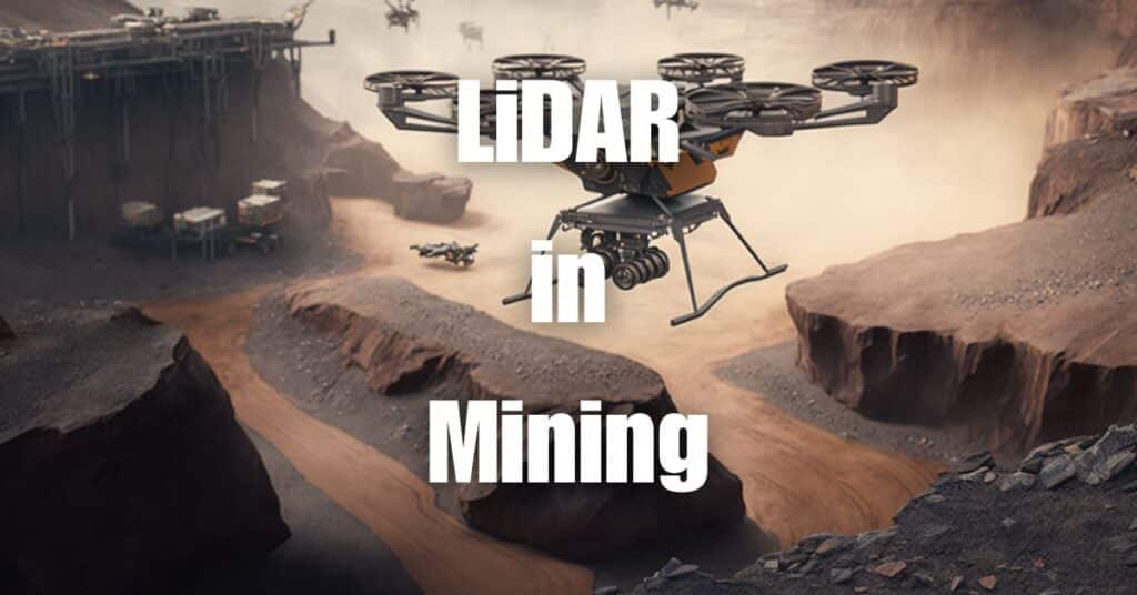
In the fast-paced world of mining, companies are constantly seeking innovative solutions to improve efficiency, safety, and decision-making. One such technology that is rapidly gaining traction in the industry is LiDAR in mining. By combining LiDAR technology with drone capabilities, mining companies can gain unprecedented insights into their operations, leading to better outcomes and increased profitability. In this article, we’ll explore the depths of drone LiDAR in mining, uncovering its many benefits and real-world applications.
What is LiDAR?
LiDAR, an acronym for Light Detection and Ranging, is a remote sensing technology that uses laser light to measure distances and generate detailed, accurate representations of the Earth’s surface. This technology works by emitting laser pulses and measuring the time it takes for the light to bounce back after hitting an object. By calculating the distance based on the speed of light and the time taken for the laser pulse to return, a LiDAR system can create detailed 3D maps of the terrain and surface features.
LiDAR has found numerous applications across various industries, including forestry, agriculture, archaeology, and civil engineering. One of its most promising applications is in the mining industry, where it has revolutionized surveying and mapping processes, providing valuable insights for decision-making and improved safety.
Traditional Mining Survey Methods
Before delving into the benefits of drone LiDAR in mining, it’s essential to understand the traditional methods of mining survey and their limitations. Traditional mining survey methods include ground-based surveying and manned aircraft surveys.
Ground-based Surveying
Ground-based surveying involves using surveying equipment like total stations, GPS devices, and theodolites to measure distances, angles, and elevations on the Earth’s surface. Surveyors must physically traverse the terrain, which can be time-consuming, labor-intensive, and sometimes dangerous, especially in harsh or remote mining environments.
Manned Aircraft Surveys
Manned aircraft surveys use airplanes or helicopters to conduct aerial surveys, capturing images and measurements from above. While this method can cover large areas quickly, it is often expensive, requiring skilled pilots and specialized equipment. Additionally, the resolution and accuracy of the data collected may be limited by the altitude and speed of the aircraft.
Challenges and Limitations
Both ground-based surveying and manned aircraft surveys have their limitations. Ground-based surveys can be slow, labor-intensive, and potentially dangerous, while manned aircraft surveys can be expensive and may not provide the desired level of detail or accuracy. Furthermore, these traditional methods may not be suitable for certain applications, such as subsurface mapping or detecting underground features.
This is where drone LiDAR technology steps in, providing a more efficient, cost-effective, and accurate solution for mining surveys and mapping applications.
How Drone LiDAR Works
Drone LiDAR combines the capabilities of LiDAR technology with the agility and flexibility of unmanned aerial vehicles (UAVs), resulting in a powerful tool for surveying and mapping in the mining industry. In this section, we’ll explore the components of a drone LiDAR system and the data collection process.
LiDAR Components
A typical drone LiDAR system consists of several key components, including:
- Laser emitter: This component emits laser pulses that travel towards the Earth’s surface and bounce back after hitting an object.
- Receiver: The receiver captures the reflected laser pulses and measures the time taken for the light to return.
- GPS: The Global Positioning System (GPS) allows the drone to determine its precise location and altitude during the survey.
- Inertial Measurement Unit (IMU): The IMU tracks the drone’s movement, orientation, and acceleration, ensuring accurate measurements and georeferencing of the collected data.
- Data storage and processing unit: This component stores the raw data and processes it to generate detailed 3D maps and models of the terrain and surface features.
Data Collection Process
The drone LiDAR survey process typically involves the following steps:
- Pre-flight planning: Before the survey, operators define the survey area, flight path, and altitude to ensure optimal coverage and data quality.
- Data acquisition: The drone flies over the survey area, emitting laser pulses and collecting the reflected light using the onboard LiDAR system.
- Post-processing: The raw data is processed using specialized software, converting the point cloud data into detailed 3D maps and models that can be further analyzed and visualized.
Benefits of Drone LiDAR in Mining
Drone LiDAR technology offers several benefits over traditional survey methods in the mining industry. These benefits include improved safety, faster data acquisition, increased accuracy, reduced costs, and enhanced decision-making.
Improved Safety
Drones can access hazardous or difficult-to-reach areas without putting surveyors at risk, significantly improving safety during mining surveys. By eliminating the need for personnel to traverse unstable or dangerous terrain, drone LiDAR reduces the risk of accidents and injuries.
Faster Data Acquisition
Drones equipped with LiDAR can cover large areas quickly, drastically reducing the time required for data collection. This allows mining companies to obtain up-to-date information about their operations more frequently, enabling them to make timely decisions and respond to changes more effectively.
Increased Accuracy
Drone LiDAR systems can achieve high levels of accuracy and resolution, providing detailed, accurate representations of the mining site. This enables mining companies to make more informed decisions about their operations, optimize resource extraction, and monitor the progress of their projects more effectively.
Reduced Costs
Compared to manned aircraft surveys, drone LiDAR is often more cost-effective due to lower operational and maintenance costs. Additionally, faster data acquisition reduces the time and labor required for surveying, further decreasing overall survey costs.
Enhanced Decision-making
By providing detailed, accurate, and up-to-date information about the mining site, drone LiDAR enables mining companies to make better-informed decisions. This can lead to improved resource management, more efficient mine planning, and better environmental impact assessment, ultimately resulting in increased profitability and sustainability of mining operations.
LiDAR Applications in Mining and Mineral Exploration
Drone LiDAR technology has numerous applications in the mining and mineral exploration industry, helping companies optimize their operations, improve safety, and reduce costs. Some of the most common LiDAR applications in mining include:
Stockpile Management
Effective stockpile management is crucial for mining companies to maximize profits and minimize waste. Drone LiDAR can accurately measure stockpile volumes, enabling companies to track inventory levels and make data-driven decisions about material extraction and processing.
Pit and Mine Planning
Drone LiDAR data can be used to create detailed 3D models of the mine site, facilitating mine planning and design. Engineers and geologists can use these models to plan the layout of the mine, design access roads, and calculate the volume of materials to be extracted. This can lead to more efficient mining operations and reduced environmental impacts.
Slope Monitoring
Slope stability is a critical concern in mining, as slope failures can lead to costly production delays and safety hazards. Drone LiDAR can be used to monitor slope conditions, providing valuable information for engineers to assess the risk of slope failure and implement appropriate mitigation measures.
Environmental Impact Assessment
Assessing and mitigating the environmental impacts of mining operations is essential for sustainable mining practices. Drone LiDAR can help identify areas of potential environmental concern, such as erosion, sedimentation, and vegetation loss, enabling companies to implement effective strategies to minimize their impacts on the environment.
Subsurface Detection Capabilities
While LiDAR cannot directly detect minerals or see through rocks, it can be used in conjunction with other technologies, such as ground-penetrating radar (GPR) or electromagnetic surveying, to provide valuable insights into subsurface features that may indicate the presence of mineral deposits.
Frequently Asked Questions about LiDAR in Mining
In this section, we will address some common questions about the use of LiDAR in mining.
Can LiDAR detect minerals?
LiDAR itself cannot directly detect minerals. However, it can be used in combination with other geophysical survey techniques to identify subsurface features that may indicate the presence of mineral deposits.
Can LiDAR find gold?
While LiDAR cannot directly detect gold, it can provide valuable information about the topography and surface features of an area, which can be used by geologists and prospectors to guide their search for gold deposits.
Can LiDAR detect underground?
LiDAR is primarily a surface mapping technology and cannot penetrate the ground to detect underground features. However, it can be used in conjunction with other subsurface survey techniques, such as ground-penetrating radar, to provide a more comprehensive understanding of the subsurface.
What is LiDAR used for?
LiDAR is a versatile technology with applications across various industries, including mining, forestry, agriculture, archaeology, and civil engineering. In the mining industry, it is used for tasks such as stockpile management, pit and mine planning, slope monitoring, and environmental impact assessment.
How deep can LiDAR detect?
LiDAR is a surface mapping technology and cannot penetrate the ground to detect subsurface features. Its primary function is to measure distances and create detailed, accurate representations of the Earth’s surface and surface features.
Can LiDAR see through rocks?
No, LiDAR cannot see through rocks. It is a surface mapping technology that measures distances by emitting laser pulses and measuring the time taken for the light to bounce back after hitting an object.
Can LiDAR see in the dark?
Yes, LiDAR can see in the dark. The technology uses its own laser light source, which is not affected by ambient light conditions, making it suitable for use during both day and night.
Selecting the Right Drone LiDAR System
Choosing the right drone LiDAR system for your mining operation is essential for ensuring accurate and efficient data collection. In this section, we will discuss the factors you need to consider when selecting a LiDAR system and some available options.
Factors to Consider
When choosing a drone LiDAR system for mining operations, consider the following factors:
Accuracy and Resolution: The accuracy and resolution of the LiDAR system directly impact the quality of the data collected. Make sure to choose a system that meets your project requirements for precision and detail.
Payload Capacity: The weight of the LiDAR sensor and any additional equipment will affect the drone’s flight time and stability. Ensure that the drone you select has the payload capacity to carry the LiDAR sensor and other necessary equipment.
Flight Time: Longer flight times allow for more extensive data collection, reducing the number of flights needed to cover the entire mining area. Opt for a drone with a sufficient flight time to meet your project requirements.
Ease of Use: The complexity of the drone and LiDAR system can affect the efficiency of data collection and the learning curve for operators. Choose a system that is user-friendly and easy to operate.
Cost: Budget constraints are always a consideration. Compare the costs of different drone LiDAR systems and weigh them against their features and capabilities to find the best value for your investment.
Available Options
There are numerous drone LiDAR systems available on the market, each with its unique features and capabilities. Some popular options include the DJI Matrice 300 RTK with Velodyne LiDAR sensors, the senseFly eBee X with RIEGL miniVUX, and the Parrot Anafi USA with GreenValley International’s LiAir V. Always consult with an expert or a reliable service provider to find the best solution for your specific needs.
Choose Blue Falcon Aerial for Your LiDAR Mapping Needs in Mining
When it comes to LiDAR mapping for mining operations, Blue Falcon Aerial is your go-to partner. We provide specialized services tailored to the unique requirements of the mining industry, ensuring that you receive the most accurate and comprehensive data for your project. Here’s why you should choose Blue Falcon Aerial for your mining operation’s LiDAR mapping needs:
High-Quality Data Collection
Our team utilizes cutting-edge drone LiDAR systems to collect accurate, high-resolution data that meets the specific demands of mining projects. This level of precision is crucial for identifying potential areas of interest, such as mineral deposits or geological features, and for informing crucial operational decisions.
Expert Analysis and Processing
At Blue Falcon Aerial, our experienced team of professionals processes and analyzes the collected LiDAR data to provide you with actionable insights. This expertise allows us to generate detailed, informative reports that you can use to optimize your mining operations and make informed decisions.
Custom Deliverables for Mining Applications
Blue Falcon Aerial offers a wide range of deliverables to suit the unique needs of your mining operation. These deliverables can be incorporated into various aspects of your operation, providing valuable data for planning, monitoring, and assessing the success of your projects. Our deliverables for mining applications include:
Topographic Maps: Accurate and detailed topographic maps allow you to visualize the terrain and identify key features, such as slopes, ridges, and valleys, which are essential for planning and managing mining operations.
Digital Terrain Models (DTMs) and Digital Surface Models (DSMs): DTMs and DSMs provide a 3D representation of the terrain and surface features, which can be used to analyze and model excavation sites, stockpiles, and other areas of interest.
Orthophotos: High-resolution orthophotos enable you to obtain a clear, detailed aerial view of your mining site, assisting in monitoring changes and identifying potential issues.
Volumetric Analysis: Volumetric analysis helps you calculate the volume of stockpiles, excavated material, or other relevant features, providing essential data for inventory management and operational planning.
Geological Mapping and Analysis: Our team can generate detailed geological maps and perform analysis to help you identify and understand the distribution of various geological features, such as rock types, faults, and fractures, that may impact your mining operation.
As we’ve explored throughout this article, the use of drone LiDAR in mining offers a multitude of benefits, ranging from improved safety and faster data acquisition to increased accuracy and reduced costs. By leveraging this cutting-edge technology, mining companies can make more informed decisions, optimize their operations, and ultimately increase their bottom line. If you’re interested in learning more about LiDAR technology and its applications, we encourage you to visit Aerial LiDAR 101: An Introduction to its Applications and Benefits. Should you require any drone services for your mining operations, don’t hesitate to contact Blue Falcon Aerial for expert advice and tailored solutions.


