Forests are the lifeblood of our planet, and managing them efficiently is essential for maintaining a healthy ecosystem. LiDAR in forestry is revolutionizing the way we manage and monitor these vital resources. With the combination of drone technology and LiDAR, we’re now able to see the forest for the trees in ways never before imagined. In this article, we’ll explore the power of drone LiDAR in forestry management, discussing its applications, benefits, and future potential. We’ll also delve into how LiDAR compares to photogrammetry, its role in sustainable forest management, and how it works through trees and foliage. Get ready to be amazed by the transformative potential of this technology!
What is LiDAR and Its Importance in Forestry Management
Brief Overview of LiDAR Technology
LiDAR (Light Detection and Ranging) is a remote sensing technology that uses laser pulses to measure distances and create highly accurate 3D representations of the Earth’s surface. It works by emitting laser pulses and measuring the time it takes for the light to bounce back after hitting an object. This time is then used to calculate the distance between the LiDAR sensor and the object, generating a detailed point cloud of data points that can be used for various applications.
Advantages of LiDAR in Forestry Management Compared to Photogrammetry
LiDAR offers several advantages over traditional photogrammetry in forestry management:
- Accuracy: LiDAR is highly accurate, with the ability to measure distances within a few centimeters. This results in highly detailed 3D models that provide a better understanding of the forest structure.
- Penetration: Unlike photogrammetry, which relies on visible light, LiDAR can penetrate through vegetation, allowing for the detection of different layers within the forest canopy and even the forest floor.
- Less affected by lighting conditions: LiDAR can operate effectively in various lighting conditions, including low light or shadowed areas, whereas photogrammetry relies heavily on the quality and consistency of available light.
- Speed: LiDAR data acquisition is typically faster than photogrammetry, as fewer images are needed to cover the same area, and post-processing is less time-consuming.
How LiDAR Works Through Trees and Detects Different Vegetation Layers
LiDAR can effectively penetrate through trees and vegetation due to its use of near-infrared laser pulses. These wavelengths have the ability to pass through small gaps in the foliage, allowing them to reach different layers within the forest canopy and even the forest floor. As the LiDAR pulses bounce off various objects, such as leaves, branches, and trunks, multiple returns are recorded, creating a detailed point cloud that represents the different vegetation layers and structures within the forest.
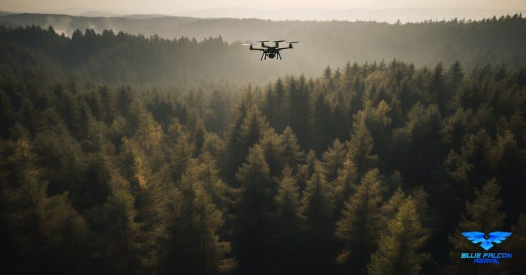
Applications of Drone LiDAR in Forestry Management
Forest Inventory and Planning
Drone LiDAR technology enables forestry professionals to efficiently conduct forest inventory and planning tasks, such as estimating timber volume, tree height, and tree density. The accurate 3D models generated by LiDAR provide valuable information for making informed decisions about forest management, including harvesting schedules, silvicultural treatments, and road planning.
Biomass Estimation
By providing accurate measurements of tree height, diameter, and canopy structure, LiDAR data can be used to estimate the aboveground biomass in a forest. This information is essential for determining the carbon sequestration potential of a forest, as well as its economic value for bioenergy production.
Carbon Sequestration Monitoring
Accurate estimation of forest biomass is crucial for monitoring carbon sequestration, a critical component in global efforts to combat climate change. Drone LiDAR data allows for the regular monitoring of changes in forest structure, providing essential information for carbon accounting and assessing the effectiveness of forest management practices aimed at increasing carbon sequestration.
Habitat Mapping
LiDAR’s ability to generate detailed 3D models of forest structure makes it an ideal tool for habitat mapping. This information can be used to identify and monitor critical habitats for various species, as well as assess the impact of forest management practices on biodiversity and ecosystem health.
Disaster Management
Drone LiDAR technology can be used to quickly assess the impact of natural disasters, such as wildfires, storms, or insect infestations, on forest ecosystems. By comparing LiDAR data collected before and after an event, forestry professionals can evaluate the extent of damage and develop appropriate response strategies to mitigate the negative effects and promote recovery.
Role in Sustainable Forest Management
Drone LiDAR plays a significant role in sustainable forest management by providing accurate and timely information about forest structure, health, and dynamics. This data allows forest managers to make informed decisions on harvesting, reforestation, and conservation efforts, ensuring that forests remain productive and resilient in the face of changing environmental conditions.
Tree Species Identification
While LiDAR itself cannot directly identify tree species, it can be used in combination with other remote sensing data, such as hyperspectral or multispectral imagery, to differentiate between tree species. By analyzing the LiDAR-derived canopy structure and integrating it with spectral information from other sensors, researchers can develop algorithms to accurately classify tree species within the forest. This information is invaluable for forest management, biodiversity assessment, and conservation planning.
Limitations of LiDAR in Forestry
What LiDAR Cannot Detect
While LiDAR offers numerous benefits for forestry applications, it is essential to understand its limitations. Some of the things LiDAR cannot detect include:
- Fine-scale features: LiDAR is not suitable for capturing very small features, such as individual leaves or the texture of tree bark.
- Color information: LiDAR does not provide color information, which can be crucial for identifying tree species or assessing the health of vegetation. This limitation can be overcome by combining LiDAR data with multispectral or hyperspectral imagery.
- Understory vegetation: Although LiDAR can penetrate through the forest canopy, the detection of understory vegetation may be limited, particularly in dense forests with a thick canopy.
LiDAR’s Ability to Penetrate Leaves and Foliage
LiDAR’s capacity to penetrate leaves and foliage depends on several factors, including the wavelength of the laser pulses, the density of the foliage, and the sensor’s configuration. Near-infrared wavelengths used by most LiDAR systems can penetrate small gaps in the foliage, allowing them to reach different layers within the forest canopy and the forest floor. However, dense foliage can still limit the amount of light that reaches the sensor, potentially reducing the accuracy and completeness of the resulting point cloud.
Case Studies: Successful Implementations of Drone LiDAR in Forestry Management
Case Study 1: Forest Inventory in the Pacific Northwest, USA
A recent project in the Pacific Northwest of the United States utilized drone LiDAR technology to conduct a comprehensive forest inventory for a private timber company. The LiDAR data allowed the company to accurately estimate timber volume, tree height, and tree density, enabling them to optimize their harvesting schedule and maximize the economic value of their resources. The data also facilitated better road planning, reducing the environmental impact of logging operations.
Case Study 2: Habitat Mapping and Conservation in the Amazon Rainforest
Researchers in the Amazon rainforest employed drone LiDAR to map and monitor the habitat of endangered species, such as the golden lion tamarin. The high-resolution data enabled the researchers to identify critical habitat areas, assess the impacts of human activity on the ecosystem, and develop targeted conservation strategies to protect these vulnerable species.
Case Study 3: Post-Wildfire Assessment in Australia
Following the devastating wildfires in Australia during 2019-2020, drone LiDAR was used to assess the extent of damage and inform recovery efforts. By comparing pre- and post-fire LiDAR data, researchers were able to evaluate the impact of the fires on forest structure, biomass, and biodiversity. This information proved essential for guiding the restoration efforts and prioritizing areas for reforestation and wildlife habitat rehabilitation.
The Future of Drone LiDAR in Forestry
As drone and LiDAR technologies continue to advance, their applications in forestry management are expected to expand and evolve, offering even more significant benefits and opportunities for sustainable practices. Some of the anticipated developments in the future of drone LiDAR in forestry include:
Integration with Other Remote Sensing Technologies
The integration of drone LiDAR with other remote sensing technologies, such as hyperspectral and multispectral imaging, will likely become more prevalent. Combining these technologies will provide a more comprehensive understanding of forest ecosystems, enabling better decision-making for management and conservation efforts.
Enhanced Data Processing and Analysis
Improvements in data processing and analysis algorithms will allow for more efficient and accurate extraction of relevant information from LiDAR datasets. This will enable forestry professionals to gain valuable insights more quickly and make informed decisions based on the latest data.
Machine Learning and Artificial Intelligence
The application of machine learning and artificial intelligence to drone LiDAR data analysis will facilitate the development of more advanced algorithms for tasks such as tree species identification, biomass estimation, and habitat classification. This will improve the accuracy and efficiency of forest management practices and promote more sustainable outcomes.
Improved Sensor Technology
Advancements in LiDAR sensor technology, such as higher pulse rates, increased accuracy, and longer-range capabilities, will further enhance the quality and resolution of the data collected by drones. This will allow for even more detailed 3D models of forest ecosystems and improved decision-making for forestry professionals.
Cost Reduction
As drone and LiDAR technologies become more accessible and cost-effective, their adoption in forestry management is likely to increase. This will enable even small-scale forestry operations to benefit from the advantages of drone LiDAR, promoting sustainable practices across the industry.
In conclusion, drone LiDAR in forestry management is a game-changer, offering unparalleled accuracy and efficiency in monitoring, managing, and protecting our precious forests. The myriad applications, from forest inventory to disaster management, make it an indispensable tool for sustainable forestry practices. While LiDAR has some limitations, its advantages far outweigh them, making it the go-to technology for forestry applications. If you’re interested in learning more about aerial LiDAR, we encourage you to visit Aerial LiDAR 101: An Introduction to Its Applications and Benefits for an in-depth look at this groundbreaking technology. If you require drone services for your forestry projects, don’t hesitate to contact Blue Falcon Aerial, a leader in drone technology and services. Let us help you harness the power of drone LiDAR in forestry management to ensure a sustainable future for our planet.