The world of power and distribution is constantly evolving, and technology has played a crucial role in enhancing its efficiency and safety. One groundbreaking technology making waves in the industry is LiDAR. Harnessing LiDAR for drone-based power and distribution solutions offers unparalleled benefits, helping companies achieve new heights in productivity and safety. In this article, we’ll explore the technology behind LiDAR, its benefits, applications, and how it is transforming the power and distribution landscape.
Overview of LiDAR Technology
What is LiDAR?
LiDAR, which stands for Light Detection and Ranging, is a remote sensing technology that utilizes laser light to measure distances and generate highly accurate, three-dimensional maps of the earth’s surface. The technology works by emitting laser pulses and measuring the time it takes for them to bounce back after hitting an object. This time delay is then used to calculate the distance between the LiDAR sensor and the object, resulting in a highly accurate, high-resolution map of the target area.
How does it work?
LiDAR systems typically consist of a laser, a scanner, a GPS receiver, and an inertial measurement unit (IMU). The laser emits pulses of light that travel towards the ground, and the scanner measures the time it takes for the light to return after striking a surface. This time is then converted into distance using the speed of light. The GPS receiver provides the position of the LiDAR sensor, while the IMU records the orientation of the sensor during data collection. Combining these data points allows for the creation of highly detailed, three-dimensional maps of the surveyed area.
Benefits of LiDAR for Power and Distribution
Improved Accuracy
LiDAR technology offers unparalleled accuracy in mapping and modeling. Its high-resolution data allows for the precise identification of power lines, poles, towers, and other infrastructure components. This level of accuracy is essential for effective planning, maintenance, and decision-making in the power and distribution industry.
Can LiDAR detect power lines?
Yes, LiDAR is highly effective at detecting power lines. The technology’s ability to provide detailed, three-dimensional data makes it possible to accurately identify and map power lines, even when they are obscured by vegetation or other obstructions. This capability is crucial for ensuring the safety and reliability of power and distribution networks.
Enhanced Safety
Using LiDAR-equipped drones for power line inspections significantly reduces the risks associated with traditional methods, such as manual inspections using helicopters or ground-based crews. Drones can easily access hard-to-reach areas without exposing personnel to hazards like high voltage, falls, or dangerous weather conditions. Furthermore, LiDAR’s high-resolution data enables the early detection of potential issues, such as sagging lines or encroaching vegetation, allowing for proactive maintenance and reduced risk of accidents or outages.
Cost-effectiveness
Drone-based LiDAR inspections can significantly reduce costs compared to traditional inspection methods. The automation and efficiency of LiDAR-equipped drones allow for rapid data collection, reducing the time and resources required for inspections. Additionally, the high-resolution data provided by LiDAR enables more informed decision-making, potentially reducing maintenance and repair costs by allowing for targeted, proactive interventions.
Rapid Data Collection
LiDAR-equipped drones can quickly cover large areas and collect vast amounts of data, providing detailed, up-to-date information on power and distribution infrastructure. This rapid data collection enables companies to monitor their assets more frequently, leading to improved reliability and faster response times when issues arise.
Applications of LiDAR in Power and Distribution
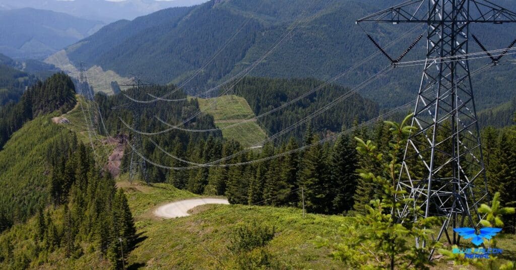
Power Line Inspections
Regular inspections of power lines are crucial for ensuring the reliability and safety of power distribution networks. LiDAR-equipped drones can effectively inspect power lines by detecting and mapping their exact locations, along with identifying potential issues such as sagging lines, damaged insulators, or corroded hardware. This high-resolution data allows utility companies to proactively address problems, reducing the risk of outages and accidents.
Vegetation Management
Vegetation encroachment is a significant concern for power and distribution companies, as it can lead to outages, fires, and other hazards. LiDAR technology can accurately map vegetation around power lines, providing essential information for managing vegetation growth and maintaining required clearance distances. With LiDAR data, utility companies can prioritize vegetation management efforts, targeting areas with the highest risk and optimizing maintenance resources.
Distribution Network Mapping
Accurate mapping of distribution networks is essential for effective planning, maintenance, and expansion. LiDAR’s high-resolution, three-dimensional data allows for the precise mapping of power lines, poles, towers, and other infrastructure components, ensuring that utility companies have a comprehensive and up-to-date understanding of their assets. This information is invaluable for making informed decisions about network upgrades, expansions, or repairs.
Asset Management
LiDAR technology plays a crucial role in asset management for power and distribution companies. By providing accurate, detailed data on the location and condition of assets, LiDAR enables companies to monitor their infrastructure more effectively and make informed decisions about maintenance, repairs, and replacements. This data-driven approach to asset management can lead to significant cost savings and improved network reliability.
Case Studies of Successful LiDAR Deployments
Case Study 1: Reducing Outages Through Proactive Vegetation Management
In an effort to reduce the number of outages caused by vegetation encroachment, a major utility company deployed LiDAR-equipped drones to map and monitor vegetation growth around their power lines. The high-resolution data provided by the LiDAR system allowed the company to identify high-risk areas and prioritize their vegetation management efforts. As a result, the company was able to reduce the number of outages caused by vegetation by over 50%, leading to significant cost savings and improved customer satisfaction.
Case Study 2: Streamlining Power Line Inspections and Maintenance
A regional power and distribution company sought to improve the efficiency and safety of their power line inspections. By deploying LiDAR-equipped drones, the company was able to quickly and accurately inspect their power lines, identifying issues such as sagging lines, damaged insulators, and corroded hardware. This data-driven approach to inspections allowed the company to proactively address potential problems, reducing the risk of outages and accidents while also lowering maintenance costs.
Case Study 3: Optimizing Asset Management with LiDAR Data
A large power and distribution company integrated LiDAR data into their asset management system, providing detailed, up-to-date information on the location and condition of their infrastructure. This comprehensive understanding of their assets enabled the company to make more informed decisions about maintenance, repairs, and replacements, resulting in significant cost savings and improved network reliability. Additionally, the company was able to optimize their capital planning process, prioritizing investments in areas with the greatest need and potential return on investment.
Future Developments in LiDAR Technology for Power and Distribution
As LiDAR technology continues to advance, its applications in the power and distribution industry are expected to grow and evolve. Some of the most promising future developments in LiDAR for power and distribution include:
Improved Data Processing and Analysis
With the continuous growth of data processing capabilities and machine learning algorithms, the analysis of LiDAR data is expected to become even more efficient and accurate. Advanced analytics can help utility companies gain deeper insights into their infrastructure, identify potential issues earlier, and optimize maintenance and repair efforts.
Integration with Other Remote Sensing Technologies
Combining LiDAR data with other remote sensing technologies, such as multispectral and hyperspectral imaging, can provide even more comprehensive and detailed information about power and distribution infrastructure. This integrated approach can lead to better decision-making, more effective maintenance strategies, and improved network reliability.
Real-time Monitoring and Response
As LiDAR technology advances, it may become possible to equip drones with real-time monitoring capabilities. This would enable utility companies to detect and respond to issues more quickly, potentially preventing outages or other incidents before they occur. Real-time monitoring could also streamline maintenance efforts, as crews could be dispatched immediately to address problems as they are detected.
Enhanced Drone Autonomy and Capabilities
Future advancements in drone technology are expected to result in more capable and autonomous drones, which could further improve the efficiency and safety of LiDAR-based inspections. As drones become more sophisticated, they may be able to perform more complex tasks, such as inspecting and repairing infrastructure components autonomously, further reducing the risks and costs associated with power line maintenance.
Increased Adoption and Standardization
As the benefits of LiDAR technology become more widely recognized, its adoption within the power and distribution industry is likely to increase. This could lead to the development of industry-wide standards and best practices for LiDAR-based inspections and maintenance, further enhancing the technology’s effectiveness and ensuring consistent, high-quality results across the industry.
Blue Falcon Aerial: Your Trusted Partner for Drone-Based Power Line Inspections
For power and distribution companies looking to harness the benefits of LiDAR technology, partnering with a reliable and experienced provider is essential. Blue Falcon Aerial is a leading provider of drone-based power line inspections, with a proven track record of delivering high-quality, accurate results.
How Blue Falcon Aerial Can Help
Blue Falcon Aerial offers a comprehensive suite of power and distribution services, utilizing state-of-the-art LiDAR-equipped drones to inspect and map power line infrastructure. Our team of experienced professionals works closely with utility companies to develop customized inspection plans, ensuring that all specific requirements and objectives are met.
Deliverables Offered by Blue Falcon Aerial
At Blue Falcon Aerial, we pride ourselves on providing our clients with detailed, accurate data that enables them to make informed decisions about their infrastructure. Our deliverables include high-resolution LiDAR point clouds, digital terrain models, digital surface models, and geo-referenced orthophotos, among others. These deliverables allow utility companies to visualize their assets, identify potential issues, and optimize maintenance and repair efforts.
By choosing Blue Falcon Aerial as your partner for drone-based power line inspections, you can rest assured that you are working with a team of experts dedicated to helping you harness the full potential of LiDAR technology. Our commitment to quality, safety, and customer satisfaction makes us the ideal choice for power and distribution companies looking to optimize their operations and enhance the reliability of their networks.
In conclusion, LiDAR technology has revolutionized the power and distribution industry by providing accurate, safe, and cost-effective solutions. Its wide range of applications, from power line inspections to asset management, has made it an indispensable tool for companies seeking to optimize their operations.
Are you interested in learning more about LiDAR and its various applications? We recommend you visit our comprehensive guide, Aerial LiDAR 101: An Introduction to its Applications and Benefits, to gain an in-depth understanding of this groundbreaking technology.
If you require any drone services for your business, don’t hesitate to contact Blue Falcon Aerial for expert assistance. Let us help you harness the power of LiDAR to drive efficiency and innovation in your operations.