Imagine a technology capable of creating highly accurate 3D models of our world, revolutionizing industries like surveying, agriculture, and autonomous vehicles. That technology is LiDAR, and you’re about to discover the fascinating answer to the question: how does LiDAR work? In this article, we’ll dive deep into the world of LiDAR technology, explore the science behind it, its various types, and its diverse applications. Get ready to have LiDAR demystified!
What is LiDAR?
LiDAR, or Light Detection and Ranging, is a remote sensing technology that uses laser light to measure distances and create high-resolution, three-dimensional digital maps of the earth’s surface. By emitting laser pulses and measuring the time it takes for them to return after reflecting off objects, LiDAR systems can accurately determine the distance and position of those objects. This powerful technology has found applications in various fields, including surveying, forestry, archaeology, and the development of autonomous vehicles.
The Science Behind LiDAR
Components of a LiDAR System
A typical LiDAR system consists of several key components:
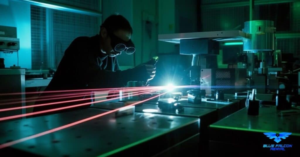
- Laser: A light source that emits laser pulses in rapid succession. These pulses travel at the speed of light and are reflected back to the LiDAR system after interacting with objects in their path. The laser source’s wavelength determines the system’s performance in various conditions. Common wavelengths include 532 nm (visible green light), 1064 nm (infrared), and 1550 nm (eye-safe infrared).
- Scanner: A device that directs the laser pulses towards the area of interest. Scanners can be either rotating or oscillating, depending on the LiDAR system’s design. The scan rate, measured in Hertz (Hz), determines the number of pulses emitted per second. Higher scan rates result in denser point clouds and increased data accuracy.
- Receiver: A sensor that detects the reflected laser pulses and records the time it took for them to return to the system. The receiver often uses an avalanche photodiode (APD) or a photomultiplier tube (PMT) to convert the returning light into an electrical signal.
- GPS and Inertial Measurement Unit (IMU): These devices provide information about the LiDAR system’s location and orientation, which are crucial for accurately determining the position of detected objects. GPS provides latitude, longitude, and altitude data, while the IMU records the system’s orientation in terms of pitch, roll, and yaw angles.
- Data processing unit: This component processes the raw data collected by the receiver, GPS, and IMU to generate the final 3D point cloud.
How LiDAR Measures Distance
LiDAR systems measure distance using the Time of Flight (ToF) principle. When a laser pulse is emitted, it travels through the air at the speed of light (approximately 299,792 kilometers per second) until it encounters an object. The pulse then reflects off the object and returns to the LiDAR system, where the receiver detects it.
The time it takes for the laser pulse to travel to the object and back is known as the Time of Flight. By multiplying the ToF by the speed of light and dividing the result by two, the system can determine the distance between the LiDAR sensor and the object. This process is repeated for thousands or even millions of laser pulses, allowing the system to create a highly detailed 3D map of the scanned area.
LiDAR Scanning Process
The LiDAR scanning process involves emitting a large number of laser pulses in a short period and capturing the reflected pulses with the receiver. The scanner directs these pulses across the area of interest, typically in a predefined pattern, ensuring that the entire region is covered.
As the laser pulses are emitted and received, the GPS and IMU provide the LiDAR system with continuous updates on its location and orientation. This information, combined with the distance measurements, allows the system to accurately determine the position of detected objects in three-dimensional space.
After the scanning process is complete, the data processing unit processes the raw data, converting it into a 3D point cloud—a collection of data points representing the scanned objects’ positions in 3D space. This point cloud can then be further processed and analyzed to create detailed maps, models, or other forms of geospatial information.
Technical Aspects of LiDAR Systems
To better understand the technical details of LiDAR systems, let’s delve into some key concepts:
- Pulse Repetition Frequency (PRF): This refers to the number of laser pulses emitted per second, measured in Hertz (Hz). A higher PRF results in denser point clouds and increased data accuracy. However, a higher PRF also requires more processing power and may introduce potential noise in the data.
Beam Divergence: The laser beam emitted by a LiDAR system spreads out as it travels, which is known as beam divergence. Lower beam divergence results in higher-resolution data, as the laser pulses are focused on a smaller area. However, systems with low beam divergence may require more time to scan a large area.
Range Resolution: The ability of a LiDAR system to distinguish between two objects that are close together in distance is called range resolution. Better range resolution is achieved by using shorter laser pulse widths and higher bandwidth receivers. High range resolution allows the system to detect small features and separate objects that are close together.
Angular Resolution: This is the ability of a LiDAR system to differentiate between two objects that are close together in angle. A higher angular resolution is achieved by increasing the number of scanning angles and improving the scanner’s positioning accuracy. This allows the system to create more detailed and accurate point clouds.
Signal-to-Noise Ratio (SNR): The ratio of the signal strength to the background noise in a LiDAR system is crucial for data accuracy. A higher SNR means that the system can more accurately detect and measure objects, even in challenging conditions like low light or atmospheric interference. LiDAR systems often employ advanced signal processing techniques to improve the SNR and enhance data quality.
Multi-return Capability: Some LiDAR systems can detect multiple returns from a single laser pulse. This is useful for scanning areas with complex structures, such as tree canopies or urban environments, where the laser pulse may encounter multiple reflecting surfaces. By analyzing multiple returns, the system can generate more detailed and accurate representations of the scanned area.
By considering these technical aspects, LiDAR system designers and operators can optimize the system’s performance for specific applications, ensuring the highest possible data quality and accuracy.
LiDAR in Remote Sensing
LiDAR technology has become a vital tool in remote sensing, enabling researchers and professionals to gather high-resolution, three-dimensional data about the Earth’s surface and its features. Remote sensing with LiDAR involves using airborne or satellite-based systems to scan large areas quickly and efficiently, providing valuable information for various applications such as environmental monitoring, urban planning, disaster management, and more.
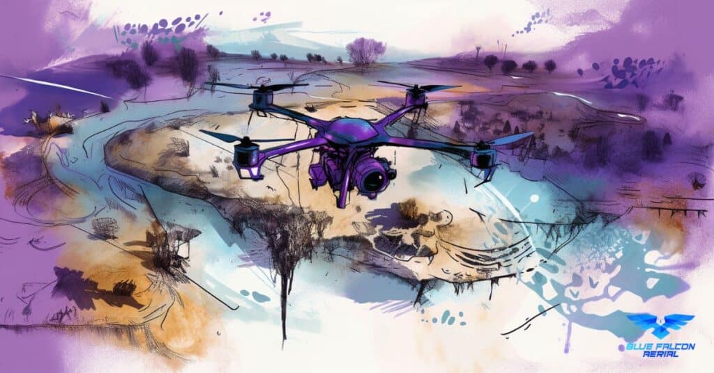
Airborne LiDAR
Airborne LiDAR systems are mounted on aircraft or drones and are used to survey large areas from above. These systems can cover vast distances in a relatively short amount of time, making them ideal for mapping and monitoring tasks. Airborne LiDAR is particularly useful for topographic mapping, where the high-resolution data can be used to create accurate elevation models of the Earth’s surface.
Satellite LiDAR
Satellite-based LiDAR systems are mounted on satellites orbiting the Earth and provide global coverage for remote sensing applications. While satellite LiDAR typically has lower spatial resolution compared to airborne systems, it offers consistent data collection over time, allowing researchers to monitor changes in the Earth’s surface and atmosphere over long periods.
Seeing Through Obstacles
One of the unique capabilities of LiDAR technology is its ability to see through certain obstacles, such as vegetation and precipitation. This ability is crucial for various applications, including forestry management and meteorological studies.
How LiDAR Sees Through Trees
In areas with dense vegetation, such as forests, LiDAR can penetrate the tree canopy and reach the ground, providing valuable information about the terrain underneath. As the laser pulses encounter leaves, branches, and other vegetation, a portion of the light is reflected back to the LiDAR sensor, while some continue to travel downward. By detecting multiple returns from a single laser pulse, LiDAR systems can create a detailed representation of the forest structure, including the canopy height, tree density, and ground elevation.
Can LiDAR See Through Rain and Walls?
LiDAR’s ability to see through obstacles is not without limitations. While it can penetrate light rain, heavy rain or fog can significantly affect the system’s performance, as the water droplets in the air scatter the laser pulses, reducing the signal strength and increasing noise in the data.
Similarly, LiDAR cannot see through solid walls or other opaque materials. However, certain materials, such as thin fabrics or translucent surfaces, may allow partial penetration of the laser pulses, enabling the system to detect objects behind them with reduced accuracy.
Types of LiDAR
LiDAR technology can be categorized into several types based on the platform on which it is mounted and the method of data collection. These categories include airborne, terrestrial, and mobile LiDAR.
Airborne LiDAR
As mentioned earlier, airborne LiDAR systems are mounted on aircraft or drones to scan large areas from above. They are widely used in surveying and mapping, environmental monitoring, and other applications requiring high-resolution, large-scale data collection.
Terrestrial LiDAR
Terrestrial LiDAR systems are ground-based and typically mounted on tripods or other stationary platforms. These systems are used to collect detailed, high-resolution data of smaller areas, such as construction sites, archaeological sites, and infrastructure projects. Terrestrial LiDAR is particularly useful for applications that require precise measurements and accurate 3D models.
Mobile LiDAR
Mobile LiDAR systems are mounted on moving platforms, such as vehicles or boats, and are used to collect data along a specific path or route. Mobile LiDAR is commonly used for transportation planning, infrastructure monitoring, and coastal mapping, among other applications.
Applications of LiDAR
LiDAR technology has a wide range of applications across various industries, thanks to its ability to provide accurate, high-resolution spatial data.
Surveying and Mapping
LiDAR is extensively used in surveying and mapping tasks, as it allows for the rapid and accurate collection of elevation data. This data can be used to create digital elevation models, contour maps, and other forms of geospatial information.
Forestry and Agriculture
In forestry and agriculture, LiDAR is used to monitor vegetation health, estimate biomass, and assess land use changes. The technology’s ability to penetrate tree canopies and provide detailed information about the underlying terrain makes it particularly valuable for these applications.
Infrastructure and Construction
LiDAR is used in infrastructure and construction projects to create accurate 3D models of structures, roads, bridges, and other features. These models can be used for design, planning, and monitoring purposes, as well as for detecting potential issues and safety hazards.
Archaeology and Cultural Heritage
In the fields of archaeology and cultural heritage, LiDAR is employed to uncover hidden structures, map archaeological sites, and create detailed 3D models of historic landmarks. The technology’s non-invasive nature makes it ideal for preserving and documenting fragile or sensitive sites.
Autonomous Vehicles
LiDAR plays a crucial role in the development of autonomous vehicles, as it provides precise distance measurements and detailed 3D data about the vehicle’s surroundings. This data is essential for enabling autonomous vehicles to navigate safely and efficiently through complex environments.
LiDAR Controversies and Competition
Despite the many benefits and applications of LiDAR technology, there are also controversies and competition surrounding its use, particularly in the field of autonomous vehicles. In this section, we will discuss some of the reasons behind Tesla’s decision to stop using LiDAR, the disadvantages of the technology, and the alternatives that are being explored.
Why Tesla Stopped Using LiDAR
As previously mentioned, Tesla has opted not to use LiDAR technology in its autonomous vehicles. The primary reasons for this decision include the cost, size, and aesthetics of LiDAR systems, as well as the belief in the potential of cameras and radar to provide the necessary data for full autonomy. Tesla’s CEO, Elon Musk, has expressed confidence that advancements in artificial intelligence and computer vision will enable camera and radar-based systems to perform at a level that matches or surpasses LiDAR’s capabilities.
Other Disadvantages of LiDAR
In addition to the reasons cited by Tesla, there are several other disadvantages of LiDAR technology that may limit its adoption in certain applications:
- Weather Sensitivity: LiDAR systems can be affected by adverse weather conditions, such as heavy rain or fog, which can scatter the laser pulses and reduce the accuracy of the data collected.
- Limited Range: The range of LiDAR systems is limited by the strength of the laser pulses and the sensitivity of the sensors. In some applications, this limited range may not provide sufficient coverage or resolution.
- Power Consumption: LiDAR systems can consume a significant amount of power, which can be a concern in applications where energy efficiency is a priority, such as autonomous vehicles or remote sensing platforms.
Alternatives to LiDAR Technology
While LiDAR is a powerful and versatile technology, there are alternative sensing technologies being explored for various applications. Some of these alternatives include:
- Radar: Advanced radar systems with higher resolution and accuracy are being developed to compete with LiDAR technology. These systems may offer some advantages, such as being less affected by adverse weather conditions and providing more extended range capabilities.
- Camera-based Solutions: As computer vision and artificial intelligence continue to advance, camera-based systems are becoming more capable of interpreting and understanding their surroundings. In some cases, these systems may offer a more cost-effective and energy-efficient alternative to LiDAR.
- Sonar: For underwater applications, sonar technology is often used as an alternative to LiDAR. Sonar systems use sound waves rather than light to measure distances and generate 3D data, making them well-suited for underwater environments.
As the field of remote sensing continues to evolve, it is likely that LiDAR technology will face increasing competition from these and other emerging sensing technologies. However, the unique capabilities and strengths of LiDAR will likely ensure its continued relevance and widespread adoption across various industries.
LiDAR Industry Landscape
As LiDAR technology continues to evolve and find new applications, the industry landscape is becoming increasingly competitive. In this section, we will explore the global leaders in LiDAR technology and discuss who has the best LiDAR technology.
Global Leaders in LiDAR Technology
Several companies are leading the way in LiDAR technology development, each with their unique strengths and focus areas. Some of these global leaders include:
- Velodyne: One of the pioneers in LiDAR technology, Velodyne is known for its high-performance sensors and wide product range, including both mechanical and solid-state LiDAR systems.
- Luminar: Luminar is a newer player in the LiDAR industry, focusing on developing advanced solid-state LiDAR systems for autonomous vehicles and other applications. Luminar’s technology is known for its long-range capabilities and high resolution.
- Innoviz: Innoviz specializes in solid-state LiDAR systems designed for automotive applications, with a focus on affordability and reliability. The company’s LiDAR sensors have been selected by several major automakers for use in their autonomous vehicles.
Who Has the Best LiDAR Technology?
Determining who has the best LiDAR technology is a complex and subjective question, as it largely depends on the specific application and requirements. Each of the leading LiDAR companies has its strengths, and the best choice for a particular project will depend on factors such as cost, performance, size, and power consumption.
As the industry continues to evolve, it is likely that we will see further advancements and improvements from these and other companies, leading to even more sophisticated and capable LiDAR systems.
The Future of LiDAR
As LiDAR technology continues to mature and find new applications, the future of the industry looks promising. In this section, we will explore emerging trends and advancements, as well as the future prospects for LiDAR technology.
Emerging Trends and Advancements
Several emerging trends and advancements in LiDAR technology are expected to shape the industry’s future, including:
- Solid-state LiDAR: As mentioned earlier, solid-state LiDAR systems offer significant advantages over traditional mechanical LiDAR systems in terms of size, durability, and cost. The development of solid-state LiDAR technology is expected to drive further adoption of LiDAR in various applications, including autonomous vehicles.
- Increased affordability: As LiDAR technology continues to advance, it is expected that the cost of LiDAR systems will continue to decrease, making the technology more accessible for a broader range of applications and industries.
- Integration with other sensing technologies: The combination of LiDAR with other sensing technologies, such as cameras and radar, is expected to enable even more advanced and robust sensing capabilities. This integrated approach is particularly important for applications such as autonomous vehicles, where the highest level of safety and reliability is required.
Does LiDAR Have a Future?
Given the ongoing advancements and the broad range of applications for LiDAR technology, it is clear that LiDAR has a bright future ahead. While alternative sensing technologies may challenge LiDAR in certain applications, the unique capabilities and strengths of LiDAR technology ensure its continued relevance and widespread adoption across various industries.
As the industry continues to evolve and mature, we can expect to see further innovation and breakthroughs in LiDAR technology, driving new applications and opportunities for growth.
In this article, we’ve explored the inner workings of LiDAR technology, its various types, and a wide range of applications. From surveying to autonomous vehicles, LiDAR continues to impact our world in exciting ways. As we’ve learned, understanding how LiDAR works is just the beginning. To learn more about aerial LiDAR and its applications, we highly recommend reading Aerial LiDAR 101: An Introduction to Its Applications and Benefits. If you’re in need of professional drone services, don’t hesitate to contact Blue Falcon Aerial – the experts in aerial data solutions.