Arizona, with its diverse landscape and breathtaking scenery, is a drone photographer’s paradise. In this article, we’ll unveil the top 5 must-visit locations in Arizona to capture stunning aerial photographs. So grab your drone and get ready to explore the Grand Canyon State like never before!
1. Grand Canyon National Park
Why it’s perfect for drone photography: The Grand Canyon is one of the most iconic natural wonders in the world, offering awe-inspiring views and diverse terrain. Capturing the canyon’s beauty from a bird’s-eye perspective is a once-in-a-lifetime experience.
Who to contact: Reach out to the Grand Canyon National Park’s Public Affairs Office for information on drone regulations and permits.
Location: The park is located in northern Arizona, near the Utah and Nevada borders.
Open to the public: The park is open year-round, but operating hours may vary by season. Check the official website for the most up-to-date information.
Key Features:
- Stunning views of the Grand Canyon
- Diverse terrain, including cliffs, plateaus, and river valleys
- Opportunities for wildlife photography

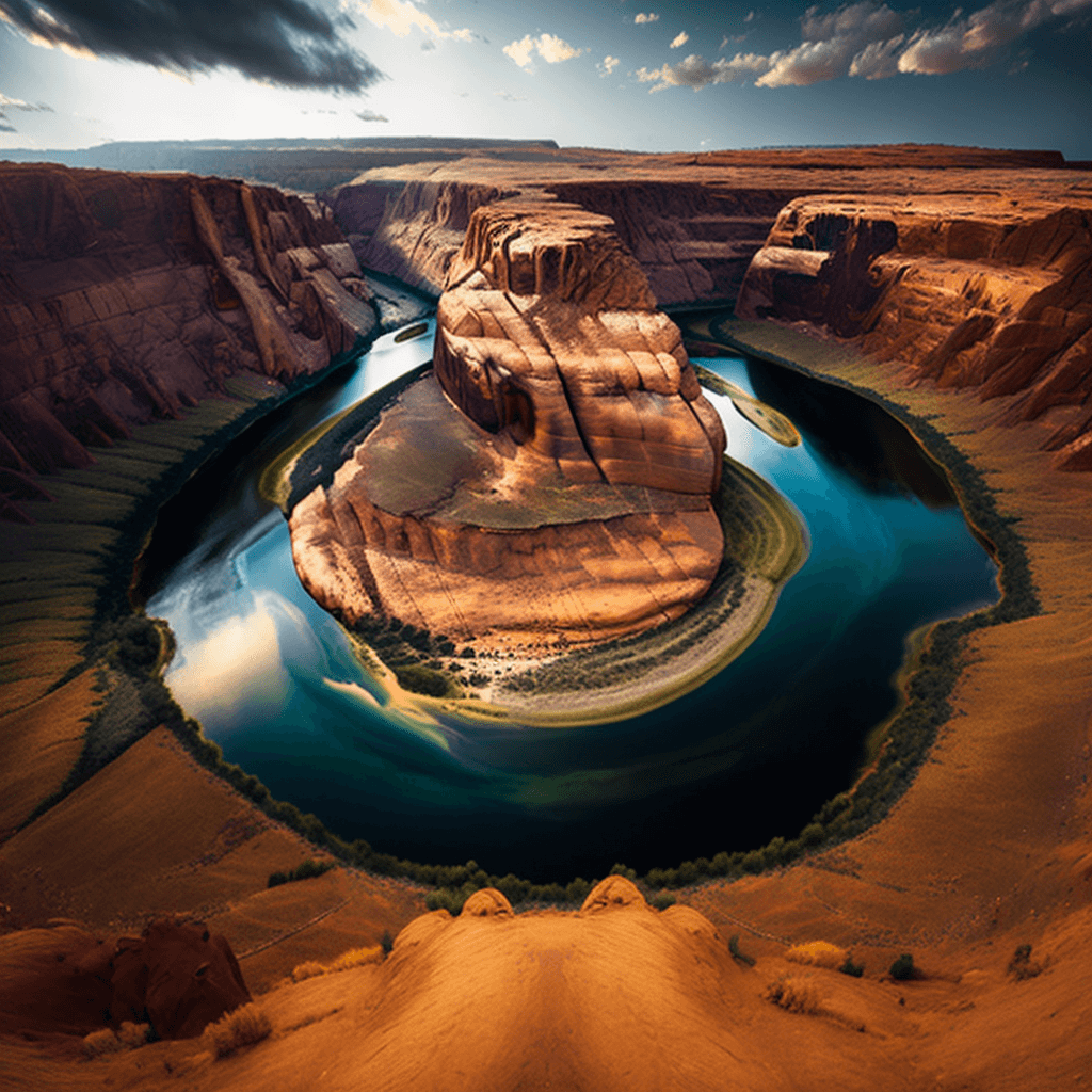
2. Horseshoe Bend
Why it’s perfect for drone photography: This dramatic bend in the Colorado River offers breathtaking views and unique geological formations. Drone photographers can capture the river’s stunning emerald-green waters and surrounding red-rock cliffs.
Who to contact: Get in touch with the Glen Canyon National Recreation Area for information on drone regulations and permits.
Location: Horseshoe Bend is located near Page, Arizona.
Open to the public: The overlook is open daily, but check the official website for current hours and fees.
Key Features:
- Scenic overlook with a 270-degree view of the Colorado River
- Unique geological formations
- Stunning contrast between the river’s green waters and red-rock cliffs
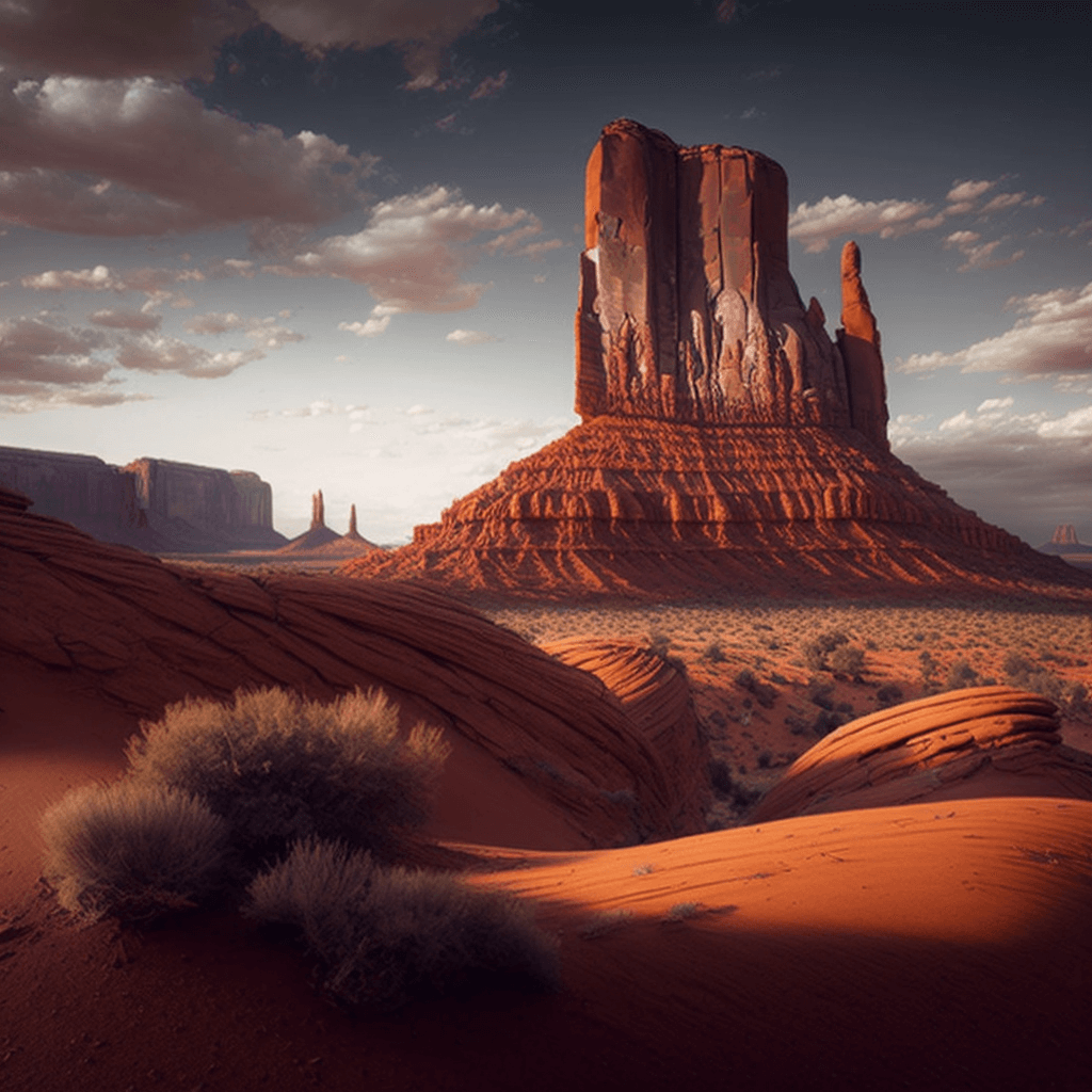
3. Monument Valley
Why it’s perfect for drone photography: This iconic valley, situated on the border of Arizona and Utah, boasts striking sandstone buttes and mesas. Drone photographers can capture the valley’s unique rock formations and dramatic shadows cast by the sun.
Who to contact: Reach out to the Navajo Nation Parks and Recreation Department for information on drone regulations and permits.
Location: Monument Valley is located near the town of Kayenta, Arizona.
Open to the public: The park is open year-round, but hours may vary by season. Check the official website for the most up-to-date information.
Key Features:
- Iconic sandstone buttes and mesas
- Dramatic shadows cast by the sun
- Rich Navajo culture and history
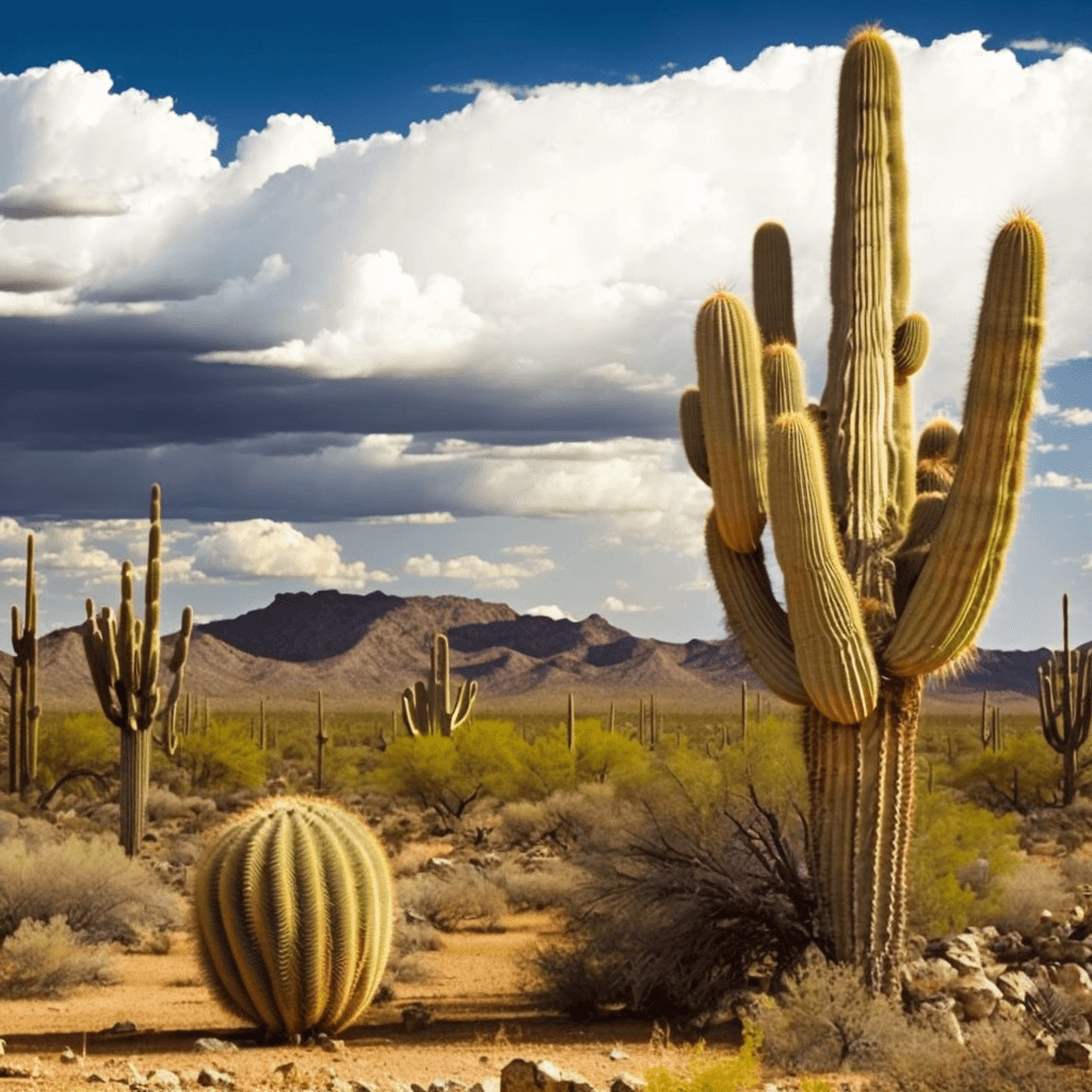
4. Saguaro National Park
Why it’s perfect for drone photography: Home to the nation’s largest cacti, the park offers a unique desert landscape perfect for capturing stunning aerial shots of the iconic saguaro cactus and other desert flora.
Who to contact: Contact the Saguaro National Park for information on drone regulations and permits.
Location: The park is divided into two districts: one east and one west of Tucson, Arizona.
Open to the public: Both districts are open year-round, but operating hours may vary by season. Check the official website for the most up-to-date information.
Key Features:
- Home to the nation’s largest cacti, the saguaro
- Unique desert landscape and flora
- Opportunities for wildlife photography
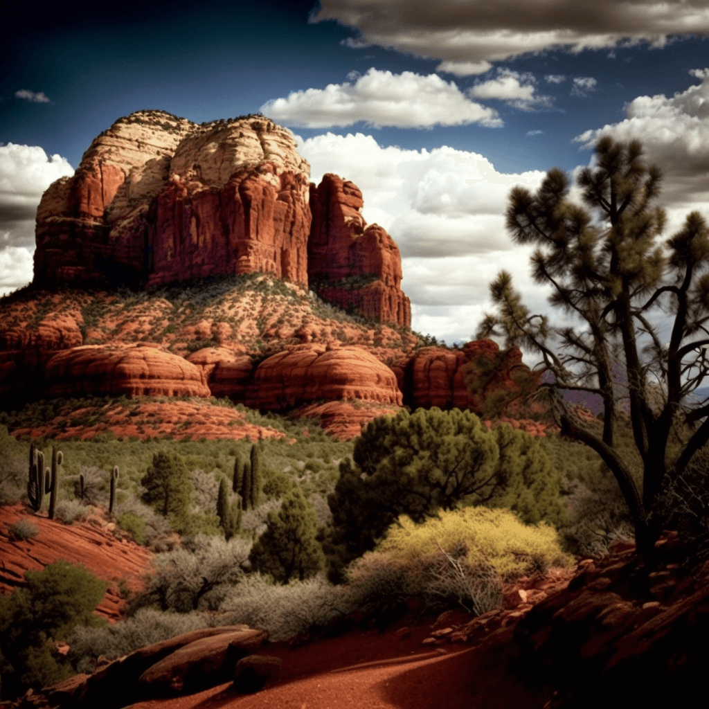
5. Sedona’s Red Rock Country
Why it’s perfect for drone photography: Known for its striking red-rock formations and vibrant colors, Sedona offers a visually stunning backdrop for drone photography. Capture the magnificent Cathedral Rock, Bell Rock, and other famous landmarks from the sky.
Who to contact: Reach out to the Coconino National Forest for information on drone regulations and permits.
Location: Sedona is located in northern Arizona, approximately 30 miles south of Flagstaff.
Open to the public: Red Rock Country is open year-round, but access to specific trails and sites may vary. Check the official website for the most up-to-date information.
Key Features:
- Striking red-rock formations
- Vibrant colors, especially during sunrise and sunset
- Numerous hiking trails and vantage points
Conclusion
Before you set out on your drone photography adventure, make sure to check federal, state, and local laws for each location. Drone regulations may vary, and obtaining the necessary permits is crucial to ensure a safe and enjoyable experience.
Looking to take your drone business to new heights? Don’t miss our comprehensive guide on building and growing your drone business, which can be found at Soaring High: A Comprehensive Guide to Building and Growing Your Drone Business.
If you need assistance with a LiDAR or Orthomosaic project or have any questions, don’t hesitate to contact Blue Falcon Aerial through our contact page. Our team of experts is ready to help you capture the beauty of Arizona from the sky!