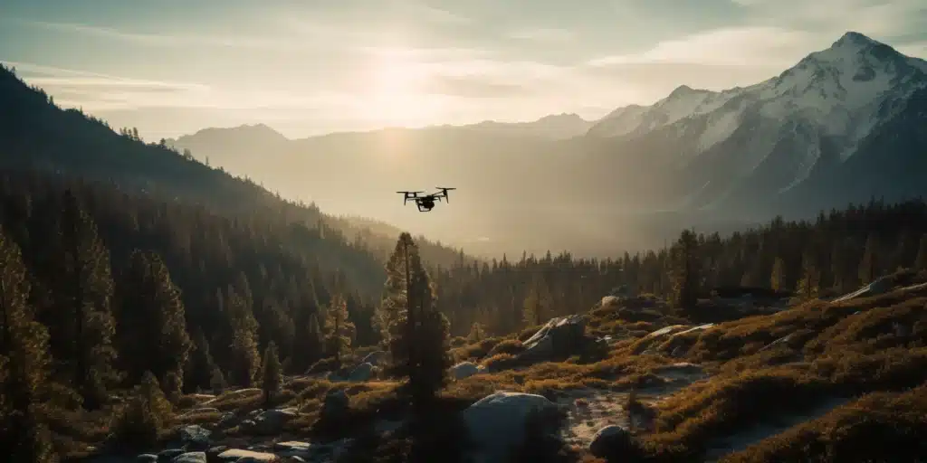
North Carolina boasts a diverse landscape that ranges from the picturesque Appalachian Mountains to the pristine coastline of the Outer Banks. In this article, we’ll showcase the top 5 must-visit locations in North Carolina for capturing stunning aerial photographs with your drone. So gear up and get ready to explore the Tar Heel State from a bird’s-eye view!
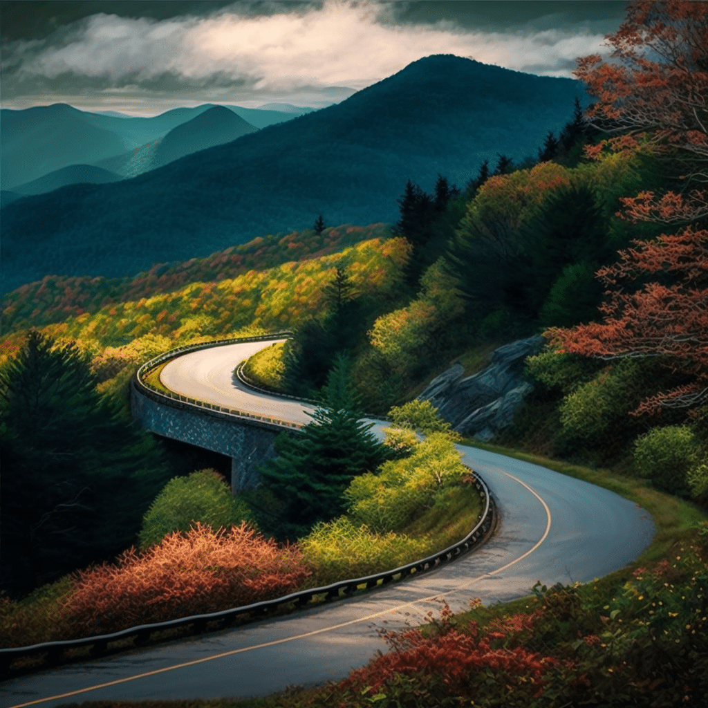
1. Blue Ridge Parkway
Why it’s perfect for drone photography: As one of America’s most scenic drives, the Blue Ridge Parkway offers panoramic views of the Appalachian Mountains, lush forests, and cascading waterfalls. Drone photography allows you to capture the breathtaking beauty of this region from unique angles and elevations.
Who to contact: Reach out to the Blue Ridge Parkway Visitor Center for information on drone regulations and permits.
Location: The parkway stretches across North Carolina and Virginia, with multiple access points in both states.
Open to the public: The Blue Ridge Parkway is open year-round, but some sections may be closed due to weather or maintenance. Check the official website for the most up-to-date information.
Key Features:
- Panoramic views of the Appalachian Mountains
- Lush forests and cascading waterfalls
- Stunning vistas and overlooks
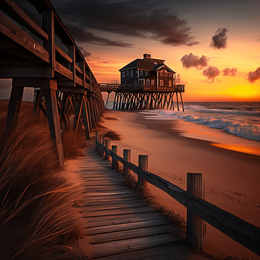
2. Outer Banks
Why it’s perfect for drone photography: The Outer Banks’ pristine coastline, historic lighthouses, and diverse wildlife offer a wealth of photographic opportunities. Capture the unique beauty of this barrier island chain from above, including the famous Cape Hatteras Lighthouse.
Who to contact: Contact the Cape Hatteras National Seashore for information on drone regulations and permits.
Location: The Outer Banks is located off the coast of North Carolina, stretching from Corolla to Ocracoke Island.
Open to the public: The Outer Banks is open year-round, but hours and access to specific sites may vary. Check the official website for the most up-to-date information.
Key Features:
- Pristine coastline and sandy beaches
- Historic lighthouses, including Cape Hatteras Lighthouse
- Diverse wildlife and birdwatching opportunities
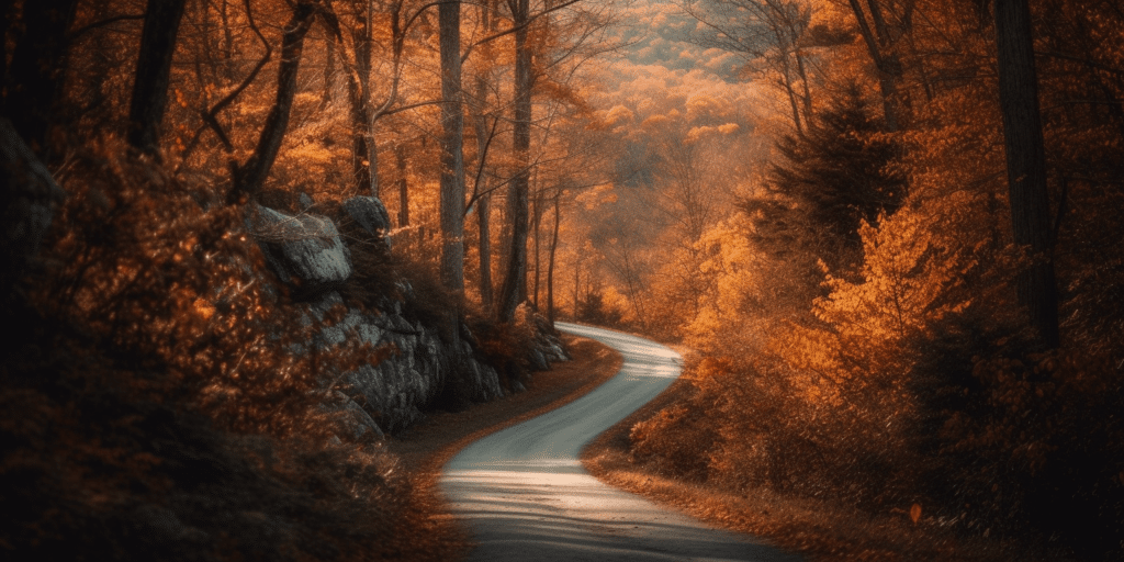
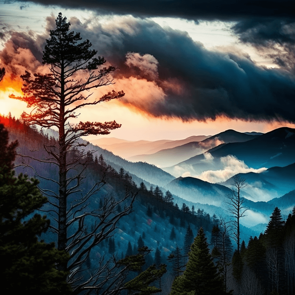
3. Great Smoky Mountains National Park
Why it’s perfect for drone photography: As the most visited national park in the United States, the Great Smoky Mountains offer spectacular mountain views, dense forests, and a rich cultural history. Aerial photography allows you to capture the park’s diverse landscape and stunning fall foliage.
Who to contact: Reach out to the Great Smoky Mountains National Park’s Public Affairs Office for information on drone regulations and permits.
Location: The park is located on the border of North Carolina and Tennessee.
Open to the public: The park is open year-round, but operating hours may vary by season. Check the official website for the most up-to-date information.
Key Features:
- Spectacular mountain views
- Dense forests and stunning fall foliage
- Rich cultural history, including historic buildings and the Cherokee heritage
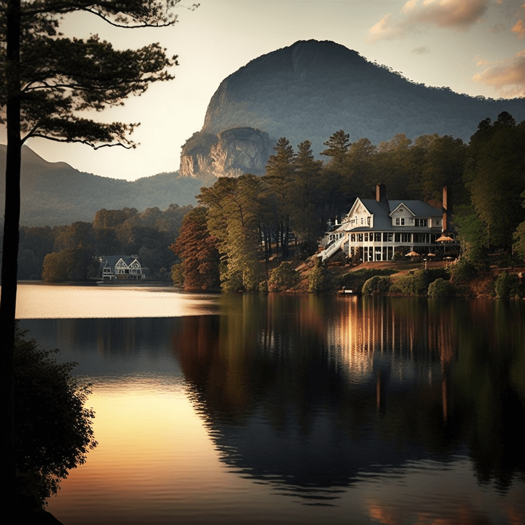
4. Lake Lure
Why it’s perfect for drone photography: Nestled in the foothills of the Blue Ridge Mountains, Lake Lure offers a picturesque setting for aerial photography. Capture the lake’s crystal-clear waters, surrounding mountains, and iconic Chimney Rock from the sky.
Who to contact: Get in touch with the Town of Lake Lure for information on drone regulations and permits.
Location: Lake Lure is located in western North Carolina, approximately 27 miles southeast of Asheville.
Open to the public: The lake is open year-round, but hours and access to specific facilities may vary. Check the official website for the most up-to-date information.
Key Features:
- Picturesque lake surrounded by mountains
- Iconic Chimney Rock landmark
- Recreational activities, including boating and hiking
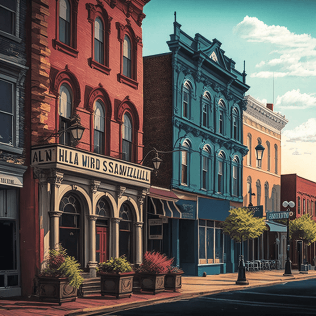
5. Wilmington’s Historic River District
Why it’s perfect for drone photography: Wilmington’s Historic River District offers a unique blend of history, architecture, and natural beauty. Drone photography allows you to capture the charming streets, historic buildings, and scenic Cape Fear River from above.
Who to contact: Reach out to the City of Wilmington for information on drone regulations and permits.
Location: Wilmington is located in southeastern North Carolina, along the Cape Fear River.
Open to the public: The Historic River District is open year-round, but hours and access to specific sites may vary. Check the official website for the most up-to-date information.
Key Features:
- Charming streets and historic architecture
- Scenic Cape Fear River
- Vibrant arts and cultural scene
Conclusion
Before you embark on your drone photography adventure in North Carolina, make sure to check federal, state, and local laws for each location. Drone regulations may vary, and obtaining the necessary permits is crucial to ensure a safe and enjoyable experience.
Looking to take your drone business to new heights? Don’t miss our comprehensive guide on building and growing your drone business, which can be found at Soaring High: A Comprehensive Guide to Building and Growing Your Drone Business.
If you need assistance with a LiDAR or Orthomosaic project or have any questions, don’t hesitate to contact Blue Falcon Aerial through our contact page. Our team of experts is ready to help you capture the beauty of North Carolina from the sky!