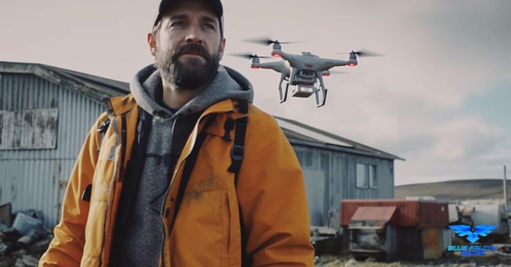
Drones have become an essential tool for capturing stunning aerial views and exploring new perspectives. As drone enthusiasts search for the perfect spots to fly drones in Lawton, Oklahoma, it’s important to understand the local rules and find the best locations that offer a unique flying experience. This article will guide you through Lawton’s aerial wonders, showcasing the top drone spots and offering practical tips for a safe and enjoyable flight.
The Growing Popularity of Drones and Their Applications
Drones, also known as unmanned aerial vehicles (UAVs), have become increasingly popular over the past few years. They are no longer just a hobby for enthusiasts but have evolved into valuable tools for various industries. Some of the many applications of drones include:
Aerial photography and videography: Drones enable photographers and videographers to capture stunning aerial shots and record breathtaking videos from angles that were once impossible to reach.
Surveying and mapping: Drones equipped with advanced sensors, such as LiDAR, can accurately map large areas and create detailed 3D models, saving time and resources in industries like construction, agriculture, and mining.
Inspections: Drones are used for inspecting structures like bridges, power lines, and wind turbines, providing real-time data and reducing the risks associated with manual inspections.
Environmental monitoring and conservation: Drones are used to monitor wildlife populations, assess damage from natural disasters, and track environmental changes.
Emergency response: Drones can quickly deliver medical supplies, assess damage, and assist in search and rescue missions during emergencies.
As the applications for drones continue to grow, so does the interest in finding great spots to fly and capture the beauty of the world from above.
Lake Lawtonka
Lake Lawtonka, a beautiful reservoir nestled between the picturesque Wichita Mountains and the rolling hills of southwest Oklahoma, offers drone enthusiasts a truly spectacular location for aerial exploration. Its 5,000-acre surface area and 21 miles of shoreline provide ample space for drone pilots to practice their skills and capture stunning views. The lake is known for its crystal-clear waters and an abundance of recreational activities such as boating, fishing, and camping. Drone pilots can capture the vibrant atmosphere of people enjoying these outdoor activities while also showcasing the natural beauty of the lake’s surroundings. The diverse landscape around Lake Lawtonka, including lush forests, rocky cliffs, and sandy beaches, creates unique visual contrasts and endless opportunities for amazing aerial photography and videography.
Elmer Thomas Park
Elmer Thomas Park is a 60-acre park in downtown Lawton that offers a variety of amenities, such as playgrounds, sports fields, a splash pad, and walking trails. Drone pilots can explore the dynamic landscape of the park by capturing the interaction between people enjoying these recreational facilities and the tranquil natural beauty of the park. The park’s centerpiece, a serene lake surrounded by a walking path, offers a great opportunity for drone pilots to practice their skills in navigating around water bodies and capturing stunning reflections on the water’s surface. The juxtaposition of urban and natural elements in Elmer Thomas Park makes it an ideal location for drone enthusiasts to capture the essence of Lawton’s community life.
Wichita Mountains Wildlife Refuge
The Wichita Mountains Wildlife Refuge, covering over 59,000 acres, is a haven for nature lovers and wildlife enthusiasts. This rugged and diverse landscape features ancient granite mountains, vast mixed-grass prairies, and a rich variety of plants and animals. As a drone pilot, you have the opportunity to capture the dramatic topography of the refuge, including the towering peaks of Mount Scott and Elk Mountain, as well as the beautiful valleys and gorges carved by the winding streams. The refuge is home to more than 50 mammal species, including bison, elk, deer, and prairie dogs. Flying your drone over the wildlife-rich grasslands allows you to capture the behavior and movement of these animals from an entirely new perspective. Additionally, the refuge’s numerous picturesque lakes, waterfalls, and rock formations offer stunning visuals for aerial photography and videography.
Cameron University Campus
Cameron University is a vibrant educational institution that boasts a beautiful campus, combining historic buildings with modern architecture. The 160-acre campus features tree-lined walkways, manicured lawns, and impressive architectural designs, such as the stunning McMahon Centennial Complex and the elegant Bentley Gardens. Flying your drone over the campus allows you to capture the intricacies of the architectural elements and the bustling campus life, with students attending classes, participating in sports, or simply enjoying the outdoor spaces. The diverse scenery and architectural styles within the campus present a unique opportunity for drone pilots to experiment with different angles, lighting conditions, and flight patterns.
The Holy City of the Wichitas
The Holy City of the Wichitas, a 66-acre religious site within the Wichita Mountains Wildlife Refuge, offers a truly unique and enchanting experience for drone pilots. Established in the 1920s, this historical site replicates Jerusalem during biblical times, complete with stone structures, intricate carvings, and a 66-foot-tall granite Christ statue. Flying your drone over this sacred site allows you to appreciate the incredible craftsmanship and attention to detail in the buildings and monuments, capturing the essence of the Holy City’s spiritual significance. The surrounding rugged landscape, dotted with granite boulders and native vegetation, adds an air of mystique to this already captivating site. Drone pilots can explore the contrast between the human-made structures and the untamed natural beauty, creating captivating visuals that tell the story of this extraordinary place.
Note: It is essential to avoid flying in restricted areas, such as the Fort Sill airspace. Always check for any no-fly zones before taking off and ensure you’re complying with local rules and regulations to maintain a safe flying environment.
Drone Flying Rules and Regulations in Lawton
To ensure the safety of both drone pilots and the general public, it is essential to be aware of and follow the rules and regulations governing drone flight in Lawton. These rules are designed to protect people, property, and wildlife while maintaining the enjoyment of flying drones.
FAA Drone Regulations
The Federal Aviation Administration (FAA) regulates drone flight in the United States. Some of the key FAA rules for drone pilots include:
- Registering your drone with the FAA if it weighs more than 0.55 lbs (250 grams) and less than 55 lbs (25 kg)
- Flying your drone below 400 feet above ground level (AGL)
- Keeping your drone within visual line-of-sight (VLOS) at all times
- Never flying your drone over people, moving vehicles, or large crowds
- Avoiding flying near airports and obtaining proper authorization if needed
- Yielding the right of way to manned aircraft
- Not operating your drone while under the influence of alcohol or drugs
Local Lawton Rules and Guidelines
In addition to the FAA regulations, drone pilots should also be aware of any local rules and guidelines in Lawton. Some important guidelines to follow include:
- Respecting private property and obtaining permission before flying over private land
- Avoiding flying in restricted areas, such as the Fort Sill airspace
- Adhering to any specific rules or guidelines for flying drones in parks, wildlife refuges, or university campuses
- Being mindful of local wildlife, especially in natural areas like the Wichita Mountains Wildlife Refuge
Always check for updates on local rules and regulations, as they may change over time.
Tips for Safe and Enjoyable Drone Flying in Lawton
To make the most of your drone flying experience in Lawton, follow these practical tips to ensure safety and enjoyment:
Check weather conditions: Before you head out to fly your drone, make sure to check the weather conditions. High winds, rain, or fog can make flying difficult and potentially dangerous.
Inspect your drone: Perform a pre-flight inspection of your drone to ensure that all components are in proper working order. Check for any damage, loose parts, or battery issues.
Plan your flight: Plan your flight path ahead of time to avoid any obstacles, restricted areas, or potential hazards. Use drone mapping apps and GPS features to help you navigate safely.
Practice safe flying techniques: Maintain a safe distance from people, animals, and property. Avoid flying too close to the ground or over water bodies, and always keep your drone within visual line-of-sight.
Respect nature and wildlife: Be aware of the impact your drone might have on local wildlife, especially in areas like the Wichita Mountains Wildlife Refuge. Keep a safe distance from animals and avoid disturbing their natural habitats.
By following these tips and adhering to the rules and regulations, you can enjoy a safe and fulfilling drone flying experience while exploring Lawton’s aerial wonders.
In this article, we’ve explored some of the best locations to fly drones in Lawton, Oklahoma, along with important rules and regulations to ensure a safe and enjoyable experience. As drone technology continues to evolve, the opportunities for capturing breathtaking aerial views and discovering new perspectives are limitless. If you’re interested in taking your drone adventures to the next level or need any drone services, don’t hesitate to contact Blue Falcon Aerial, your local Oklahoma business specializing in Aerial LiDAR and Orthomosaic services. Their expertise will help you unlock the full potential of drone technology and make the most of Lawton’s aerial wonders.