Welcome to the ultimate Drone Flight Software Showdown! In today’s fast-paced world, drones are revolutionizing various industries, from agriculture to photography. With this growing demand, choosing the best drone software is crucial to ensure a seamless and efficient flying experience. In this article, we’ll dive into what drone software is, the different types available, and the essential features to look for. We will also cover specific drone software for various purposes and compare the top options. By the end of this comprehensive guide, you’ll have a better understanding of which software reigns supreme and meets your unique needs.
Key Takeaways
- The article discusses different types of drone software, focusing on flight control, mapping, surveying, and data analysis.
- It highlights features to look for in drone software, including user-friendliness, compatibility, and real-time data processing.
- Free and open-source drone software options like Mission Planner and QGroundControl are explored.
- The importance of selecting the right drone software based on ease of use, compatibility, and specific needs is emphasized.
- The article covers the benefits of drone software in various commercial applications, including construction, agriculture, and real estate.
- It also discusses future trends in drone software development, like AI integration and cloud-based data processing.

Exploring the World of Drone Software
Drone software is much more than just a tool; it’s the brain behind the operation, enhancing the capabilities of Unmanned Aerial Vehicles (UAVs) for a myriad of applications.
The Essence of Drone Software
Drone software transforms drones from simple flying machines into sophisticated data-gathering and processing units. It’s akin to having a skilled co-pilot, ensuring that every mission, from capturing breathtaking aerial photographs to conducting detailed surveys, is executed with precision and efficiency.
Delving into Diverse Software Categories
Flight Control Software
- Focus: Flight control software is akin to the nerve center of a drone. It’s like having an expert pilot at the helm, guiding every movement with precision.
- Key Aspects: This software regulates key flight parameters, including altitude and trajectory, much like a seasoned captain steering a ship through rough seas.
Mapping and Surveying Software
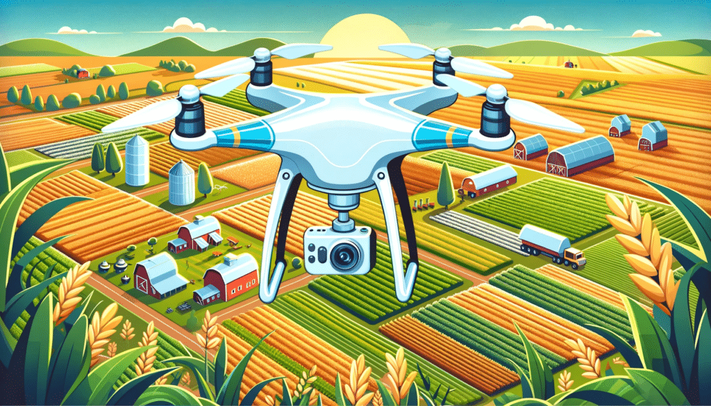
- Purpose: Imagine creating a detailed map of uncharted territory. This software turns that into reality, allowing industries such as construction and agriculture to chart new courses with unparalleled accuracy.
- Real-world Application: In agriculture, it’s like having a bird’s-eye view of every inch of a farm, helping farmers make informed decisions.
Image and Video Processing Software
- Function: This software acts like a skilled artist, transforming raw footage into a masterpiece. It’s essential for professions that rely on visual storytelling.
- User Experience: Real estate agents, for instance, use this to showcase properties in the most appealing light, attracting potential buyers with stunning visuals.
Data Analysis Software
- Role: It sifts through mountains of data, much like a detective looking for clues, to provide actionable insights.
- Industry Impact: Environmentalists use this to monitor changes in ecosystems, making informed decisions to preserve nature.
Fleet Management Software
- Design: Think of it as the command center for drone fleets. It helps businesses keep their fleet in top condition, scheduling maintenance like a well-oiled machine.
- Business Efficiency: Large-scale operators manage their fleets with ease, ensuring each drone is ready for its next mission.
Open-source Drone Software
- Nature: It’s the playground for innovation, where developers and enthusiasts collaborate, pushing the boundaries of what drones can do.
- Community Contribution: A story of collaboration – a developer in one part of the world improves a feature, benefiting users globally.
Enhancing Drone Capabilities with Advanced Software
Utilizing these diverse software solutions, drone operators can elevate their UAVs from simple flying objects to powerful tools that can revolutionize industries. From farmers utilizing drones to monitor crop health to filmmakers capturing breathtaking aerial shots, the right drone software opens up a world of possibilities.
By embracing the full potential of drone software, the sky is not the limit; it’s just the beginning. Whether it’s mapping unexplored terrains, inspecting vast infrastructures, or capturing moments from the heavens, drone software stands as the cornerstone of innovation and efficiency in the drone industry.

Enhancing Your Drone Operations with the Right Software
Selecting the perfect drone software is pivotal for efficient and safe drone operations. Whether you’re a hobbyist or a professional, the right software can transform your drone experience. Let’s delve deeper into the essential features and options available.
User Experience: Navigating with Ease
- Intuitive Design: The hallmark of good drone software is its ease of use. An intuitive interface with straightforward navigation makes it accessible for all skill levels.
- Streamlined Operation: A well-organized dashboard with clear menus enhances the flying experience, making it enjoyable and efficient, even for beginners.
Ensuring Broad Compatibility
- Matching Drone and Software: Compatibility is key. Confirm that your chosen software syncs seamlessly with your drone model and hardware.
- Versatility Across Brands: Some software offers wide-ranging compatibility, making them versatile choices for various drone models.
Custom Flight Plans for Precision
- Tailored Routes: Advanced flight planning features let you chart precise routes, set waypoints, and customize altitude and speed.
- Automation and Accuracy: Automate your drone flights with these settings for more accurate and consistent results, crucial in professional applications.
Real-Time Data for Informed Decisions
- Live Feed and Adjustments: Look for software offering real-time data transmission and processing, crucial for monitoring and adjusting drone flights as needed.
- Enhanced Flight Control: Real-time capabilities ensure safe and responsive drone operation, especially in dynamic environments.
Prioritizing Safety with Geofencing
- Navigational Boundaries: Software with geofencing helps you steer clear of no-fly zones and restricted areas, keeping your operations legal and safe.
- Accident Avoidance: This feature is essential for minimizing risks and complying with aviation regulations.
Data Analysis for Actionable Insights
- Robust Analysis Tools: Choose software with strong data processing and visualization capabilities, turning drone data into actionable insights.
- Custom Reporting: Look for customizable reporting options that align with your specific project or industry requirements.
Seamless Integration with Third-party Software
- Expanded Capabilities: Integration with external tools can significantly enhance your drone’s capabilities, fitting into a broader technological ecosystem.
- Industry-specific Applications: Certain software can integrate with industry-specific tools, providing more targeted solutions.
Exploring Free and Open-source Options
Mission Planner
- Versatile and Comprehensive: Suitable for a variety of drones, it offers extensive flight planning and data analysis capabilities.
- Community-Driven Features: Being open-source, it benefits from community contributions, offering innovative features regularly.
QGroundControl
- Ideal for Beginners: Its user-friendly design makes it accessible to newcomers.
- Comprehensive Control: Offers a full suite of flight control and planning features.
Open Drone Map
- Focus on Aerial Imagery: Specializes in processing aerial photos for mapping and 3D modeling.
- Cost-Effective Mapping Solution: A go-to tool for drone enthusiasts interested in mapping without a hefty price tag.
ArduPilot
- Customizable Autopilot Software: Offers advanced control and customization options for experienced users.
- Community-Supported Development: Benefits from a robust community, ensuring regular updates and cutting-edge features.
Conclusion: Making the Right Choice
Remember, the choice of drone software should align with your specific needs, whether you’re focused on recreational flying, professional photography, mapping, or inspections. While free and open-source options provide a good starting point, more complex needs might necessitate investing in advanced, paid software. The right software not only enhances your drone operations but also ensures safety, compliance, and high-quality data output.
Deciphering the Best Drone Software: A Comprehensive Guide
Selecting the ideal drone software involves navigating a sea of choices, each offering unique features and functionalities. This expanded guide will delve into the intricacies of choosing the right drone software, tailoring it to your specific needs and applications.
User-Friendly Interface: Simplifying Drone Operations
- Ease of Navigation: Look for software with a straightforward and well-structured interface, reducing the learning curve.
- Accessible for All: Ideal software should cater to both beginners and seasoned pilots, balancing simplicity with advanced features.
Compatibility Check: The Cornerstone of Drone Software Selection
- Drone-Model Specificity: Verify the software’s compatibility with your drone’s model and technical specifications.
- Brand Exclusive vs. Universal Software: Some software solutions are tailored for specific drone brands, while others are versatile, covering a wider range of models.
Flight Planning: Tailoring Your Aerial Journey
- Custom Flight Routes: Advanced software should allow you to set specific flight paths, speeds, altitudes, and waypoints.
- Automated Flights for Accuracy: Automation in flight planning ensures consistent, precise, and efficient drone operations.
Real-Time Data Processing: The Backbone of Effective Drone Operation
- Instantaneous Feedback: Essential for immediate adjustments, offering better control over the flight.
- Vital Stats at Your Fingertips: The software should provide essential data like live video streams and telemetry for real-time decision-making.
Budget and Pricing: Striking the Right Balance
- Cost-Benefit Analysis: Evaluate the features against the cost, considering the long-term value the software adds to your operations.
- Open-Source vs. Paid Solutions: While free software can be a good starting point, paid versions often offer more comprehensive features and support.
Unleashing the Power of Drone Software in Various Industries
Drone software extends its utility across numerous sectors, enhancing operational capabilities and data interpretation.
Revolutionizing Commercial and Industrial Applications
- In Construction: It aids in precise site surveys and project progress tracking.
- For Agriculture: Vital for crop health analysis, irrigation planning, and yield prediction.
- Real Estate Marketing: Transforms property showcases with high-quality aerial imagery.
- Surveying and Land Analysis: Brings accuracy to terrain measurements and planning.
Data Analysis: Turning Aerial Data into Actionable Insights
- Spatial Analysis for Mapping: Converts aerial images into detailed topographical maps and 3D models.
- Agricultural Decision Support: Provides in-depth crop health analysis, guiding targeted farming interventions.
- Infrastructure Inspection: Assists in regular checks for maintenance and safety compliance.
- Environmental Monitoring: Offers valuable insights into ecological changes and disaster assessments.
The Final Verdict: Choosing the Right Software
The journey to picking the best drone software hinges on understanding your specific needs, ensuring compatibility with your hardware, and aligning your choice with your financial plan. Whether for commercial applications, hobbyist pursuits, or research, the right software can significantly enhance the functionality and results of your drone operations. Remember, as the drone industry evolves, so do the software solutions – staying updated with the latest advancements will keep you flying high in the drone world.

In-Depth Analysis of Premier Drone Software Solutions
The selection of drone software can significantly influence the efficiency and effectiveness of drone operations. This expanded overview details various drone software options, emphasizing their suitability for different applications.
DJI Drones: Optimized Software Solutions
- DJI GO 4 and DJI Fly: Tailored for DJI drones, these software solutions excel in synchronization with DJI hardware. They offer an integrated experience, encompassing flight planning, real-time video streaming, and comprehensive data analytics. Ideal for DJI users seeking a seamless, brand-specific operating system.
3D Mapping Excellence
- Pix4Dmapper: A top-tier choice for creating detailed 3D maps and models, Pix4Dmapper offers precision photogrammetry. It’s a favorite in sectors like construction and surveying, where accuracy is paramount. Advanced features include terrain modeling and volumetric measurements.
Specialized Inspection Software
- Flyability Inspector: Designed for intricate inspection tasks, this software supports industries requiring detailed examination of structures, like energy and infrastructure. Key features include live feed analysis and custom report generation, tailored for thorough inspections.
Agricultural Drone Applications
- Agisoft Metashape: This software stands out for agricultural usage, providing detailed crop analysis and aiding in efficient farm management. It translates drone-captured imagery into actionable agricultural data, like crop health indicators and irrigation planning.
Real-time Operational Software
- AirMap: Known for its live operational capabilities, AirMap is perfect for dynamic environments. It’s widely used in scenarios requiring immediate data, such as emergency responses or live event coverage, offering real-time flight planning and airspace management.
Beginner-Friendly Open-source Options
- QGroundControl: A great starting point for beginners, this open-source platform is user-friendly and offers essential features like flight planning and basic data analysis. Its community-driven development ensures continuous updates and improvements.
Simplified Mapping Software
- DroneDeploy: Emphasizing ease of use, DroneDeploy is suitable for users seeking simple yet effective mapping solutions. It offers intuitive operation for creating detailed maps and models, suitable for diverse industries from real estate to conservation.
Budget-Friendly Inspection Software
- Skyward: An affordable option for small businesses, Skyward combines flight planning with effective data analysis tools. It’s particularly useful for inspection tasks in industries like construction and infrastructure.
Precision Agriculture: Data-Driven Farming
- PrecisionHawk’s PrecisionAnalytics Agriculture: This software excels in precision agriculture, offering advanced features like plant health analysis and yield prediction. It provides farmers with insights into optimizing crop management and increasing yields.
User-Friendly Surveying Software
- Propeller Aero: Ideal for surveying applications, this software offers a straightforward approach to creating accurate maps and models. Its user-friendly interface is well-suited for professionals requiring quick and reliable survey data.
By selecting the appropriate software, you can significantly enhance your drone operations, whether for commercial tasks or personal projects. Each software option brings unique capabilities to the table, ensuring that there is a solution tailored to every need in the dynamic world of drone technology.

Navigating the Future: Key Trends in Drone Software Development
The drone software landscape is rapidly evolving, driven by technological advancements and changing industry needs. Here’s a comprehensive look at the significant trends shaping the future of drone software.
Revolutionizing with AI and Machine Learning
- Enhanced Autonomy: The integration of AI enhances drones’ decision-making capabilities, allowing for autonomous operations like precision landings and advanced flight paths.
- Intelligent Analytics: Machine learning algorithms enable drones to analyze data in real-time, offering insights for industries like agriculture for crop health monitoring or construction for site analysis.
Embracing Cloud-Based Platforms
- Scalable Data Management: Cloud platforms offer scalable solutions for data storage and processing, catering to drones’ expansive data collection needs.
- Seamless Collaboration: They facilitate real-time collaboration among teams and devices, enhancing project management and decision-making efficiency.
Fortifying Data Security
- Robust Encryption: With the increasing sensitivity of drone-captured data, the focus is on implementing stronger encryption and secure transmission methods.
- Compliance with Regulations: Developers are ensuring that software complies with global data protection regulations, safeguarding user privacy and maintaining industry standards.
Integration with the Internet of Things (IoT)
- Expanding Capabilities: Combining drone software with IoT devices extends drones’ capabilities, enabling them to interact with a vast network of connected devices for diverse applications.
- Smart City Applications: This integration is particularly beneficial in urban planning and smart city initiatives, where drones can collect and relay critical data to connected city infrastructures.
User Experience and Customization
- User-Centric Design: Focus is on creating user-friendly interfaces that are intuitive and customizable, catering to both novice and experienced users.
- Personalized Settings: Customization allows users to tailor their experience, be it through adjustable control settings or configurable data display options, enhancing operational efficiency.
Leveraging VR and AR
- Immersive Flight Control: VR and AR technologies are being used to provide drone operators with an immersive experience, offering a new dimension to remote piloting.
- Enhanced Visualization: AR, in particular, can overlay valuable data and information over live footage, providing richer context during inspections or surveillance missions.
Additional Emerging Trends
- Energy Efficiency: As sustainability becomes a focal point, software that optimizes battery life and reduces energy consumption is gaining traction.
- Social Integration: Integration with social media platforms for seamless content sharing is becoming increasingly popular, especially in marketing and content creation.
- Regulatory Compliance Tools: Software that helps users comply with evolving drone laws and airspace regulations is becoming a necessity.
Future-Proofing with Innovation
As these trends illustrate, the future of drone software is geared towards creating more intelligent, efficient, and user-centric solutions. From AI-powered analytics to cloud-based collaborations, these advancements are not only enhancing the capabilities of drones but also opening up new possibilities across various sectors. By keeping pace with these trends, drone operators and businesses can ensure they are well-positioned to leverage the benefits of advanced drone technology in an increasingly competitive market.

Navigating the World of Drone Software Training and Support
The dynamic nature of drone software necessitates comprehensive training and dependable support for users. Let’s dive deeper into the various forms of training and support that empower users to harness the full potential of their drone software.
Comprehensive Training from Manufacturers
- In-depth Programs: Software developers typically offer extensive training programs, which could include interactive video tutorials, detailed webinars, and immersive in-person workshops.
- Specific to Software: These trainings are tailored specifically for the software, ensuring users grasp both basic functionalities and advanced features.
- Real-world Scenarios: Often, these training sessions include examples and scenarios that users might encounter, aiding in practical understanding.
Leveraging Online Communities and Forums
- Collaborative Learning: Online communities and forums present opportunities for collaborative learning, where users can exchange experiences, troubleshoot issues, and share innovative uses of the software.
- Case Studies and User Stories: These platforms often feature real-life case studies and user stories, providing insights into practical application and problem-solving with the software.
Specialized Industry Training
- Targeted Instruction: Industry-specific training programs delve into using drone software within particular fields, addressing unique challenges and leveraging industry-specific features.
- Expert-led Sessions: These trainings are often led by industry experts and include hands-on practical exercises.
Professional Certification Programs
- Recognition of Expertise: Obtaining professional certification in drone software not only showcases proficiency but also enhances credibility in the industry.
- Career Development: These certifications can be pivotal for career advancement, providing recognized credentials that stand out in a competitive job market.
- Continuous Learning: Certifications often require ongoing education, ensuring that users stay updated with the latest advancements in drone technology and software.
Accessible and Efficient Technical Support
- Round-the-Clock Support: Many software providers offer 24/7 technical support, ensuring users can get help whenever needed.
- Multilingual Assistance: To cater to a global user base, support services often include multilingual assistance, breaking down language barriers in troubleshooting and guidance.
- Customized Help: Support services are increasingly personalized, with assistance tailored to the specific issues and needs of individual users.
Additional Resources for Enhanced Learning
- Video Libraries: Some manufacturers and community forums provide extensive video libraries, offering step-by-step guides and tips.
- Regular Webinars and Updates: Regularly scheduled webinars keep users informed about the latest software updates, new features, and best practices.
- User Conferences: Annual or bi-annual user conferences bring together users, experts, and developers, fostering a community of learning and innovation.
Elevating Drone Operations Through Education and Support
By engaging deeply with these varied training and support resources, drone software users can elevate their operational capabilities. This comprehensive approach to learning and support ensures that users are not just equipped to use their drone software effectively but are also prepared to tackle emerging challenges and leverage new opportunities in the fast-evolving world of drone technology.
As we’ve explored in this article, the best drone software depends on your unique requirements and preferences. Each option has its own strengths and weaknesses, and the ultimate choice should be based on factors like ease of use, compatibility, flight planning features, real-time data processing capabilities, and pricing. We hope this Drone Flight Software Showdown has provided you with the insight needed to make an informed decision.
Now that you’ve learned about the top drone flight software options, why not delve deeper into the world of drones? We encourage you to visit Soaring High: A Comprehensive Guide to Building and Growing Your Drone Business for a complete guide on how to create and scale your own drone business.
If you require any drone services or have further questions, don’t hesitate to reach out to us at Blue Falcon Aerial. You can contact us here. We’re always here to help!