In a world where technological advancements shape our daily lives, it’s exhilarating to witness these innovations being leveraged for a noble cause – the conservation of our ecosystems. Enter Drone-Based Ecosystem Monitoring, a powerful tool that allows us to view and preserve the planet’s biodiversity from a completely new perspective. Imagine a soaring bird’s eye view, rapidly and accurately capturing data from forests, wetlands, marine ecosystems, and agricultural landscapes. This is more than just a lofty dream; it’s a reality transforming the field of conservation. Join us as we delve into the captivating world of drones, the technologies they employ, the benefits they offer, and the remarkable potential they hold for ecosystem monitoring and management.
What is Drone-Based Ecosystem Monitoring?
Drone-Based Ecosystem Monitoring is an advanced method that uses unmanned aerial vehicles (UAVs), commonly known as drones, to gather and analyze data about an ecosystem. It’s a technology-driven approach to conservation that utilizes the vantage point of the skies and cutting-edge sensors to yield invaluable insights about our natural environment.
The Core of Drone-Based Monitoring: Technology and Sensors
A key element of this monitoring approach is the technology it employs. At the heart of a drone, you’ll find a multitude of high-tech sensors designed to capture a broad spectrum of data.
Optical Sensors: These include standard digital cameras and multispectral cameras. They capture visible light in high-resolution images, essential for general surveillance and land-use analysis.
Infrared Sensors: Useful in detecting temperature differences, these sensors are great for monitoring plant health, as healthier plants emit less heat than their distressed counterparts.
LiDAR Sensors: Light Detection and Ranging sensors use pulsed light to measure distances and create high-resolution 3D maps of the terrain, which are useful for various analyses, including forest structure and hydrological modeling.
Hyperspectral Sensors: These capture a vast spectrum of light, including both visible and invisible wavelengths, allowing for detailed analyses such as species identification and health assessments.
| Sensor Type | Use Cases |
|---|---|
| Optical | General surveillance, Land-use analysis |
| Infrared | Plant health monitoring |
| LiDAR | 3D mapping, Forest structure analysis, Hydrological modeling |
| Hyperspectral | Species identification, Detailed health assessments |
These sensors, combined with the inherent mobility and flexibility of drones, make Drone-Based Ecosystem Monitoring an innovative tool in the hands of conservationists, ecologists, and environmental scientists alike.
How do Drones Assist in Monitoring Ecosystems?
Drones have opened up new avenues in the field of ecosystem monitoring by providing high-resolution, real-time data in a swift and cost-effective manner. They have made it possible to reach remote and inaccessible areas, giving scientists the opportunity to explore and monitor ecosystems like never before.
Data Collection and Analysis
Drones capture high-quality images and other data types over a large area in a short time, making them ideal for tasks such as mapping and monitoring land-use changes, tracking wildlife, or assessing plant health.
Once the data has been collected, it can be processed using various software tools to create detailed maps, 3D models, and other types of visualizations. This data can also be analyzed to extract meaningful insights, such as changes in vegetation over time, the presence of certain animal species, or indications of environmental stressors.
Integrating Drone Data with GIS for Ecosystem Mapping
One of the major applications of drone data is its integration with Geographic Information System (GIS) tools to create detailed and accurate ecosystem maps. These maps can show various aspects of the ecosystem, such as vegetation types, wildlife habitats, and terrain features. They can also track changes over time, providing essential information for ecosystem management and conservation planning.
By bridging the gap between ground-based surveys and satellite imagery, drones are revolutionizing the way we monitor and understand our ecosystems. Their ability to gather high-quality data quickly and efficiently makes them an indispensable tool in today’s data-driven world.
Benefits of Drone-Based Ecosystem Monitoring
As drones steadily rise in popularity across various industries, they’ve proven to be especially impactful in the world of conservation. Drone-based ecosystem monitoring has been lauded for its ability to provide a multitude of benefits that extend beyond traditional methods of ecosystem monitoring.
Enhanced Accuracy and Precision
One of the foremost advantages of drone-based ecosystem monitoring is the superior level of accuracy and precision it provides. Drones equipped with advanced sensors can capture high-resolution images and data, leading to detailed and precise insights about the ecosystem.
Rapid Data Collection and Analysis
Speed is another factor where drone-based ecosystem monitoring shines. In a fraction of the time it would take a human team to survey an area, drones can collect a wealth of data swiftly. Furthermore, with the aid of modern data analysis tools, this information can be quickly processed to yield actionable insights.
Cost-Effective Solution
While the initial investment for drones might be substantial, the overall cost savings over time can be significant. The ability of drones to cover large areas quickly, combined with minimal operational costs, makes them a highly cost-effective solution for ecosystem monitoring.
Non-Intrusive Monitoring
Drones have the capability to monitor ecosystems without causing significant disturbances to the wildlife or the environment, which is a considerable advantage over some traditional methods.
Specific Benefits for Different Types of Ecosystems
Different ecosystems can benefit uniquely from drone monitoring. For instance, forest ecosystems can benefit from 3D mapping to assess tree height, density, and health. Wetlands can be surveyed with infrared sensors to evaluate water quality and vegetation health. Agricultural landscapes can be analyzed for crop health and yield predictions, and coastal ecosystems can be monitored for changes in the coral reefs or shoreline.
Applications of Drone-Based Ecosystem Monitoring
The practical applications of drone-based ecosystem monitoring are both extensive and exciting. From forest conservation to precision farming, drones are proving to be an invaluable tool.
Forest Monitoring for Biodiversity Conservation
Forests are vital habitats for a plethora of species and contribute significantly to global biodiversity. Drones can aid in monitoring these biodiverse ecosystems, identifying changes in the flora and fauna, mapping tree species, and assisting in identifying areas affected by pests or diseases.
Marine Ecosystems and Coral Reef Monitoring
Marine ecosystems, particularly coral reefs, are often difficult to monitor due to accessibility issues and the complexity of underwater imaging. However, drones equipped with specialized cameras can capture high-resolution images of shallow marine areas, providing valuable data about the health and composition of coral reefs.
Wetland Ecosystem Assessment
Wetlands are crucial ecosystems that provide a wide range of services, from water filtration to carbon sequestration. Drones can play a critical role in monitoring wetland health, mapping wetland extent, and identifying changes over time.
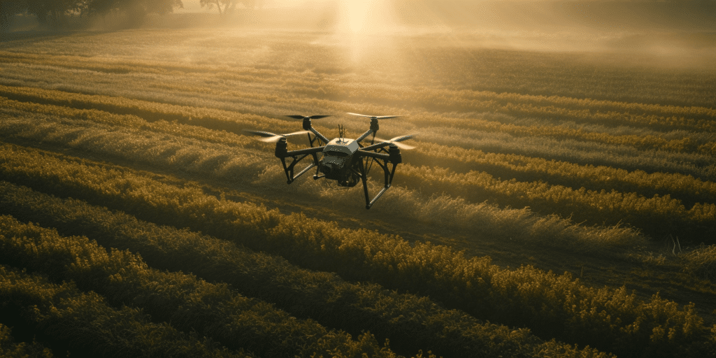
Agricultural Landscape Monitoring for Precision Farming
Precision farming aims to optimize crop yield and resource usage by making data-driven decisions. Drones can provide detailed information about crop health, soil moisture, and pest presence, enabling farmers to apply resources such as water or fertilizers more efficiently.
Mapping Invasive Species
Invasive species pose a significant threat to local biodiversity. Drone-based ecosystem monitoring can help in identifying and mapping these species, allowing for prompt and effective management actions.
By enabling such wide-ranging applications, drones are transforming how we interact with and manage our natural world. They are enhancing our capabilities, enabling us to better care for and protect our precious ecosystems.
Best Practices and Remote Sensing Techniques
As with any advanced technology, getting the most out of drone-based ecosystem monitoring requires knowledge of the best practices and techniques in the field. By applying these principles, we can ensure the data collected is of the highest quality and accuracy.
Guidelines for Conducting Drone-Based Ecosystem Surveys
While drone operations might seem simple, careful planning is essential for successful ecosystem surveys. Here are a few guidelines:
- Understand the Objective: Before launching the drone, have a clear understanding of what you aim to achieve with the data collected. This will inform the choice of sensors and flight parameters.
- Consider the Conditions: Weather, time of day, and season can all affect the quality of data collected. Plan your drone flights accordingly.
- Comply with Local Regulations: Always ensure that you comply with local aviation and privacy regulations.
- Respect Wildlife: Minimize disturbance to wildlife during your drone operations.
Remote Sensing Techniques in Ecosystem Monitoring
Remote sensing techniques are fundamental to drone-based ecosystem monitoring. These techniques interpret the data collected by the drone’s sensors to yield actionable insights.
- Spectral Analysis: Using the different wavelengths captured by the sensors, spectral analysis can identify various types of vegetation and assess their health.
- Thermal Imaging: Infrared sensors can capture thermal images, useful in detecting heat sources or assessing plant health.
- 3D Mapping: LiDAR and photogrammetry allow for the creation of detailed 3D maps of an ecosystem, useful for understanding terrain and vegetation structure.
- Change Detection: By comparing data from different points in time, changes in the ecosystem can be detected and monitored.
Drones for Wildlife Conservation and Habitat Assessment
The use of drones extends beyond vegetation monitoring, proving invaluable for wildlife conservation and habitat assessment.
Use of Drones in Wildlife Conservation
Drones can play a significant role in wildlife conservation. They offer a non-intrusive method to monitor animal populations and their behaviors. Equipped with high-resolution cameras or thermal sensors, drones can locate and track wildlife, even in difficult terrain or low-light conditions.
For example, drones have been used to monitor the populations of various species like elephants, whales, and birds. They’ve also been utilized to combat poaching by providing surveillance in high-risk areas.
Drone Technology for Habitat Assessment
Drones can provide a detailed view of an animal’s habitat, yielding crucial insights for conservation efforts. They can map the extent of a habitat, identify food sources, and detect potential threats such as invasive species or human activity. This data can inform conservation strategies, helping ensure a suitable environment for wildlife to thrive.
By leveraging drone technology, conservationists can gain unprecedented insights into wildlife populations and their habitats, aiding efforts to preserve the world’s biodiversity. Drones offer a promising future for wildlife conservation, providing tools that are fast, cost-effective, and remarkably versatile.
Regulations and Ethical Considerations in Drone-Based Ecosystem Monitoring
With the increasing use of drones for ecosystem monitoring, it’s crucial to discuss the regulatory and ethical considerations that come into play.
Current Regulations and Guidelines
In most countries, drone operations are subject to aviation regulations, which often include restrictions on the altitude at which drones can fly, the proximity to airports, and requirements for operator licensing. In addition, there may be specific rules for drone use in environmentally sensitive areas or for wildlife monitoring.
For instance, in the United States, the Federal Aviation Administration (FAA) regulates the use of drones, with various requirements based on the drone’s weight, purpose of flight (recreational or commercial), and operation in controlled airspace.
Privacy and Ethical Considerations
Along with regulations, drone operators must also adhere to ethical considerations. Respecting privacy is paramount, particularly when operating drones near residential areas or private land.
Furthermore, when using drones for wildlife monitoring, it’s important to minimize any potential disturbance to the animals. In many cases, it’s advisable to consult with wildlife experts to ensure that drone operations are conducted in a manner that is respectful to the animals and their habitats.
By adhering to regulations and considering the ethical implications, drone operators can ensure responsible and sustainable use of this technology for ecosystem monitoring.
Analyzing and Interpreting Drone Data for Ecosystem Management
Drone-based ecosystem monitoring generates large volumes of data, but the true value of this data lies in its analysis and interpretation.
Data Analysis Methods
As mentioned earlier, several data analysis methods are employed in drone-based ecosystem monitoring, including image analysis, classification, and spatial analysis. However, interpreting this data for ecosystem management requires additional steps.
Turning Drone Data into Actionable Insights for Ecosystem Management
The ultimate goal of drone-based ecosystem monitoring is to derive actionable insights that can guide ecosystem management decisions. Here’s how it happens:
- Identify Patterns and Trends: By analyzing drone data over time, patterns and trends can be identified. For instance, changes in vegetation cover or animal populations can be detected and monitored.
- Predictive Modeling: The data collected by drones can feed into predictive models, helping to forecast future changes in the ecosystem. This can inform proactive management strategies.
- Inform Management Decisions: Drone data can provide evidence to support management decisions. For instance, data showing the spread of an invasive species can justify intervention efforts.
In this way, the data collected by drones becomes a powerful tool for ecosystem management, enabling informed, evidence-based decision-making. It’s not just about collecting data, but about translating that data into actions that support the health and sustainability of our ecosystems.
The Role of Blue Falcon Aerial in Drone-Based Ecosystem Monitoring
When it comes to drone-based ecosystem monitoring, Blue Falcon Aerial brings a unique combination of expertise, cutting-edge technology, and a commitment to environmental stewardship.
Services Offered
At Blue Falcon Aerial, we specialize in providing two vital services that are essential for comprehensive ecosystem monitoring and mapping:
Orthomosaic Mapping: This service involves creating highly detailed, accurate maps from aerial images. These orthomosaic maps are crucial for various applications in ecosystem monitoring, from tracking changes in land use to identifying the spread of invasive species.
LiDAR Mapping: LiDAR technology uses laser pulses to create highly accurate 3D representations of the environment. This service is invaluable for understanding the structure of various ecosystems, from the heights of forest canopies to the topography of the landscape.
Through these services, Blue Falcon Aerial enables a detailed, accurate understanding of various ecosystems, supporting effective management and conservation efforts.
Expertise and Experience
Blue Falcon Aerial is staffed by a team of dedicated professionals with expertise in drone technology, remote sensing, and data analysis. We bring years of experience to every project, delivering high-quality data that drives informed decision-making. Our operations adhere to the highest standards of safety, ethics, and regulatory compliance.
In the rapidly evolving field of drone-based ecosystem monitoring, Blue Falcon Aerial’s commitment to innovation, excellence, and environmental stewardship makes us a trusted partner for organizations seeking to understand and conserve our precious ecosystems. Through our services and expertise, we are proud to contribute to the global effort to leverage drone technology for a more sustainable future.
As we conclude this exploration into the realm of Drone-Based Ecosystem Monitoring, we can see how this technology offers a new and innovative approach to ecosystem conservation. Whether it’s enhancing our understanding of diverse habitats, tracking elusive wildlife, or providing invaluable data for precision farming, drones have cemented their place in the vanguard of conservation technology.
For those eager to learn more about leveraging drones for real-world applications, we strongly recommend reading our comprehensive guide on Building and Growing Your Drone Business. This in-depth resource provides further insights and practical tips that could prove invaluable for your journey in drone technology.
At Blue Falcon Aerial, we are proud to be at the forefront of this exciting field, providing a range of professional drone services, including ecosystem monitoring. Our team, armed with extensive experience and a commitment to environmental preservation, is ready to assist you in your drone-related needs. Contact us today to explore how we can help you navigate the skies and contribute to the future of conservation.