Oklahoma City, OK – Blue Falcon Aerial, renowned for its expertise in drone LiDAR technology, has joined forces with the esteemed Francis Tuttle Technology Center to launch an innovative Advanced Aerial Mapping Course. This partnership is a testament to the commitment of both organizations to provide cutting-edge educational experiences in surveying and mapping.
Course Overview: Bridging Technology and Expertise
Set to commence in April 2024 at Francis Tuttle’s Rockwell campus, the course is meticulously designed to offer comprehensive training in aerial mapping, covering both theoretical knowledge and practical skills.
Core Curriculum Components:
Introduction to Drones and Legal Compliance: Understanding drone operation fundamentals, navigating FAA regulations, and ensuring safe and compliant flight practices.
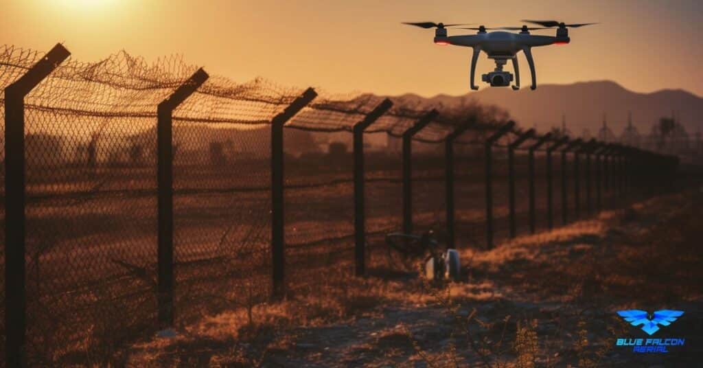
LiDAR Technology and Applications: Delving into the capabilities of LiDAR technology, exploring its diverse applications in professional surveying and mapping.
Ground Control Techniques: Teaching the principles of surveying and the critical role of ground control in achieving accurate and reliable mapping data.
Capturing and Processing Orthomosaics and LiDAR Data: Hands-on training in capturing high-quality orthomosaics and LiDAR data, followed by comprehensive lessons in data processing to produce various deliverables like planimetrics, topography, breaklines, and LiDAR classifications.
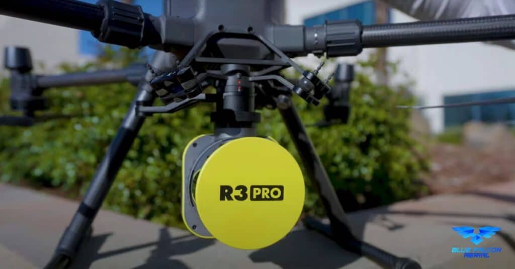
Practical Flight Training: Extensive flight time with a range of drones, including the M350, Mavic 3 Enterprise, and R3Pro LiDAR system, ensuring students gain confidence and proficiency in operating the equipment.
Industry Expertise and Instruction
The course will benefit from the seasoned expertise of Nick Powell and Trey Ayers from Francis Tuttle’s Aerospace Technologies program. Their knowledge and experience in aerial technologies will be key in delivering an educational program that is both in-depth and practical.
Francis Tuttle’s Educational Legacy
Francis Tuttle Technology Center, named in honor of Dr. Francis Tuttle and his visionary approach to career and technical education, provides the perfect backdrop for this course. With its history of advancing Oklahoma’s aerospace sector, the center offers an ideal environment for learning and innovation in aerial mapping.
Blue Falcon Aerial’s Mission and Contribution
Blue Falcon Aerial brings its commitment to making LiDAR technology accessible for all surveyors to this course. Their focus on precision, efficiency, and tailored solutions in LiDAR services enriches the course content, ensuring that it meets the needs of modern surveying professionals.
Enroll and Transform Your Skills
This course is not just a learning opportunity; it is a doorway to the future of aerial mapping. It is designed for surveyors, geospatial professionals, and anyone eager to delve into the world of advanced mapping technologies.
Join us in this pioneering venture that combines Blue Falcon Aerial’s cutting-edge LiDAR expertise with Francis Tuttle’s rich educational legacy. This Advanced Aerial Mapping Course is set to redefine the standards of surveying and mapping education. Be part of this transformative journey and take your professional skills to new heights.
Frequently Asked Questions (FAQs)
As the excitement builds for the Advanced Aerial Mapping Course, we’ve gathered some of the most common questions to shed light on this unique educational offering. Here’s what you need to know:
| Questions | Answers |
|---|---|
| When does the Advanced Aerial Mapping Course begin? | The course is scheduled to start in April 2024. |
| Where will the course be held? | It will be hosted at Francis Tuttle’s Rockwell campus, 12777 N Rockwell Ave, Oklahoma City, OK 73142. |
| Who is the course intended for? | The course is designed for surveyors, geospatial professionals, and anyone interested in advanced mapping technologies. |
| What topics will the course cover? | Topics include drone basics, FAA compliance, LiDAR applications, ground control techniques, data processing, and practical flight training. |
| What drones and technology will be used in the course? | Technologies include M350, Mavic 3 Enterprise, R3Pro LiDAR system, and various GNSS systems. |
| Who are the main instructors for the course? | The course will be led by Nick Powell and Trey Ayers from Francis Tuttle, along with instructors from the Blue Falcon Aerial team. |
| Is there any financial aid or scholarship available for this course? | Information on financial aid or scholarships isn’t specified, but Francis Tuttle typically offers various financial support options. |
| How long is the course? | Undetermined at this time, however the intention is to be a comprehensive course. |
| Will there be hands-on training with drones? | Yes, the course includes extensive hands-on training with various advanced drones. |
| How can I register for the course? | Registration details are yet to be announced. Stay tuned to Blue Falcon Aerial’s and Francis Tuttle’s websites for updates. |
These FAQs are designed to provide a snapshot of what the course will offer. For more detailed information or if you have other questions, please feel free to contact us.