Oklahoma, a state rich in diverse landscapes and breathtaking views, presents unique opportunities for drone enthusiasts. From serene lakes to bustling cityscapes, the state offers an array of locations perfect for capturing stunning aerial photography. Here are the top five locations in Oklahoma that will elevate your drone photography to new heights.
1. Grand Lake o’ the Cherokees
Location: Northeast Oklahoma
Contact: Grand Lake Visitor Center
Key Features:
- Experience the grandeur of water sports and serene lake life from an aerial perspective.
- The numerous inlets and marinas present a playground for dynamic and engaging drone footage.
- Capture the essence of lake-side living and Oklahoma’s natural beauty.
Why It’s Perfect for Drones: The lake’s vast expanse and beautiful surroundings make it an ideal spot for capturing breathtaking aerial footage.
Best Time to Fly: Summer months for vibrant activity, fall for stunning foliage.
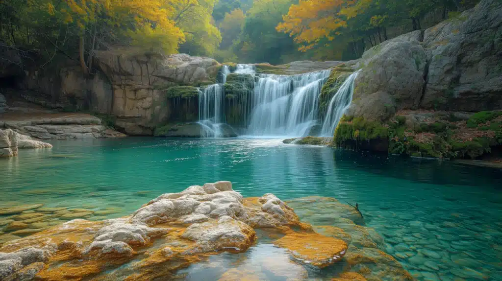
2. Turner Falls Park
Location: Davis, OK
Contact: Turner Falls Park Office
Key Features:
- The park’s landscape is a tapestry of natural wonders, perfect for adventurous drone explorers.
- Capture the dynamic views of the waterfall as it cascades into a natural swimming pool.
- The park’s elevation changes provide a fantastic opportunity for panoramic views.
Why It’s Perfect for Drones: Turner Falls’ cascading waterfall and lush surroundings provide a spectacular backdrop for drone photography. Its elevation changes allow for varied and interesting aerial shots.
Best Time to Fly: The park is most visually striking in the late spring and summer.
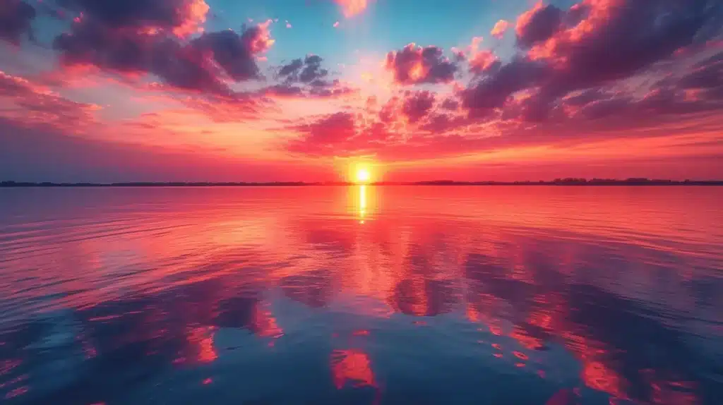
3. Lake Hefner
Location: Oklahoma City, OK
Contact: Oklahoma City Parks and Recreation
Key Features:
- Ideal for urban landscape enthusiasts, this location combines cityscapes with natural beauty.
- A hotspot for capturing sailing events, kite flying, and dynamic sunset views.
- Note: Lake Hefner is in a 400-foot airspace, so make sure to get LAANC approval before flying your drone here.
Why It’s Perfect for Drones: Lake Hefner’s mix of urban and natural landscapes offers diverse photographic opportunities, from capturing water sports activities to serene lake views.
Best Time to Fly: The lake is especially beautiful during the golden hours of early morning and late afternoon.

4. Paseo Arts District
Location: Oklahoma City, OK
Contact: Paseo Arts District Association
Key Features:
- A cultural hub that’s a feast for the eyes, the district’s vibrancy is unmatched.
- Ideal for those who love to blend urban art, bustling streets, and architectural beauty in their footage.
- Drone footage can capture the essence of the district’s lively festivals and events.
Why It’s Perfect for Drones: The Paseo Arts District’s urban vibrancy and colorful street scenes make it an ideal location for dynamic and culturally rich aerial photography.
Best Time to Fly: The area is lively year-round, with special events and festivals offering unique flying opportunities.
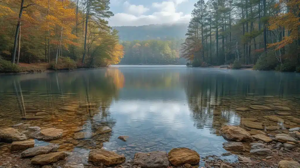
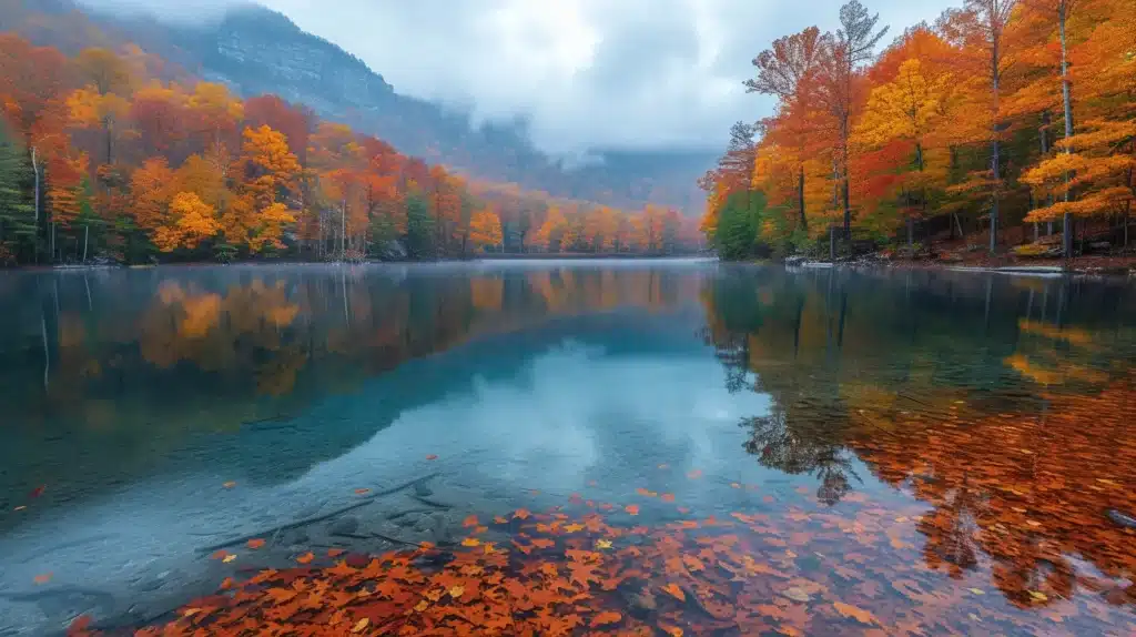
5. Beavers Bend State Park
Location: Broken Bow, OK
Contact: Beavers Bend State Park Office
Key Features:
- With its rugged terrain, the park offers dramatic landscapes that are a dream for any drone photographer.
- Capture the diverse wildlife and rich natural scenery in stunning detail.
- The changing seasons bring new dimensions to the park, offering a year-round opportunity for breathtaking footage.
Why It’s Perfect for Drones: The park’s varied landscapes, from river views to forested hills, provide a multitude of scenic opportunities for drone pilots.
Best Time to Fly: The park is open year-round, with fall providing spectacular foliage colors.
While these locations offer fantastic opportunities for drone flying, always ensure to check federal, state, and local laws before flying in any of these areas to ensure a safe and legal flight experience.
For those looking to take their drone business to the next level, explore our comprehensive guide, Soaring High: A Comprehensive Guide to Building and Growing Your Drone Business. This guide is packed with insights and tips to help you succeed in the drone industry.
Additionally, if you require professional assistance with LiDAR or Orthomosaic projects, or have any questions, don’t hesitate to contact Blue Falcon Aerial. We are here to help you achieve your aerial imaging objectives with expertise and precision.