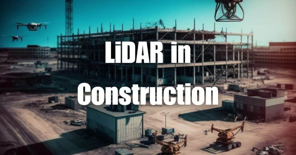
LiDAR in Construction has revolutionized the way professionals in the industry plan, execute, and monitor projects. By combining the power of LiDAR technology with the versatility of drone systems, construction professionals now have access to a game-changing tool that streamlines processes and boosts productivity. In this article, we’ll explore how Drone LiDAR has become an indispensable asset for construction professionals and dive deep into its applications and benefits. Get ready to discover how this cutting-edge technology is shaping the future of construction!
What is LiDAR?
LiDAR, short for Light Detection and Ranging, is a remote sensing technology that uses lasers to measure distances and create detailed, three-dimensional maps of the environment. It works by emitting laser pulses and then measuring the time it takes for the light to bounce back after hitting a surface. This information is used to calculate the distance between the LiDAR sensor and the target object, allowing for the creation of precise and accurate point cloud data.
LiDAR technology has been around for several decades and was initially used in meteorology and atmospheric studies. However, its applications have expanded significantly over the years, and it is now widely employed in various fields such as geology, forestry, agriculture, and, most notably, construction and civil engineering.
How Drone LiDAR Works
Drone LiDAR systems combine the power of LiDAR technology with the flexibility and mobility of unmanned aerial vehicles (UAVs) to provide construction professionals with an efficient and cost-effective solution for capturing high-resolution spatial data. In this section, we’ll explore the main components of a Drone LiDAR system and how data is processed and analyzed.
Components of a Drone LiDAR System
A typical Drone LiDAR system consists of several key components, including:
- LiDAR sensor: The core component that emits laser pulses and captures the reflected light to measure distances.
- Drone: An unmanned aerial vehicle that carries the LiDAR sensor and other necessary equipment, allowing for autonomous or remote-controlled flight.
- Global Positioning System (GPS) and Inertial Measurement Unit (IMU): These systems work together to determine the exact position and orientation of the drone, ensuring accurate geospatial data.
- Data storage: Onboard data storage is used to record the raw point cloud data, GPS information, and other metadata during the flight.
- Software: Specialized software is used to process and analyze the collected data, transforming it into actionable information.
Data Processing and Analysis
Once the Drone LiDAR system has completed its mission and collected the raw point cloud data, it must be processed and analyzed to generate useful insights. This typically involves the following steps:
- Data preprocessing: The raw point cloud data is cleaned and filtered to remove any noise or artifacts.
- Georeferencing: The point cloud data is combined with the GPS and IMU information to accurately position it in the real world.
- Data analysis: Advanced algorithms and software tools are used to extract valuable information from the processed point cloud data, such as terrain models, building outlines, and vegetation classifications.
- Visualization and reporting: The analyzed data is visualized and presented in various formats, such as 2D maps, 3D models, or reports, to aid construction professionals in making informed decisions.
Applications of LiDAR in Construction
LiDAR technology has found numerous applications in the construction industry, thanks to its ability to provide accurate and detailed spatial data. In this section, we’ll discuss some of the most common uses of LiDAR in construction.
Site Planning and Pre-Construction Analysis
Drone LiDAR systems are invaluable during the site planning and pre-construction phases of a project. They can quickly and accurately capture topographic data, identify potential hazards, and evaluate site conditions. This information helps construction professionals make informed decisions regarding site selection, design, and resource allocation, ultimately leading to more efficient project execution.
Earthworks and Infrastructure Monitoring
Drone LiDAR is an effective tool for monitoring earthworks, grading, and other infrastructure-related activities. It enables construction professionals to track progress, evaluate the quality of work, and quickly identify any deviations from the planned design. By providing real-time data on the status of a project, Drone LiDAR can significantly improve decision-making and help keep projects on schedule.
As-Built Surveys and Quality Assurance
As-built surveys are essential for verifying that a construction project has been completed according to the design specifications. Drone LiDAR systems can quickly and accurately capture as-built data, allowing construction professionals to compare the final product with the original design and identify any discrepancies. This ensures that the project meets quality standards and can prevent costly rework.
Building Information Modeling (BIM) Integration
BIM is a digital representation of a building’s physical and functional characteristics, which can be used for design, construction, and facility management. Drone LiDAR data can be seamlessly integrated with BIM software, allowing construction professionals to create accurate 3D models and streamline various project phases, such as design, scheduling, and cost estimation.
LiDAR in Civil Engineering
In addition to its applications in construction, LiDAR technology has also become an essential tool for civil engineering projects. In this section, we’ll explore some of the ways LiDAR is used in civil engineering.
Topographic Surveys
Topographic surveys are crucial for civil engineering projects, as they provide detailed information on the elevation and shape of the terrain. Drone LiDAR systems can quickly and accurately capture this data, making them an ideal choice for large-scale surveying projects.
Floodplain Mapping and Hydrological Studies
Accurate floodplain mapping and hydrological studies are essential for predicting and mitigating the impacts of natural disasters such as floods. Drone LiDAR can efficiently collect high-resolution elevation data, enabling civil engineers to create detailed floodplain maps, analyze water flow patterns, and identify potential flood hazards.
Transportation Infrastructure Analysis
Drone LiDAR is an effective tool for analyzing and managing transportation infrastructure, such as roads, bridges, and railways. It can be used to monitor the condition of these assets, identify maintenance needs, and plan for future expansions or upgrades.
Environmental Impact Assessments
Before embarking on a civil engineering project, it is essential to assess its potential environmental impact. Drone LiDAR can help in this process by providing detailed information on the existing landscape, vegetation, and wildlife habitats. This data can be used to identify environmentally sensitive areas and develop mitigation strategies to minimize the project’s impact on the environment.
LiDAR in Infrastructure
LiDAR technology has become increasingly important in the management and maintenance of infrastructure assets. In this section, we will discuss some of the key applications of LiDAR in the infrastructure sector.
Inspection and Maintenance of Bridges
Regular inspection and maintenance of bridges are crucial to ensure their safety and longevity. Drone LiDAR can be used to perform detailed inspections of bridge structures, identifying any signs of damage or deterioration, such as cracks, corrosion, or deformation. This information can help engineers prioritize maintenance tasks and prevent potential failures.
Utilities and Pipeline Management
Drone LiDAR can be used to inspect and manage utilities and pipeline networks, such as electrical power lines, water supply systems, and gas pipelines. By capturing high-resolution data, LiDAR can help identify potential issues, such as vegetation encroachment, leaks, or structural damage, allowing for timely maintenance and repair.
Urban Planning and Smart Cities Development
LiDAR technology can play a significant role in urban planning and the development of smart cities. By providing accurate and detailed data on the built environment, LiDAR can help planners make informed decisions about land use, transportation networks, and infrastructure development. In addition, LiDAR data can be used to create digital twins of urban environments, facilitating the integration of smart city technologies and improving overall urban efficiency.
LiDAR in Building Information Modeling (BIM)
The integration of LiDAR technology with Building Information Modeling (BIM) has brought numerous benefits to the architecture, engineering, and construction industries. In this section, we will explore some of the key applications of LiDAR in BIM.
3D Modeling and Design
Drone LiDAR can be used to capture detailed and accurate point cloud data, which can then be converted into 3D models of buildings and other structures. These models can be imported into BIM software, allowing architects and engineers to create realistic and data-driven designs that account for the existing site conditions.
Construction Progress Monitoring
LiDAR technology can be employed to monitor the progress of construction projects and ensure that they are on track and adhering to the design specifications. By comparing LiDAR scans taken at different stages of the project, construction professionals can quickly identify any deviations from the planned design and take corrective action as needed.
Facility Management and Asset Tracking
BIM models enriched with LiDAR data can be used for facility management and asset tracking purposes. These models can provide facility managers with detailed information about the building’s systems and components, enabling them to plan and execute maintenance tasks more efficiently. In addition, LiDAR data can be used to create accurate inventories of building assets, facilitating better management and tracking of resources.
LiDAR Architecture
LiDAR technology has become an invaluable tool in the field of architecture, providing architects with accurate and detailed data to inform their designs and make better decisions. In this section, we will discuss some of the key applications of LiDAR in architecture.
Historical Building and Heritage Preservation
Drone LiDAR can be used to create detailed and accurate 3D models of historical buildings and heritage sites, allowing for their preservation and documentation. This data can be used to monitor the condition of these structures, identify any signs of deterioration, and plan for necessary restoration work. In addition, LiDAR models can serve as a valuable resource for researchers and historians studying the architectural history of a site.
Interior and Exterior Architectural Surveys
LiDAR technology can be used to perform both interior and exterior architectural surveys, capturing detailed information about a building’s structure, materials, and finishes. This data can be used to inform design decisions, create as-built documentation, and ensure that construction projects adhere to building codes and regulations.
Structural Health Monitoring and Defect Detection
Drone LiDAR can be employed to monitor the structural health of buildings and detect any defects or potential issues, such as cracks, settlement, or deformation. By providing accurate and up-to-date information on a building’s condition, LiDAR can help architects and engineers plan for necessary maintenance work and prevent potential failures.
Benefits of Using Drone LiDAR in Construction
The use of drone LiDAR technology in construction and related fields offers numerous benefits, which can lead to increased efficiency, cost savings, and improved safety. In this section, we will explore some of the main advantages of using drone LiDAR in construction.
Cost Savings
Drone LiDAR systems can significantly reduce the time and labor required to perform surveys and capture spatial data, resulting in substantial cost savings. Traditional surveying methods can be time-consuming and labor-intensive, while drone LiDAR can quickly and accurately capture the necessary data with minimal manpower.
Time Efficiency
By streamlining the data collection process, drone LiDAR can save valuable time on construction projects. Faster data acquisition means that project timelines can be shortened, and important decisions can be made more quickly, ensuring that projects stay on schedule.
Enhanced Accuracy and Precision
Drone LiDAR systems can capture extremely accurate and high-resolution spatial data, providing construction professionals with reliable information on which to base their decisions. This level of accuracy can help reduce errors and rework, ultimately leading to better project outcomes.
Improved Safety
By using drone LiDAR systems to perform surveys and inspections, construction professionals can minimize the need for workers to access hazardous areas or perform dangerous tasks, such as climbing scaffolding or working at height. This can significantly improve the overall safety of construction sites and reduce the risk of accidents and injuries.
In conclusion, Drone LiDAR has proven to be a game-changer for construction professionals, offering numerous advantages such as cost savings, time efficiency, enhanced accuracy, and improved safety. By leveraging this technology, the industry can significantly streamline operations and achieve better results.
If you’re interested in learning more about aerial LiDAR, we encourage you to visit Aerial LiDAR 101: An Introduction to its Applications and Benefits for a comprehensive guide. Furthermore, if you require drone services for your construction projects, don’t hesitate to contact Blue Falcon Aerial for expert advice and solutions tailored to your needs.