
Are you looking to up your aerial mapping game and produce high-quality, accurate orthomosaic maps? Look no further! In this comprehensive guide, we’ll explore the Top Orthomosaic Drones on the market and how they can elevate your aerial mapping projects. With the right drone, you can obtain precise, detailed data for various applications across numerous industries. So, buckle up and let’s dive into the world of orthomosaic drones.
What is Construction Site Drone Mapping?
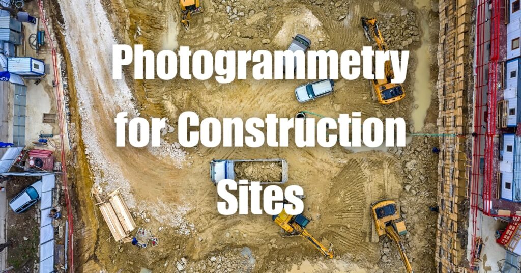
Construction site drone mapping is the process of using unmanned aerial vehicles (UAVs) or drones to collect aerial imagery and data of a construction site. This data is then used to create highly accurate 2D maps, 3D models, or orthomosaics of the site, allowing construction professionals to monitor, plan, and manage projects more effectively. By providing real-time insights and visual representations of the construction site, drone mapping helps identify potential issues, track progress, and make informed decisions throughout the project lifecycle.
How Does Construction Site Drone Mapping Work?
Construction site drone mapping involves several steps, from flight planning and data collection to data processing and analysis. Here’s a brief overview of the process:
Flight Planning: Before flying a drone over a construction site, it’s essential to create a flight plan that outlines the drone’s flight path, altitude, and desired image resolution. The flight plan should also consider any obstacles, such as buildings or trees, and any relevant airspace restrictions.
Data Collection: Equipped with high-resolution cameras and GPS, drones capture aerial images and geospatial data while flying over the construction site. These images are taken at regular intervals, ensuring adequate overlap to create accurate maps and models.
Data Processing: Once the drone captures the necessary images, specialized software processes the data to create 2D maps, 3D models, or orthomosaics. This involves stitching together the individual images, correcting for distortions, and georeferencing the resulting map or model to real-world coordinates.
Data Analysis: Construction professionals can then analyze the generated maps and models to track progress, identify potential issues, and make data-driven decisions. This can include measuring distances, calculating volumes, or overlaying design plans onto the map for comparison.
By automating these steps and leveraging advanced software, construction site drone mapping enables rapid and accurate data collection, helping construction teams stay on track and within budget.
Applications of Drones in Construction Site Mapping
Drones are increasingly being utilized in various aspects of construction site mapping. Here are some of the key applications:
Site Inspection and Progress Monitoring
Drones offer a fast and efficient way to inspect construction sites and monitor project progress. They can easily capture high-resolution images and videos of hard-to-reach or hazardous areas, enabling construction managers to identify potential issues early on and make necessary adjustments. Additionally, regular drone flights help create a visual timeline of the project, providing stakeholders with a clear understanding of the work completed and remaining tasks.
Earthwork and Volume Calculation
Drones equipped with photogrammetry or LiDAR sensors can accurately measure cut and fill volumes for earthwork projects. By creating detailed 3D models and terrain maps, construction teams can calculate the amount of material needed for excavation, grading, or backfilling, reducing the risk of costly errors or delays.
Stockpile Management
Accurate stockpile management is crucial for construction projects. Drones can quickly and safely measure stockpile volumes and track inventory changes over time, ensuring efficient resource allocation and minimizing waste. Additionally, drone-generated data can be easily shared with suppliers, helping to streamline procurement and logistics processes.
Structural Integrity Assessment
Drones can be used to inspect the structural integrity of buildings and other infrastructure, identifying any defects or maintenance needs. By providing high-resolution images and 3D models, drones enable engineers to assess structures from various angles and zoom in on critical areas, facilitating thorough inspections and reducing the need for manual, time-consuming site visits.
Risk Assessment and Safety Improvements
Drones play a vital role in assessing potential risks and improving safety at construction sites. They can identify hazards, such as unstable structures, exposed electrical wires, or uneven terrain, helping project managers to implement appropriate safety measures. Furthermore, drones minimize the need for workers to access dangerous or hard-to-reach areas, reducing the risk of accidents.
Benefits of Construction Site Drone Mapping
The use of drones in construction site mapping offers several advantages over traditional methods, including:
Time and Cost Efficiency
Drones can cover large areas quickly, drastically reducing the time required for data collection and site inspections. This speed translates to significant cost savings, as construction teams can identify issues early on and make informed decisions, preventing delays and reducing the need for rework.
Enhanced Data Accuracy
Drones equipped with advanced sensors and cameras can capture high-resolution images and precise geospatial data. This level of detail allows for more accurate maps and models, improving overall project planning and execution.
Improved Worker Safety
By using drones to access hard-to-reach or hazardous areas, construction teams can minimize the need for manual inspections, reducing the risk of accidents and injuries. In addition, drone data can help identify potential safety hazards, enabling project managers to take corrective action and maintain a safer work environment.
Streamlined Decision Making
Drone-generated data can be easily shared with project stakeholders, enabling better communication and collaboration. With access to real-time information, construction teams can make data-driven decisions, improving overall project efficiency and outcomes.
How Accurate is Construction Site Drone Mapping?
The accuracy of construction site drone mapping depends on several factors, including the quality of the drone’s camera, the accuracy of its GPS system, and the software used for processing the data. When executed correctly, drone mapping can achieve remarkable accuracy, often within a few centimeters of the actual measurements.
High-resolution cameras and advanced sensors, such as LiDAR or RTK GPS, can greatly improve the precision of the data collected. Additionally, using ground control points (GCPs) during the mapping process can further enhance the accuracy of the final maps and models. GCPs are marked points on the ground with known coordinates, which are used to align the drone-generated data with real-world coordinates.
By combining high-quality hardware, software, and best practices, construction site drone mapping can provide highly accurate and reliable data, enabling construction professionals to make informed decisions and improve project outcomes.
Can Construction Site Drone Mapping Save Time and Money?
Yes, construction site drone mapping can save both time and money when compared to traditional methods of data collection and site inspection. Here are some ways drone mapping contributes to cost and time savings:
Faster Data Collection: Drones can cover large areas quickly, drastically reducing the time required for site inspections and data collection. This rapid turnaround enables construction teams to identify potential issues early on, helping to prevent costly delays and rework.
Reduced Need for Manual Inspections: Using drones to access hard-to-reach or hazardous areas minimizes the need for manual inspections, saving time and reducing the risk of accidents and injuries. This not only improves worker safety but also lowers the costs associated with worker compensation and insurance premiums.
Improved Resource Allocation: By providing accurate data on earthwork volumes, stockpile management, and site conditions, drone mapping helps construction teams allocate resources more efficiently, minimizing waste and ensuring materials are used effectively.
Streamlined Decision Making: Drone-generated data can be easily shared with project stakeholders, enabling better communication and collaboration. With access to real-time information, construction teams can make data-driven decisions, improving overall project efficiency and reducing the likelihood of costly mistakes or miscommunications.
By adopting drone mapping technology, construction professionals can save time and money, while also improving project outcomes and worker safety.
Top Construction Site Drone Mapping Software
There are several software options available for processing and analyzing drone-generated data for construction site mapping. Some of the top construction site drone mapping software solutions include:
Pix4D: A comprehensive photogrammetry software suite that allows users to process aerial images into 2D maps, 3D models, and orthomosaics, as well as perform advanced analysis and measurements.
DroneDeploy: A cloud-based platform that offers tools for drone flight planning, data processing, and analysis, enabling users to create detailed construction site maps and models.
Agisoft Metashape: A powerful photogrammetry software solution that supports the creation of high-resolution georeferenced orthomosaics, 3D models, and digital elevation models from drone-captured images.
Bentley ContextCapture: A 3D reality modeling software that allows users to generate detailed, high-resolution 3D models of construction sites from drone imagery.
Global Mapper: A GIS software that includes a range of tools for processing and analyzing drone-generated data, such as terrain analysis, volume calculations, and feature extraction.
When selecting construction site drone mapping software, consider factors such as ease of use, compatibility with your drone’s sensors, and the specific mapping and analysis features you require.
Best Practices for Construction Site Drone Mapping
To ensure accurate and reliable results from construction site drone mapping, it is essential to follow best practices, such as:
Choose the Right Equipment: Select a drone and sensors that meet the specific requirements of your construction project, considering factors such as flight time, payload capacity, and the quality of the camera or sensors.
Obtain Necessary Permits and Certifications: Ensure that the drone pilot has the appropriate certifications and permissions to operate in the designated airspace, and comply with all local regulations.
Create a Detailed Flight Plan: Develop a comprehensive flight plan that outlines the drone’s flight path, altitude, and image resolution. Consider potential obstacles, such as buildings or trees, and any relevant airspace restrictions.
Use Ground Control Points (GCPs): Enhance the accuracy of your maps and models by using GCPs, marked points on the ground with known coordinates that help align the drone-generated data with real-world coordinates.
Fly at the Optimal Altitude: To achieve the best balance between image resolution and coverage, fly the drone at the optimal altitude for your project. Keep in mind that higher altitudes may result in lower resolution images, while lower altitudes may require more flight time to cover the same area.
Ensure Adequate Image Overlap: To create accurate maps and models, it’s crucial to capture images with sufficient overlap, typically between 60% and 80%. This ensures that the software can effectively stitch the images together and correct for distortions.
Regularly Inspect and Maintain Your Drone: Perform regular inspections and maintenance on your drone, checking for any damage or malfunctions that could compromise safety or data quality.
By following these best practices, construction professionals can optimize their drone mapping efforts, ensuring accurate and reliable results that contribute to improved project outcomes.
Construction Site Drone Mapping Regulations
As drone technology becomes increasingly prevalent in the construction industry, it’s essential to be aware of and adhere to local regulations that govern their use. While specific requirements may vary by region, some common construction site drone mapping regulations include:
Drone Pilot Certification: In many regions, drone pilots are required to obtain a certification or license, demonstrating their knowledge of drone operation, safety, and local aviation regulations.
Drone Registration: Depending on the region and the drone’s weight, you may need to register your drone with the relevant aviation authority.
Operational Restrictions: Local regulations may impose restrictions on drone operations, such as maximum altitude limits, no-fly zones, and requirements for maintaining visual line-of-sight with the drone at all times.
Insurance Requirements: Some regions may require drone operators to carry insurance coverage for potential damages or injuries caused by their drone.
Privacy and Data Protection: Be mindful of privacy concerns and data protection regulations when capturing and processing drone-generated data, particularly when operating in residential areas or near sensitive infrastructure.
It’s crucial to familiarize yourself with the specific regulations in your region and ensure that your construction site drone mapping activities are compliant with all relevant rules and guidelines.
How to Choose the Best Drone for Construction Site Mapping
Selecting the right drone for construction site mapping is crucial to ensure the best results. When choosing a drone, consider the following factors:
Payload Capacity: Determine the type of sensors and cameras you need for your mapping project, and ensure the drone can carry the required payload.
Flight Time: Longer flight times can improve efficiency by reducing the need for frequent battery changes or recharging.
GPS Accuracy: High-precision GPS systems, such as RTK (Real-Time Kinematic) or PPK (Post-Processed Kinematic), can significantly enhance the accuracy of your maps and models.
Camera Quality: High-resolution cameras are essential for capturing detailed images, so choose a drone with a high-quality camera or one that supports your preferred camera system.
Stability and Wind Resistance: Construction sites can be windy or subject to varying weather conditions. Choose a drone with strong stability and wind resistance to ensure safe flights and high-quality data capture.
Ease of Use: Opt for a drone that is user-friendly and easy to operate, especially if you have limited experience with drone technology.
Support and Maintenance: Consider the manufacturer’s reputation for customer support and the availability of spare parts, as this can affect the long-term usability of the drone.
By considering these factors, you can select the best drone for your construction site mapping needs, ensuring accurate and reliable results.
Tips for Accurate Construction Site Drone Mapping
To achieve the most accurate results from construction site drone mapping, follow these tips:
Use Ground Control Points (GCPs): Enhance the accuracy of your maps and models by using GCPs, marked points on the ground with known coordinates that help align the drone-generated data with real-world coordinates.
Fly at the Optimal Altitude: To achieve the best balance between image resolution and coverage, fly the drone at the optimal altitude for your project.
Ensure Adequate Image Overlap: Capture images with sufficient overlap, typically between 60% and 80%, to allow the software to effectively stitch the images together and correct for distortions.
Plan Flights for Optimal Lighting Conditions: Schedule drone flights for times when the sun is at a high angle, reducing shadows and ensuring more uniform lighting across the site.
Regularly Calibrate Sensors: Periodically calibrate your drone’s sensors, such as the GPS and camera, to ensure accurate and consistent data capture.
By following these tips, you can optimize the accuracy of your construction site drone mapping, providing valuable insights for informed decision-making.
The Future of Construction Site Mapping with Drones
As drone technology continues to advance, its applications in construction site mapping are expected to expand, offering new opportunities for efficiency, safety, and innovation. Some potential developments in the future of construction site mapping with drones include:
Integration with BIM: Combining drone-generated data with Building Information Modeling (BIM) can enhance project management, enabling real-time monitoring and comparisons between the planned and actual state of a construction site.
Autonomous Drone Operations: Advances in artificial intelligence and machine learning may enable drones to perform increasingly autonomous operations, reducing the need for human intervention and streamlining the mapping process.
Multi-Sensor Payloads: Future drones may be equipped with multiple sensors, such as LiDAR, thermal cameras, and multispectral cameras, providing a more comprehensive view of construction site conditions and progress.
Real-Time Data Processing: As processing capabilities improve, drone-generated data may be processed and analyzed in real-time, enabling immediate access to valuable insights and faster decision-making.
Increased Adoption of Regulations: As drone use becomes more widespread, governments and regulatory agencies are likely to develop more comprehensive regulations and guidelines to ensure safe and responsible drone use in construction site mapping.
Contact Blue Falcon Aerial for Orthomosaic and LiDAR Projects
If your construction project requires high-quality orthomosaic or LiDAR mapping, consider partnering with Blue Falcon Aerial. As a professional drone services provider, Blue Falcon Aerial specializes in delivering advanced mapping solutions for the construction industry. They offer a range of services and deliverables to meet your project needs, including orthomosaic mapping, topographic surveys, and LiDAR data processing.
Learn more about how Blue Falcon Aerial can help with your construction mapping needs at www.bluefalconaerial.com/construction/. You can also explore their comprehensive list of deliverables at www.bluefalconaerial.com/deliverables/.
In conclusion, drone technology has transformed construction site mapping, providing increased efficiency, safety, and cost savings. By implementing best practices and staying informed on the latest developments in drone technology, construction professionals can maximize the benefits of this powerful tool. If you’re ready to explore how drone mapping can enhance your construction project, don’t hesitate to reach out to the experts at Blue Falcon Aerial. Visit their Ultimate Guide to Drone Photogrammetry and Orthomosaics for more information or contact them to discuss your specific needs.


Thanks for pointing out that detailed images could be captured when high-quality drones are used. Many roofing companies will take note of this tip to ensure that assessing damage to roofs can be made easy for them. I would assume that hiring a professional drone photographer would ensure that the right equipment would be used to get the images that they need.