Aerial Solutions for the

Construction Industry

At Blue Falcon Aerial, we proudly offer state-of-the-art drone LiDAR services for the construction industry. Our advanced LiDAR systems provide accurate, efficient, and cost-effective data collection for construction projects.

How we can help

We provide reliable and valuable data when you need it

Improved accuracy and precision in surveying and mapping

Drone-based LIDAR systems can quickly and efficiently collect high-resolution 3D data, allowing for more accurate and detailed mapping of construction sites.

Reduced surveying and mapping costs

Using drones to collect LIDAR data can significantly reduce the cost of surveying and mapping compared to traditional ground-based methods. While we are not surveyors ourselves, our data exceeds survey grade accuracy standards and significantly reduces or eliminates the time that surveyors need to be on site.

Increased safety

Drone-based LIDAR systems can scan and map dangerous or difficult-to-access areas, reducing the risk to human surveyors.

Faster data collection

Drones can quickly cover large areas, allowing for more immediate data collection and efficient project planning and execution.

Enhanced visualization

LIDAR data create detailed 3D models of construction sites, providing valuable information for project planning and design, as well as communication and collaboration among project stakeholders.

Our company is among the best drone LiDAR data providers in the market. We would love the opportunity to work with your company. Please do not hesitate to contact us for further information and to schedule a demonstration of our services. We will help streamline your construction projects and increase your productivity.
numbers

Client results

0 +
Completed operations programs
0 x
Realized return on fees
Learn more

Frequently Asked Questions

Aerial lidar is commonly used in the construction industry for tasks such as creating digital terrain models, measuring volumes of stockpiles and cut/fill areas, and identifying potential issues with a construction site before work begins.

Aerial lidar (light detection and ranging) is a remote sensing method that uses laser technology to measure the distance to a target. It differs from other forms of remote sensing such as photogrammetry and radar in that it can collect high-resolution, precise 3D data in a relatively short amount of time.

Aerial lidar measurements can be extremely accurate, with typical horizontal and vertical accuracy levels of less than 10 cm. The level of accuracy is dependent on factors such as the density of the point cloud data collected and the quality of the sensor used.

Orthomosaic is a type of mosaic that has been geometrically corrected to minimize distortion and ensure that each pixel represents the same ground area throughout the image. A regular mosaic is a composite image made up of several overlapping images, but it does not have the same geometric correction.

Orthomosaics can be used in construction for tasks such as creating accurate maps, measuring distances and areas, and identifying potential issues with a construction site. They can also be used to monitor progress on a construction site over time.

To ensure that data obtained from aerial lidar and orthomosaics is accurate, it is important to use high-quality sensors and to properly process the data using specialized software. Additionally, ground control points can be used to accurately align the data with known coordinates.

Support Functions

Lorem ipsum dolor sit amet, consectetur adipiscing elit. Ut elit tellus, luctus nec ullamcorper mattis.

Service Operations

Lorem ipsum dolor sit amet, consectetur adipiscing elit. Ut elit tellus, luctus nec ullamcorper mattis.

Supply Chain

Lorem ipsum dolor sit amet, consectetur adipiscing elit. Ut elit tellus, luctus nec ullamcorper mattis.

GET IN TOUCH

Contact us today to schedule an online or in person demo!

Our team of professionals will be assisting you appropriately with the business setup to make the financial decisions. Get in touch with our team today and get the needed assistance with the business establishment and making the financial decisions.
Why Choose us

Our Solutions

The data collected can be used for a variety of applications such as land surveying, construction planning, and environmental monitoring. Whether you are a professional in one of these fields or simply curious about the capabilities of LiDAR technology, we will provide you with a comprehensive understanding of how LiDAR is revolutionizing various industries.

Orthomosaic Mapping

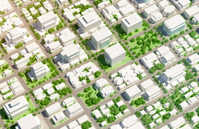
High-Fidelity Orthomosaic Mapping

Experience a transformative view with our Orthomosaic Mapping. We masterfully combine multiple aerial images to create a unified, highly accurate representation. This comprehensive imagery offers precision and clarity, essential for informed decision-making.

radar point

Advanced Aerial LiDAR Mapping

Embrace the cutting-edge of remote sensing technology with Blue Falcon Aerial. Our LiDAR mapping services employ laser pulses to generate intricate 3D point clouds. This technology transforms complex terrains into clear, actionable data, propelling your projects towards success.

Camera Drone

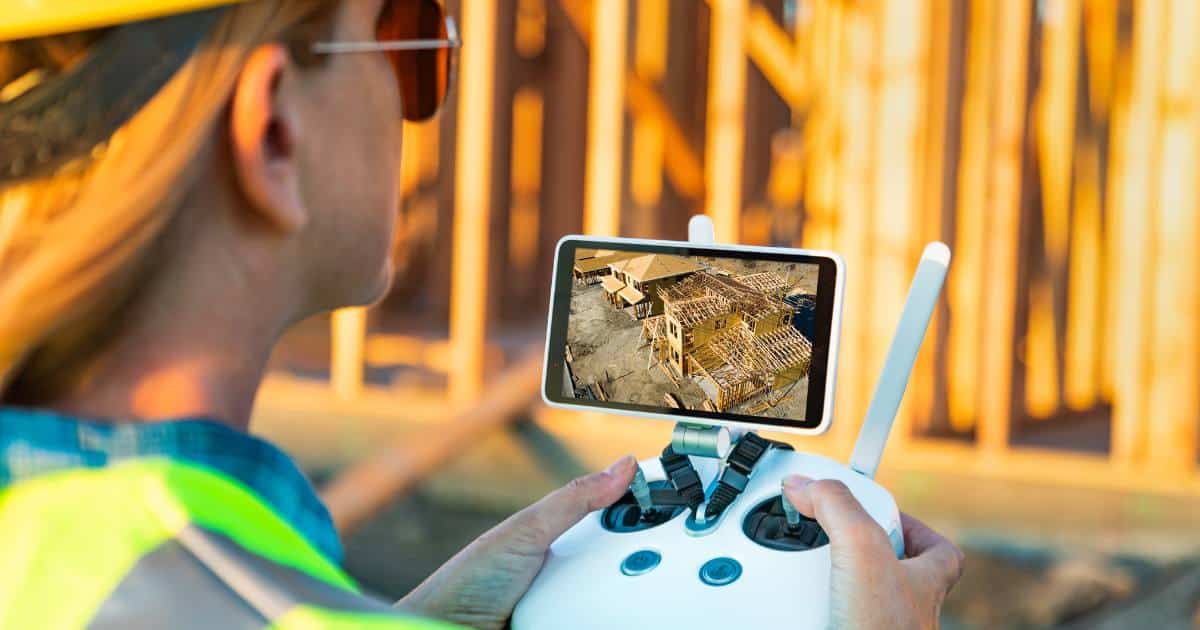
Drone Technology Integration Services

Customized solutions to seamlessly integrate drones into your existing business workflows, enhancing efficiency and decision-making with advanced mapping, 3D modeling, and comprehensive team training.

Want to Learn More on How we can Help Your Next Project?

Scroll to Top