Blue Falcon Aerial: Redefining Surveying with Advanced Aerial LiDAR Solutions
Excellence in Aerial LiDAR Technology
At Blue Falcon Aerial, we’re not just about offering drone LiDAR services; we’re revolutionizing surveying and data collection. Our advanced aerial LiDAR solutions outshine traditional ground capture methods, positioning us as a top choice for businesses across the nation.
Transforming Surveying with Drone LiDAR
Advantages of Choosing Our Drone LiDAR:
- Enhanced Safety: Accessing difficult terrains and hazardous zones safely, reducing ground-related risks.
- Rapid Project Completion: What took weeks now takes days, thanks to our fast drone-based data collection.
- Precision Data: Delivering data with exceptional accuracy, capturing details as precise as 2cm.
- Efficient Vegetation Analysis: Excelling in dense vegetation for accurate data collection.
Our Promise: Quality and Adaptability for Every Project
Tailored LiDAR Solutions for Varied Needs:
- Speed and Efficiency: Ideal for diverse projects, we turn your project backlog into history.
- Scalable Services: Catering to all project sizes, from vast infrastructure developments to small land surveys.
- Client-Focused Approach: Balancing innovation with cost-effectiveness to meet your unique challenges.
Engaging with Our Clients: Meeting Your Expectations
Understanding the Tech-Savvy Market:
- Active Engagement: Connecting through industry events, webinars, and personalized presentations.
- Digital Presence: Showcasing our LiDAR solutions’ versatility on platforms like LinkedIn and YouTube.
Why Opt for Blue Falcon Aerial?
Our mission is to democratize LiDAR technology, ensuring accessibility for every surveyor. We’re dedicated to providing solutions that enhance efficiency, cut costs, and improve service quality. Our technology is designed for a market that values innovation, efficiency, and quality.
Witness Our Impact: The Project Gallery Showcase
Our Project Gallery reflects the diversity and effectiveness of our LiDAR services, illustrating our impact across various industries and projects.
Elevate Your Surveying Experience with Us
Interested in integrating advanced LiDAR solutions into your projects? Contact Blue Falcon Aerial to discover how our technology can bring precision, efficiency, and success to your surveying needs.
Rapid Data Collection
Covering large areas quickly, slashing the time and cost linked to traditional surveying.
Canopy Penetration
Ideal for forested or densely vegetated areas, providing accurate mapping and surveying.
High Accuracy
Superior to photogrammetry in elevation accuracy, ensuring precise measurements for diverse applications.
Minimal Environmental Impact
Non-invasive surveys that are environmentally friendly, perfect for ecological projects.
numbers
Client results
Support Functions
Lorem ipsum dolor sit amet, consectetur adipiscing elit. Ut elit tellus, luctus nec ullamcorper mattis.
Service Operations
Lorem ipsum dolor sit amet, consectetur adipiscing elit. Ut elit tellus, luctus nec ullamcorper mattis.
Supply Chain
Lorem ipsum dolor sit amet, consectetur adipiscing elit. Ut elit tellus, luctus nec ullamcorper mattis.
Official Partner
Proudly Partnered with
Deliverables Offered
The Science Behind Aerial LiDAR's Vegetation Penetration
The Science Behind Aerial LiDAR’s Vegetation Penetration
Aerial LiDAR is a marvel in surveying technology, especially in its ability to penetrate dense vegetation. But how does it achieve this?
The Mechanism of LiDAR Technology:
- Emission of Light Pulses: LiDAR systems emit laser pulses that travel towards the target and bounce back to the sensor.
- Time and Distance Measurement: The sensor calculates the time taken for the light to return, determining the distance to the object.
Vegetation Penetration Capabilities:
- High-Frequency Laser Pulses: To penetrate leaves and branches, LiDAR emits a multitude of laser pulses at a very high frequency.
- Data Collection from Multiple Points: These pulses gather data from various points within the vegetation.
- Creation of a 3D Model: The collected data is then used to construct a detailed 3D model of the area.
Advanced LiDAR Systems:
- Utilization of Multiple Wavelengths: Some LiDAR systems employ multiple light wavelengths, enhancing their ability to penetrate through vegetation.
- Detailed 3D Modeling: This technique allows the detection of objects deeper within the vegetation, resulting in a more comprehensive 3D model.
The Impact of LiDAR in Understanding Vegetation
Aerial LiDAR’s ability to penetrate vegetation is more than just a technical feature. It’s a gateway to:
- Accurate Terrain Mapping: Essential in forestry and environmental studies.
- Detailed Analysis: Offers insights for construction planning and wildlife habitat assessments.
- Enhanced Project Efficiency: Improves the speed and accuracy of surveying in vegetated areas.
Conclusion: Aerial LiDAR – A Game Changer in Vegetation Analysis
Aerial LiDAR by Blue Falcon Aerial stands as a testament to our commitment to providing innovative, efficient, and detailed surveying solutions. This technology’s ability to penetrate and map vegetation-rich areas opens up new possibilities in various fields, ensuring that our clients always stay ahead in their projects.
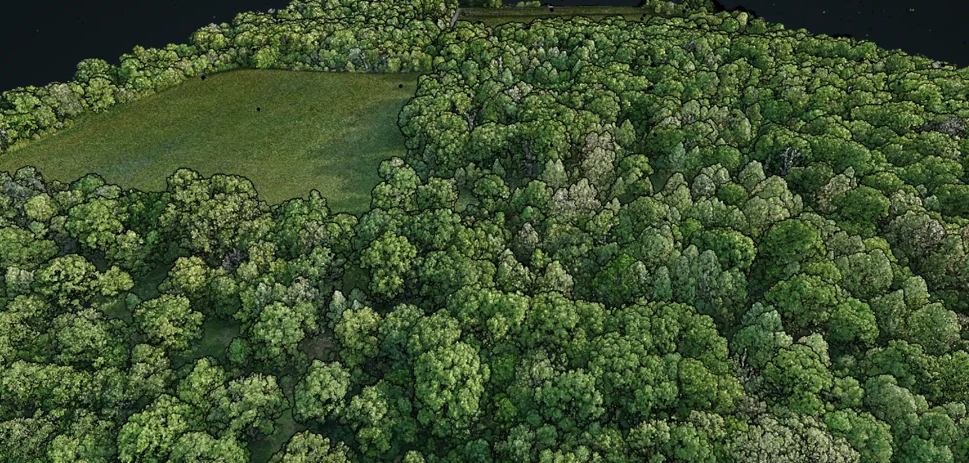
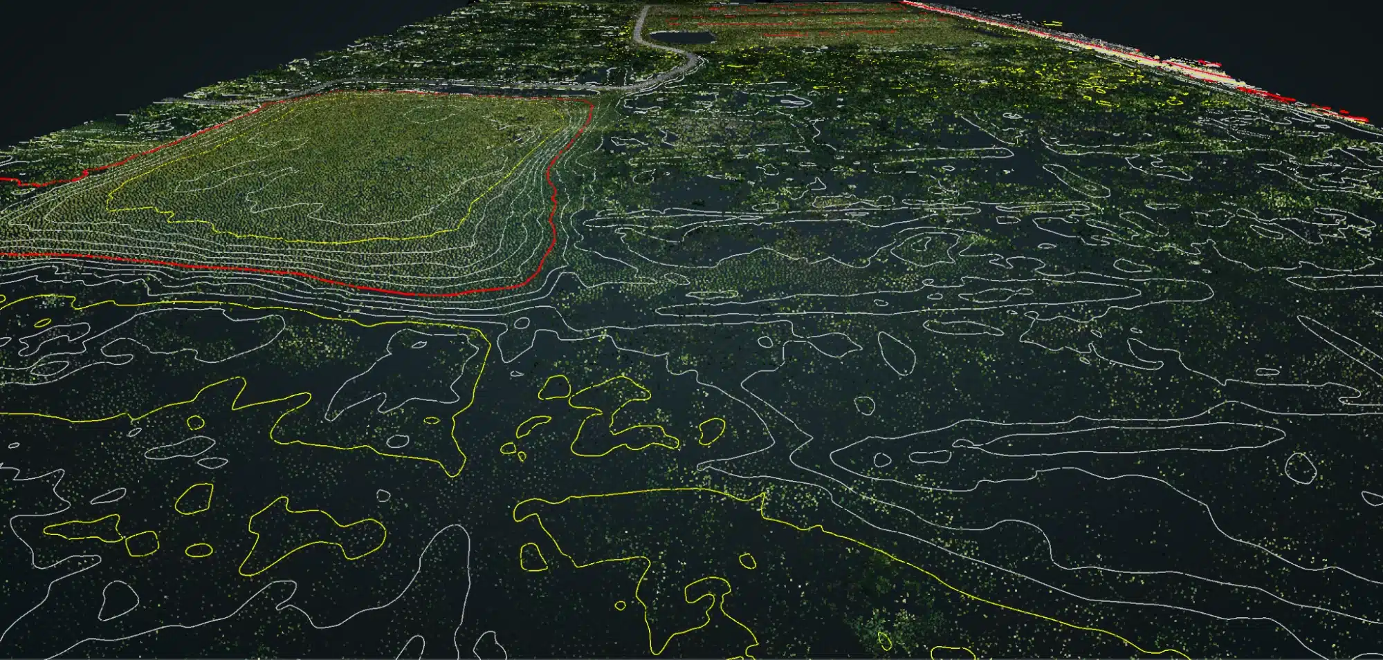
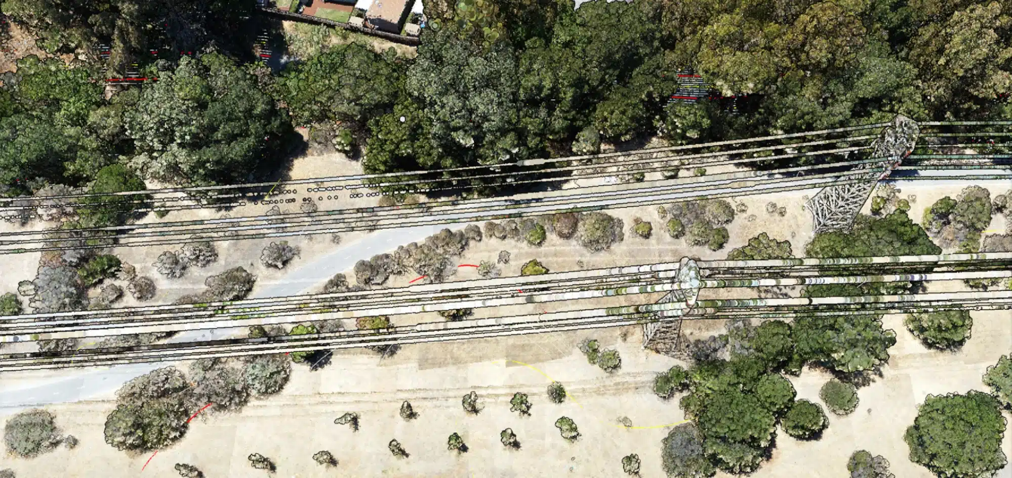
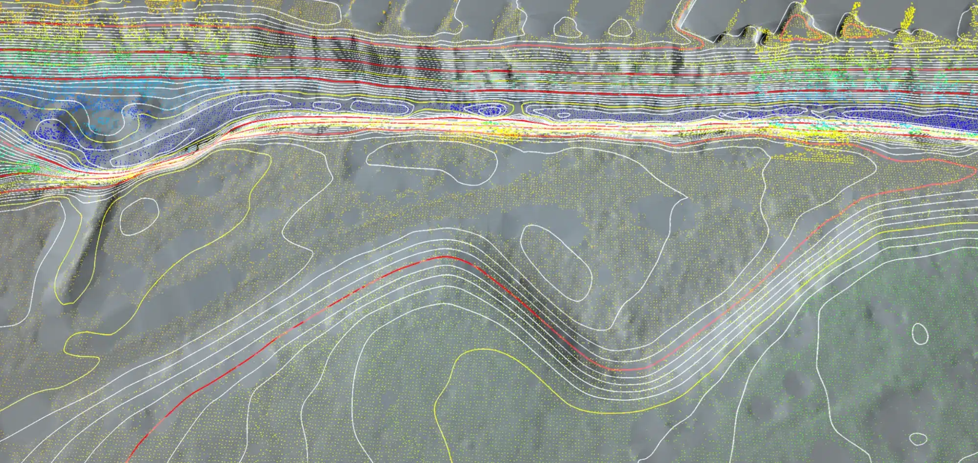
Video demonstrating Canopy Penetration
Learn more
Frequently Asked Questions
Aerial lidar is commonly used in the construction industry for tasks such as creating digital terrain models, measuring volumes of stockpiles and cut/fill areas, and identifying potential issues with a construction site before work begins.
Aerial lidar (light detection and ranging) is a remote sensing method that uses laser technology to measure the distance to a target. It differs from other forms of remote sensing such as photogrammetry and radar in that it can collect high-resolution, precise 3D data in a relatively short amount of time.
Aerial lidar measurements can be extremely accurate, with typical horizontal and vertical accuracy levels of less than 10 cm. The level of accuracy is dependent on factors such as the density of the point cloud data collected and the quality of the sensor used.
Orthomosaic is a type of mosaic that has been geometrically corrected to minimize distortion and ensure that each pixel represents the same ground area throughout the image. A regular mosaic is a composite image made up of several overlapping images, but it does not have the same geometric correction.
Orthomosaics can be used in construction for tasks such as creating accurate maps, measuring distances and areas, and identifying potential issues with a construction site. They can also be used to monitor progress on a construction site over time.
To ensure that data obtained from aerial lidar and orthomosaics is accurate, it is important to use high-quality sensors and to properly process the data using specialized software. Additionally, ground control points can be used to accurately align the data with known coordinates.
High-Fidelity Orthomosaic Mapping
Experience a transformative view with our Orthomosaic Mapping. We masterfully combine multiple aerial images to create a unified, highly accurate representation. This comprehensive imagery offers precision and clarity, essential for informed decision-making.
Advanced Aerial LiDAR Mapping
Embrace the cutting-edge of remote sensing technology with Blue Falcon Aerial. Our LiDAR mapping services employ laser pulses to generate intricate 3D point clouds. This technology transforms complex terrains into clear, actionable data, propelling your projects towards success.
Drone Technology Integration Services
Customized solutions to seamlessly integrate drones into your existing business workflows, enhancing efficiency and decision-making with advanced mapping, 3D modeling, and comprehensive team training.

