Welcome to the world of Aerial Photography, an exciting and ever-evolving field that has transformed the way we capture and perceive our surroundings. In this comprehensive guide, we’ll provide an Aerial Photography Overview, exploring the history, types, applications, and equipment involved in this dynamic industry. As a leading drone services provider, Blue Falcon Aerial is excited to share our knowledge and expertise with you. So, strap in and get ready to take flight into the captivating realm of aerial photography!
What is Aerial Photography?
Aerial photography is the art and science of capturing images from an elevated vantage point. By taking photos from above, aerial photographers can provide unique perspectives and capture large-scale scenes that would be impossible to achieve from ground level. Aerial photography can be accomplished using various platforms, such as airplanes, helicopters, balloons, kites, and, more recently, drones.
History of Aerial Photography
The history of aerial photography dates back to the 19th century. In 1858, French balloonist Gaspard-Félix Tournachon, better known as “Nadar,” became the first person to capture aerial photographs from a hot air balloon. Unfortunately, his images have not survived, but his pioneering spirit set the stage for future aerial photographers.
The first surviving aerial photograph was taken by James Wallace Black in 1860. Black captured an aerial view of Boston from a hot air balloon tethered at an altitude of 1,200 feet. This photograph, titled “Boston, as the Eagle and the Wild Goose See It,” laid the foundation for aerial photography’s future development.
Aerial photography played a significant role during World War I and World War II, as it was used for reconnaissance and mapping enemy territories. The invention of airplanes provided an ideal platform for capturing images from the sky, and advances in camera technology allowed for higher resolution images with better detail.
In the second half of the 20th century, aerial photography expanded into commercial and civilian applications, such as land surveying, urban planning, and environmental monitoring. With the advent of satellite imaging in the 1960s, remote sensing technologies became more sophisticated, providing even broader perspectives of the Earth’s surface.
The introduction of drones in the 21st century revolutionized aerial photography, making it more accessible and affordable for both professionals and hobbyists. Today, aerial photography is an essential tool in various industries and continues to evolve as new technologies and techniques are developed.
Types of Aerial Photography
There are two main types of aerial photography, each offering distinct advantages and producing unique results. Understanding the differences between these types will help you choose the right approach for your photography projects.
Oblique Aerial Photography
Oblique aerial photography involves capturing images at an angle, typically between 20 and 60 degrees relative to the ground. This type of photography provides a more natural and familiar perspective, as it resembles the way we view our surroundings from elevated positions, such as hills or tall buildings.
Oblique aerial photographs can be further classified into two categories: high oblique and low oblique. High oblique photographs include the horizon, while low oblique photographs do not. Oblique aerial photography is particularly useful for showcasing landscapes, real estate properties, and large structures, as it provides a clear view of the subject and its surroundings.
Vertical Aerial Photography
Vertical aerial photography is captured directly above the subject, with the camera pointing straight down towards the ground. This type of photography produces a bird’s-eye view, which is ideal for creating maps, surveying land, and monitoring large areas.
Vertical aerial photographs provide consistent scale and accurate distance measurements, making them a valuable tool in geographic information systems (GIS), urban planning, and environmental studies. However, they may not be as visually appealing as oblique photographs, as they lack the sense of depth and perspective that comes from angled shots.
Types of Cameras Used in Aerial Photography
The camera is an essential piece of equipment for aerial photography, and the choice of the camera will greatly impact the quality and versatility of the images captured. There are several types of cameras suitable for aerial photography, each offering unique features and benefits.
DSLR and Mirrorless Cameras
DSLR (Digital Single-Lens Reflex) and mirrorless cameras are popular choices for aerial photography due to their high image quality, interchangeable lenses, and manual controls. These cameras allow photographers to capture images in RAW format, providing greater flexibility during post-processing. Additionally, the wide selection of lenses available for DSLR and mirrorless cameras enables photographers to choose the optimal focal length and aperture for their specific needs.
Compact Cameras
Compact cameras, also known as point-and-shoot cameras, are lightweight and easy to use, making them a popular choice for hobbyists and beginners. Some advanced compact cameras offer manual controls, RAW image capture, and high-quality lenses, providing a good balance between convenience and image quality.
Action Cameras
Action cameras, such as GoPro, are small, durable, and designed to capture wide-angle images and videos. While their image quality may not be on par with DSLR or mirrorless cameras, their compact size and rugged build make them a popular choice for capturing fast-paced action from drones or other aerial platforms.
Drone Cameras
Many drones come equipped with built-in cameras specifically designed for aerial photography. These cameras often feature gimbal stabilization, which helps to counteract the movement of the drone and ensure smooth, stable footage. Drone cameras typically offer a range of shooting modes, such as still images, time-lapse, and slow-motion, providing versatility for various aerial photography applications.
Applications of Aerial Photography
Aerial photography offers unique perspectives and large-scale overviews that are invaluable in various industries and applications. From real estate to environmental monitoring, aerial photography provides crucial data and captivating visuals that enhance our understanding and appreciation of the world around us.
Real Estate
Aerial photographs and videos showcase properties from an elevated perspective, highlighting their size, layout, and surrounding features. This allows potential buyers to better visualize the property and understand its context within the neighborhood or landscape. Aerial photography is particularly useful for large estates, commercial properties, and development sites, as it can capture the entire property in a single image.
Agriculture
Farmers and agricultural specialists use aerial photography to monitor crop health, assess irrigation systems, and optimize land use. By analyzing aerial images, they can identify issues such as pest infestations, nutrient deficiencies, and water stress, enabling them to make informed decisions about crop management and resource allocation.
Construction
Aerial photography plays a crucial role in construction projects, from initial planning and site selection to progress monitoring and final inspections. Engineers and architects use aerial images to assess the feasibility of proposed developments, evaluate the impact on the surrounding environment, and track the progress of ongoing construction.
Film and Television
Aerial photography adds a dynamic and cinematic quality to films and television productions. By capturing sweeping landscapes, dramatic cityscapes, and high-speed action from the sky, aerial photographers can create visually stunning and engaging content that captivates audiences.
Environmental Monitoring
Aerial photography is an essential tool for monitoring and analyzing the environment, providing large-scale overviews and detailed images of natural and man-made features. Scientists and researchers use aerial images to track changes in land use, assess the impact of climate change, and document the spread of invasive species, among other applications.
Weddings
Aerial photography adds a unique and creative element to wedding photography, capturing the venue, ceremony, and reception from an elevated perspective. By including aerial shots in their portfolios, wedding photographers can offer their clients a comprehensive and memorable record of their special day.
Aerial Photography vs. Satellite Imagery
While both aerial photography and satellite imagery involve capturing images from above the Earth’s surface, there are several key differences between the two that affect their respective applications and advantages.
Resolution and Detail
Aerial photography generally offers higher resolution and greater detail than satellite imagery. This is because aerial platforms, such as drones and airplanes, can fly closer to the ground, allowing cameras to capture images with a smaller ground sampling distance (GSD). In contrast, satellites are positioned much further away from the Earth, resulting in lower-resolution images with larger GSD values.
Flexibility and Control
Aerial photography provides greater flexibility and control over the image capture process. Photographers can choose the optimal time, angle, and altitude for their shots, ensuring that lighting conditions, weather, and other factors align with their creative vision. In contrast, satellite imagery is limited by the satellite’s orbit and predetermined image capture schedule, making it less adaptable to specific project requirements.
Cost and Accessibility
Aerial photography, particularly when using drones, is generally more affordable and accessible than satellite imagery. While the cost of satellite imagery has decreased in recent years, it can still be prohibitively expensive for some projects, especially when high-resolution images are required. In contrast, drones and other aerial platforms are widely available and relatively inexpensive, making aerial photography a more cost-effective option for many applications.
Applications
Both aerial photography and satellite imagery have unique advantages that make them suitable for different applications. Aerial photography is ideal for projects that require high-resolution images, precise control over the image capture process, and rapid data acquisition. In contrast, satellite imagery is better suited for large-scale mapping, global monitoring, and long-term change analysis, as each method provides unique insights and perspectives of the Earth’s surface.
Timeliness and Frequency
Satellite imagery offers more frequent coverage of the Earth’s surface, as satellites continuously orbit the planet and capture images at regular intervals. This allows for more consistent monitoring of changes over time, making satellite imagery ideal for tracking long-term trends and seasonal patterns.
In contrast, aerial photography is typically conducted on a project-by-project basis and may not provide the same level of consistency and frequency as satellite imagery. However, aerial photography can be more responsive to specific needs and can capture images at precise moments in time, making it suitable for projects that require targeted data collection or rapid response.
Overall, both aerial photography and satellite imagery have unique advantages and limitations that should be considered when deciding which method is best suited for a particular project. By understanding the differences between these two approaches, you can choose the most appropriate technology for your needs and maximize the benefits of aerial and satellite-based remote sensing.
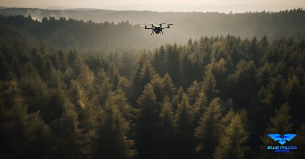
Aerial Photography Drones
Aerial photography drones, also known as unmanned aerial vehicles (UAVs) or quadcopters, have become increasingly popular in recent years due to their affordability, ease of use, and advanced features. These drones offer a versatile platform for capturing high-quality aerial images and videos, making them a valuable tool for both professionals and hobbyists.
Aerial photography drones come in various sizes and price points, ranging from consumer-grade models suitable for beginners to professional-grade systems designed for advanced users. Some popular aerial photography drone models include:
DJI Phantom 4 Pro: Featuring a 1-inch CMOS sensor and a mechanical shutter, the Phantom 4 Pro captures high-resolution images and 4K video with excellent detail and dynamic range. Its advanced flight features, such as obstacle avoidance and automated flight modes, make it a popular choice among professional aerial photographers.
DJI Mavic 2 Pro: The Mavic 2 Pro is a compact and portable drone with a Hasselblad L1D-20c camera, which boasts a 1-inch CMOS sensor and adjustable aperture. With its foldable design and advanced features, the Mavic 2 Pro is ideal for photographers who need a high-quality aerial camera on the go.
Autel Robotics EVO II: The EVO II is a versatile drone that offers interchangeable camera modules, including an 8K video camera and a 6K camera with a 1-inch sensor. Its long flight time and advanced obstacle avoidance system make it a reliable choice for various aerial photography applications.
When choosing an aerial photography drone, consider factors such as image quality, flight time, range, and ease of use, as well as any additional features that may be important for your specific needs. Additionally, ensure that you comply with local regulations and obtain any necessary permits or certifications before operating a drone for aerial photography purposes.
Technology Advancements in Aerial Photography
The field of aerial photography has come a long way since its inception in the 19th century. Technological advancements have made it more accessible, efficient, and versatile, opening up new possibilities and applications for both professionals and hobbyists.
Drones
Drones, also known as unmanned aerial vehicles (UAVs), have revolutionized aerial photography by providing a cost-effective and user-friendly platform for capturing images from the sky. With their ability to fly at low altitudes, hover in place, and maneuver with precision, drones offer unparalleled flexibility and control over the image capture process.
Modern drones come equipped with advanced features such as GPS navigation, obstacle avoidance, and automated flight modes, making them more reliable and easy to use than ever before. Additionally, many drones feature built-in cameras with gimbal stabilization, ensuring smooth and stable footage even in challenging conditions.
Post-Processing Software
Advances in post-processing software have greatly enhanced the potential of aerial photography by allowing photographers to edit, analyze, and manipulate their images with greater precision and flexibility. Programs like Adobe Lightroom, Photoshop, and specialized mapping software enable photographers to correct lens distortion, adjust exposure, and stitch together panoramic images, among other tasks.
In addition to basic editing functions, some post-processing software includes advanced tools for creating 3D models, orthomosaics, and elevation maps from aerial photographs. These capabilities have expanded the range of applications for aerial photography, particularly in the fields of surveying, mapping, and environmental monitoring.
Aerial Photography Companies and Pricing
With the growing popularity of aerial photography, numerous companies have emerged to offer professional aerial imaging services to clients in various industries. These companies typically employ experienced photographers and operate a fleet of drones or other aerial platforms to capture high-quality images and videos for a range of applications.
The cost of aerial photography services can vary widely depending on several factors, such as the scope of the project, the equipment used, and the level of expertise required. For example, a simple real estate shoot using a consumer-grade drone may cost a few hundred dollars, while a complex mapping project involving high-resolution cameras and specialized software could cost thousands of dollars.
When choosing an aerial photography company, it’s essential to consider factors beyond price, such as the company’s reputation, portfolio, and level of experience. Additionally, make sure the company is properly licensed and insured, as commercial drone operators are required to obtain a Remote Pilot Certificate from the Federal Aviation Administration (FAA) and should carry appropriate liability insurance to protect both themselves and their clients.
Before hiring an aerial photography company, request a detailed quote that outlines the scope of the project, the equipment to be used, and any additional services, such as post-processing or 3D modeling. This will help ensure that you have a clear understanding of the costs involved and can make an informed decision based on your specific needs and budget.
Aerial Photography Equipment
In addition to a suitable aerial platform such as a drone or manned aircraft, successful aerial photography requires various pieces of equipment to capture and process high-quality images. Some essential aerial photography equipment includes:
Cameras
The choice of camera is crucial for capturing high-quality aerial images. Depending on your specific needs and budget, you may opt for a built-in camera on a drone or a separate camera mounted on a gimbal. When selecting a camera, consider factors such as resolution, sensor size, dynamic range, and low-light performance. Some popular camera models for aerial photography include the DJI Zenmuse X7, Sony A7R IV, and Canon EOS 5D Mark IV.
Gimbals
A gimbal is a stabilizing device that allows the camera to remain level and steady during flight, ensuring smooth and sharp images. Many drones come with built-in gimbals, while others require separate gimbal attachments compatible with various camera models. Popular gimbal options include the DJI Zenmuse H20, Freefly Movi Pro, and Gremsy T3.
Filters
Camera filters can enhance the quality of aerial images by reducing glare, increasing color saturation, and controlling exposure. Some commonly used filters in aerial photography include polarizing filters, neutral density (ND) filters, and graduated neutral density (GND) filters.
Remote Controllers
A reliable remote controller is essential for controlling the aerial platform and camera during flight. Many drones come with their own dedicated remote controllers, while others are compatible with third-party controllers or smartphone apps. When choosing a remote controller, consider factors such as range, ergonomics, and display quality.
Post-Processing Software
After capturing aerial images, post-processing software is used to edit, analyze, and enhance the photos. Popular programs for editing aerial photographs include Adobe Lightroom, Photoshop, and specialized mapping software like Pix4D and Agisoft Metashape.
Legal Considerations and Safety
It is crucial to understand and adhere to legal and safety guidelines to ensure responsible and lawful operation. Some key areas to consider include FAA regulations, privacy and property rights, and safety precautions.
FAA Regulations
In the United States, the Federal Aviation Administration (FAA) governs the operation of drones for commercial purposes. Commercial drone operators are required to obtain a Remote Pilot Certificate under Part 107 of the FAA regulations. To obtain this certification, operators must pass a knowledge test covering airspace, weather, and drone operations.
Additionally, drone operators must follow specific guidelines, including:
- Flying below 400 feet above ground level (AGL)
- Maintaining a line of sight with the drone
- Not flying over people, moving vehicles, or near other aircraft
- Operating during daylight hours or civil twilight with proper lighting
It is essential to familiarize yourself with the FAA regulations and any local laws that may apply in your area before conducting aerial photography.
Privacy and Property Rights
Aerial photography can raise concerns regarding privacy and property rights, as drones have the potential to capture images of people and private property without consent. To minimize potential legal issues, always obtain permission from property owners before conducting aerial photography over private property and avoid capturing identifiable images of people without their consent.
Safety Precautions
Operating a drone safely should be a top priority for aerial photographers. Some general safety precautions include:
- Conducting a pre-flight check of your drone and equipment
- Avoiding flying in adverse weather conditions or near obstacles
- Staying aware of your surroundings and potential hazards
- Following manufacturer guidelines for drone operation
By adhering to legal and safety guidelines, you can ensure a responsible and enjoyable aerial photography experience.
Tips for Capturing Stunning Aerial Photos
To capture stunning aerial photos, consider the following tips:
Plan your flight: Before taking off, plan your flight path and camera angles to ensure a smooth and efficient flight. Use tools like Google Earth and local weather reports to gather information about the location and conditions.
Experiment with perspectives: Aerial photography offers unique perspectives that can’t be achieved with ground-based photography. Explore different altitudes and camera angles to find the most visually striking shots.
Utilize the golden hour: The golden hour, which occurs shortly after sunrise and before sunset, offers the best lighting conditions for aerial photography. During this time, the low angle of the sun creates warm, soft light and long shadows that can enhance the depth and texture of your images.
Capture motion: Aerial photography allows you to capture dynamic scenes with ease. Experiment with capturing moving subjects, such as cars, boats, or wildlife, to add a sense of motion and excitement to your images.
Use leading lines and patterns: Aerial photography often reveals striking patterns and lines in the landscape. Look for elements such as roads, rivers, and fields that can create visual interest and guide the viewer’s eye through the image.
Edit your images: Post-processing is a crucial step in creating stunning aerial photos. Learn to use editing software like Adobe Lightroom or Photoshop to enhance colors, correct imperfections, and create compelling compositions.
Industry-specific Aerial Photography Applications
Aerial photography has found numerous applications across various industries, with each requiring unique approaches and techniques. Some common industry-specific applications include:
Aerial Photography for Real Estate
Aerial photography has become an essential marketing tool in the real estate industry, providing unique perspectives of properties that showcase their features, layout, and surroundings. High-quality aerial images can help real estate agents and property owners attract potential buyers and increase the perceived value of a property.
When capturing aerial images for real estate, consider emphasizing key features such as pools, landscaping, and unique architectural elements. Also, showcase the property’s location in relation to nearby amenities, parks, and schools to provide potential buyers with a better understanding of the neighborhood.
Aerial Photography for Weddings
Aerial photography has gained popularity in the wedding industry, as it can capture stunning and memorable images from a unique vantage point. Drones can be used to photograph the wedding venue, ceremony, and reception, offering a bird’s-eye view of the festivities and capturing the emotions and atmosphere of the special day.
When photographing weddings, work closely with the couple and the wedding planner to understand their vision and expectations. Be mindful of safety and privacy concerns, ensuring that the drone does not disrupt the ceremony or pose a risk to guests. Additionally, plan your shots in advance, taking advantage of the golden hour for the best lighting conditions.
Finding Aerial Photography Services Near You
If you’re looking for professional aerial photography services, there are several ways to find qualified providers in your area:
Search online: Use search engines like Google or Bing to search for local aerial photography providers. Look for reviews and testimonials to evaluate their quality and reputation.
Ask for referrals: Reach out to friends, family, or colleagues who have used aerial photography services in the past and ask for their recommendations.
Check professional directories: Many industry-specific websites and directories, such as the Professional Aerial Photographers Association (PAPA), list qualified aerial photography providers.
Social media: Explore social media platforms like Instagram and Facebook to find aerial photographers showcasing their work. Look for local hashtags or location tags to narrow down your search.
Once you’ve identified potential providers, review their portfolios, pricing, and availability to determine the best fit for your project.
Building a Successful Aerial Photography Business
Starting and growing a successful aerial photography business requires a combination of technical skills, business acumen, and marketing strategies. Here are some tips for building a thriving aerial photography business:
Develop your skills: Invest in high-quality equipment and hone your aerial photography skills through practice and education. Consider taking workshops or online courses to improve your technique and stay updated on industry trends and technologies.
Obtain necessary certifications: Ensure that you have the required certifications and permits to operate a drone for commercial purposes, such as the FAA’s Remote Pilot Certificate.
Create a portfolio: Build a strong portfolio showcasing your best aerial images across a variety of subjects and industries. A well-rounded portfolio will help you attract clients and demonstrate your expertise.
Develop a business plan: Outline your business goals, target market, pricing strategy, and marketing plan to guide your growth and decision-making.
Network with industry professionals: Attend industry events, join online forums, and connect with other aerial photographers and potential clients to build relationships and grow your business.
Market your services: Utilize various marketing channels such as social media, search engine optimization (SEO), and online advertising to promote your aerial photography business and attract clients.
Deliver exceptional customer service: Ensure client satisfaction by providing high-quality images, responsive communication, and professional service.
By following these tips and continuously improving your skills and business strategies, you can build a successful and sustainable aerial photography business.
Blue Falcon Aerial: Your Orthomosaic Project Partner
If you’re looking to undertake an orthomosaic project or require professional aerial photography services, Blue Falcon Aerial is the partner you need. With their expertise in aerial photography and a wide range of deliverables, they can provide high-quality solutions tailored to your specific requirements.
Orthomosaic projects involve creating detailed, georeferenced maps from stitched-together aerial images. These maps are widely used in industries such as agriculture, construction, and environmental monitoring. Blue Falcon Aerial’s team of experts is well-versed in the intricacies of orthomosaic mapping, ensuring that your project is executed with precision and professionalism.
To learn more about how Blue Falcon Aerial can help with your aerial photography needs, check out their deliverables page, which showcases the various services they offer, including orthomosaic mapping, 3D modeling, and more.
Conclusion
Aerial photography offers unique perspectives and valuable insights across numerous industries and applications. By understanding the legal and safety considerations, honing your skills, and leveraging the latest technology and equipment, you can capture stunning aerial images that elevate your projects to new heights.
For those looking to further their knowledge and skills in the drone business, we recommend visiting Blue Falcon Aerial’s comprehensive guide on building and growing a successful drone enterprise. This guide will provide you with invaluable insights and practical tips for establishing a thriving aerial photography business.
If you require professional aerial photography services or assistance with an orthomosaic project, don’t hesitate to contact Blue Falcon Aerial. Their experienced team is ready to help you achieve your goals and capture breathtaking aerial images that make an impact.