Drones have revolutionized various industries, and aerial imaging is no exception. With the help of powerful photogrammetry software, drone imagery can be transformed into highly accurate and detailed maps, models, and more. But what if you could experience the capabilities of this technology without any upfront costs? We’ve got you covered! In this article, we will explore the best photogrammetry software for free, allowing you to test drive these powerful tools before making a commitment. Get ready to discover the top free photogrammetry software options available for your drone mapping needs, and learn how to choose the perfect solution for your specific requirements.
What is Photogrammetry Software?
Photogrammetry software is a powerful tool used to process and analyze images captured by cameras, typically mounted on drones, to generate accurate and detailed maps, models, and other geospatial data. The software utilizes advanced algorithms to stitch together multiple overlapping images, creating a 2D orthomosaic or a 3D model of the surveyed area. Photogrammetry software is widely used across various industries such as construction, agriculture, real estate, environmental monitoring, and more.
The primary goal of photogrammetry software is to extract precise measurements, such as distance, elevation, and area, from the captured images. This process involves identifying common points in the overlapping images and calculating the camera’s position and orientation for each image. The software then reconstructs the 3D structure of the scene and produces the final output in the form of an orthomosaic, a digital surface model (DSM), or a 3D point cloud.
What is Drone Photogrammetry?
Drone photogrammetry is a specialized application of photogrammetry that utilizes drones or unmanned aerial vehicles (UAVs) for image acquisition. Equipped with high-resolution cameras, drones can capture images from various angles and altitudes, providing comprehensive coverage of the area of interest. The use of drones in photogrammetry has multiple advantages, including increased efficiency, cost-effectiveness, and safety, as well as the ability to access hard-to-reach areas.
In drone photogrammetry, the UAV follows a predetermined flight path, capturing images at regular intervals. The images are then imported into photogrammetry software, which processes the data and generates the desired output. This approach enables professionals across various industries to obtain accurate, up-to-date, and high-quality geospatial data to support informed decision-making and improve project outcomes.
Advantages of Using Drone Photogrammetry Software
Drone photogrammetry software offers several advantages that make it a preferred choice for various industries. Here are some of the key benefits:
- Efficiency: Drone photogrammetry software can process large volumes of images quickly, significantly reducing the time it takes to generate maps and models compared to traditional surveying methods.
- Cost-effectiveness: By automating the process of generating geospatial data, drone photogrammetry software can help reduce labor costs and minimize the need for expensive equipment, such as manned aircraft or ground-based surveying tools.
- Safety: Drones can safely capture images from hard-to-reach or hazardous areas, eliminating the need for surveyors to physically access these locations, thereby reducing the risk of accidents and injuries.
- High-resolution data: Drone photogrammetry software can produce high-quality, detailed maps and models, offering valuable insights for various applications, such as construction planning, environmental monitoring, or infrastructure inspection.
- Accessibility: As drone technology becomes more affordable and user-friendly, drone photogrammetry software has become increasingly accessible to professionals and enthusiasts alike.
Accuracy of Drone Photogrammetry
The accuracy of drone photogrammetry is largely determined by the quality of the input data, which includes factors such as the resolution of the camera, the drone’s GPS system, and the flight altitude. In general, drone photogrammetry can achieve a high degree of accuracy, often within a few centimeters, when optimal conditions are met.
To ensure accurate results, it’s essential to consider the following factors when conducting drone photogrammetry:
- Camera quality: A high-resolution camera with a low distortion lens is crucial for capturing detailed images. The use of a global shutter, rather than a rolling shutter, can also help reduce motion blur and ensure sharp images.
- Ground control points (GCPs): Placing GCPs throughout the surveyed area and referencing them during image processing can greatly improve the accuracy of the final output.
- Flight altitude and speed: Flying at a lower altitude can result in higher resolution images and greater accuracy, while maintaining a consistent speed can help minimize motion blur and image distortion.
- Image overlap: Ensuring sufficient overlap between consecutive images is essential for accurate image stitching and 3D reconstruction. A minimum of 60% front overlap and 30% side overlap is typically recommended for drone photogrammetry projects.
- Weather conditions: Clear skies and minimal wind can help reduce the risk of image blur and ensure optimal lighting conditions for image capture.
By carefully considering these factors and employing best practices, drone photogrammetry can provide accurate and reliable geospatial data for a wide range of applications.
Types of Drones for Photogrammetry
When it comes to drone photogrammetry, choosing the right drone is essential for achieving optimal results. Various drones on the market are suitable for photogrammetry, but they can be broadly categorized into two types: fixed-wing drones and multirotor drones.
Fixed-wing drones resemble traditional airplanes, with a single rigid wing that generates lift. These drones are known for their long flight times and ability to cover large areas quickly. Fixed-wing drones are ideal for large-scale mapping projects, such as agricultural surveys or environmental monitoring. Some popular fixed-wing drones for photogrammetry include the senseFly eBee X, Parrot Disco-Pro AG, and WingtraOne.
Multirotor drones are the more common choice for drone photogrammetry, with four or more rotors providing lift and stability. These drones offer greater maneuverability, allowing them to hover in place and capture images from various angles. Multirotor drones are well-suited for smaller-scale projects, such as construction site mapping or real estate photography. Popular multirotor drones for photogrammetry include the DJI Phantom 4 RTK, DJI Matrice 300 RTK, and Yuneec H520.
Ultimately, the choice of drone for photogrammetry will depend on factors such as project size, budget, and desired level of accuracy.
Requirements for Using Photogrammetry Software
To effectively use photogrammetry software for drone mapping, there are several requirements and considerations to keep in mind:
High-quality images: Capturing high-resolution images with a suitable camera is crucial for achieving accurate and detailed maps and models. Consider factors such as camera resolution, sensor size, and lens quality when selecting a drone for photogrammetry.
Geotagged images: For accurate geolocation, ensure that the images captured by your drone are geotagged with GPS coordinates. Most modern drones come equipped with built-in GPS systems that automatically geotag images during the flight.
Sufficient image overlap: To accurately stitch images together and create a seamless map or model, ensure that there is enough overlap between images. A minimum of 60% front overlap and 30% side overlap is generally recommended.
Ground control points (GCPs): Using GCPs can significantly improve the accuracy of the final output. Ensure that GCPs are placed throughout the surveyed area and properly referenced during image processing.
Computer hardware: Photogrammetry software can be resource-intensive, requiring a powerful computer with a high-performance CPU, a dedicated GPU, and sufficient RAM to process large datasets efficiently.
Software training: Familiarize yourself with the photogrammetry software’s features, capabilities, and limitations. Many software providers offer tutorials, webinars, and other resources to help users get started.
By meeting these requirements and following best practices, you can effectively leverage photogrammetry software to generate accurate and valuable geospatial data for your projects.
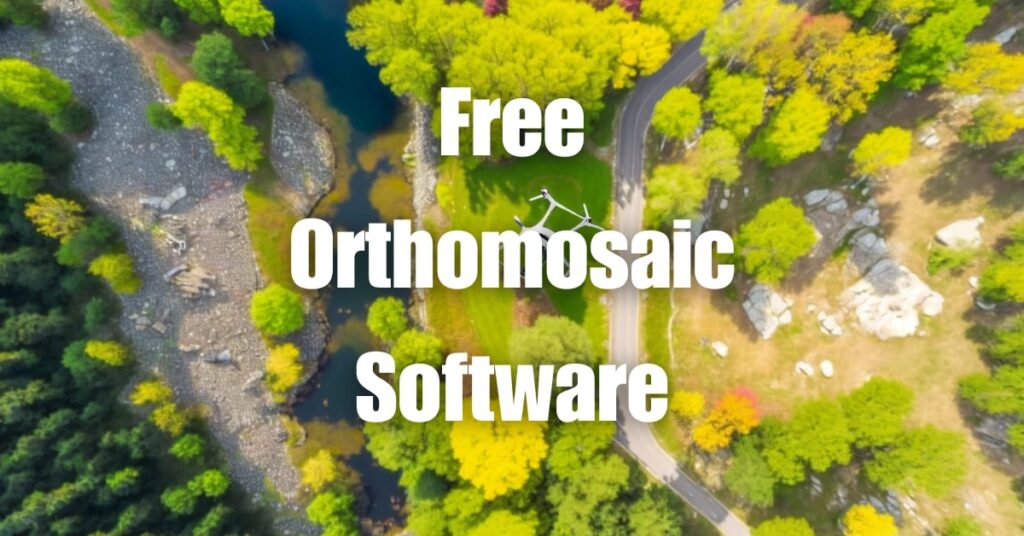
Top Free Drone Photogrammetry Software
There are several free drone photogrammetry software options available on the market that allow you to test their capabilities before committing to a paid plan. Here are some of the top choices:
Pix4Dmapper
Pix4Dmapper is a popular photogrammetry software solution that offers a free trial, allowing users to experience its powerful features for a limited time. With Pix4Dmapper, you can generate high-quality 2D and 3D maps, models, and point clouds from drone imagery.
Agisoft Metashape
Agisoft Metashape is another well-known photogrammetry software that offers a free trial version with limited features. Metashape can process drone images to create orthomosaics, digital elevation models (DEMs), and 3D models.
DroneDeploy
DroneDeploy is a cloud-based drone mapping software with a free tier that provides access to basic mapping and analysis tools. DroneDeploy is user-friendly and compatible with various drone models, making it an excellent option for beginners.
OpenDroneMap
OpenDroneMap is an open-source photogrammetry software that provides a free and customizable solution for drone mapping. OpenDroneMap can generate orthomosaics, point clouds, and 3D models from drone images.
Maps Made Easy
Maps Made Easy is a web-based drone mapping software with a pay-as-you-go model that allows you to use the software for free, with some limitations. Maps Made Easy is known for its user-friendly interface and compatibility with various drone models.
How to Choose the Right Software for Your Needs
When selecting drone photogrammetry software, it’s essential to consider your specific requirements and goals. Here are some tips for choosing the right software based on various use cases:
Best drone photogrammetry software for small businesses
Small businesses may require a cost-effective and user-friendly solution. In this case, consider trying DroneDeploy or Maps Made Easy, as both offer affordable pricing options and intuitive interfaces.
Top free drone photogrammetry software for real estate
Real estate professionals may benefit from easy-to-use software with features tailored to property visualization. DroneDeploy offers a range of tools specifically designed for real estate applications, making it an excellent option in this category.
Easy-to-use drone photogrammetry software for beginners
Beginners may prefer a software with a gentle learning curve and a user-friendly interface. DroneDeploy and Maps Made Easy are both great choices for those new to drone photogrammetry.
Professional drone photogrammetry software for agriculture
Agricultural applications often require specialized tools for crop monitoring and analysis. Pix4Dmapper and Agisoft Metashape are popular choices among professionals for their advanced features and capabilities tailored to agricultural use.
Affordable drone photogrammetry software for construction
Construction professionals may require software with features designed for site planning, progress monitoring, and inspection. Pix4Dmapper and Agisoft Metashape are both powerful and versatile options that can be tailored to suit the needs of construction projects.
Test Driving Photogrammetry Software for Free
Before committing to a paid photogrammetry software, it’s essential to evaluate its features, ease of use, and compatibility with your specific requirements. Many drone photogrammetry software providers offer free trials or limited-feature versions, allowing you to test their capabilities without any financial commitment. Here’s how to make the most of your test drive experience:
Research and Select Suitable Software Options
Begin by researching and shortlisting photogrammetry software options that align with your project goals and requirements. Look for software that offers a free trial, limited-feature version, or a pay-as-you-go model, as these options allow you to test their features without making an upfront investment.
Register for Free Trials or Limited-Feature Versions
Once you have a list of potential software options, register for their free trials or limited-feature versions. Make sure to provide accurate information during the registration process to avoid any delays or issues in accessing the software.
Familiarize Yourself with the Software
To make the most of your test drive, invest time in learning about the software’s features and capabilities. Many software providers offer tutorials, webinars, and documentation to help you understand their offerings better. These resources can help you navigate the software and make informed decisions about its suitability for your projects.
Process Sample Datasets
Gather a sample dataset of drone images for your test drive. Ensure that the images are high-quality, geotagged, and have sufficient overlap for accurate processing. Upload the dataset to the photogrammetry software and follow the recommended processing steps to generate orthomosaics, point clouds, or 3D models. Evaluate the quality, accuracy, and level of detail in the output.
Compare Results and Make a Decision
After processing sample datasets with multiple software options, compare the results and make a decision based on factors such as output quality, ease of use, processing speed, and available features. Consider your project’s specific requirements and budget constraints when making your final decision.
Taking advantage of free trials and limited-feature versions of drone photogrammetry software can help you make an informed decision about the best software for your needs. By test driving various options, you can ensure that you invest in a solution that will provide the highest quality results for your projects.
Partnering with Blue Falcon Aerial for Orthomosaic and LiDAR Projects
While free drone photogrammetry software can provide valuable insights for various applications, partnering with a professional drone service provider like Blue Falcon Aerial can elevate your projects to new heights. Blue Falcon Aerial specializes in creating high-quality orthomosaics and LiDAR point clouds for various industries, such as construction, agriculture, and real estate.
Blue Falcon Aerial’s construction mapping services can help you monitor construction progress, plan site logistics, and ensure safety compliance. With their state-of-the-art drones and software, Blue Falcon Aerial can generate detailed orthomosaics, elevation models, and 3D models for your projects.
Moreover, Blue Falcon Aerial offers a range of deliverables tailored to suit your specific needs, including topographic maps, volumetric calculations, and contour maps. By combining their expertise in drone technology with industry-leading software, Blue Falcon Aerial can provide you with the most accurate and reliable geospatial data.
In conclusion, while free photogrammetry software can be a useful starting point, leveraging the expertise of a professional drone service provider like Blue Falcon Aerial can ensure the highest quality results for your projects. If you’re interested in learning more about drone photogrammetry or require drone services, don’t hesitate to contact Blue Falcon Aerial.
Additionally, we encourage you to visit the Ultimate Guide to Drone Photogrammetry and Orthomosaics for an in-depth understanding of the various aspects of drone photogrammetry. This comprehensive guide will provide you with valuable insights and tips to help you make the most of drone mapping technology for your projects.