
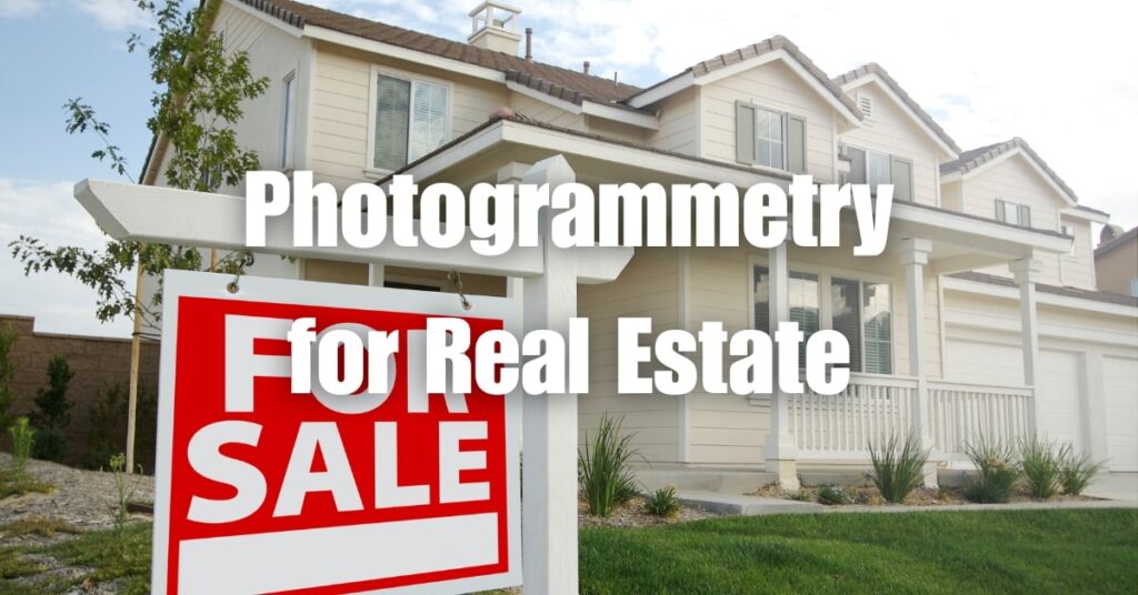
In today’s competitive real estate market, the key to standing out and closing deals quickly often lies in the presentation of your property. One emerging technology that is revolutionizing property marketing is drone photogrammetry. By capturing detailed and accurate aerial images, photogrammetry in real estate is making it easier than ever to showcase the best aspects of a property and attract potential buyers. In this article, we will explore the power of drone photogrammetry in the real estate industry, and how it can help you sell your homes in a snap.
Key Takeaways
- Drone Photogrammetry in Real Estate: The article discusses how drone photogrammetry revolutionizes real estate marketing.
- Advantages for Property Sales: Offers immersive, detailed property views, leading to quicker sales.
- Superior to Traditional Photography: Captures extensive property features and surrounding areas.
- Precision and Detail: Provides accurate measurements and topographical data.
- Diverse Applications: Useful in showcasing residential and commercial properties.
- Technological Aspects: Involves flight planning, image capture, and 3D model generation.
- Enhancing Marketing Materials: Integrates seamlessly into digital and print marketing strategies.
- Professional Service Benefits: Hiring professionals ensures quality and compliance.

Understanding Drone Photogrammetry
Definition
Drone photogrammetry is a remote sensing technique that involves capturing high-resolution aerial images using unmanned aerial vehicles (UAVs) or drones. These images are then processed and analyzed to create detailed, accurate, and scalable 3D models and maps of the surveyed area. In the context of real estate, drone photogrammetry allows for the efficient and cost-effective visualization of properties from unique perspectives, providing potential buyers with an immersive experience.
How it Works
The process of drone photogrammetry typically involves several steps:
- Flight planning: Before the drone takes off, a flight plan is created to ensure that the drone captures images with the necessary overlap and coverage.
- Image capture: The drone follows the flight plan, taking a series of high-resolution aerial images with precise geolocation information.
- Image processing: The captured images are imported into specialized photogrammetry software, which uses advanced algorithms to stitch the images together, creating a seamless, high-resolution orthomosaic.
- 3D model generation: The software then generates a 3D model or map by identifying and measuring key features and structures in the images, taking into account the geolocation data and camera parameters.
- Analysis and output: The resulting 3D model or map can be further analyzed and manipulated to extract valuable information, such as measurements, contours, and points of interest.
The Impact of Drone Photogrammetry in Real Estate
Drone photogrammetry has become an indispensable tool for real estate professionals, transforming the way properties are marketed, evaluated, and managed.
Speeding up Property Sales
High-quality aerial images and 3D models generated through photogrammetry enable potential buyers to explore properties remotely and in detail, making it easier for them to envision living in the space. This immersive experience helps create an emotional connection with the property, leading to faster sales and higher closing rates.
Enhancing Property Presentations
Traditional photography methods often struggle to capture the full extent and unique features of a property. Drone photogrammetry, on the other hand, provides a comprehensive view of the property and its surroundings, highlighting important aspects such as landscaping, architecture, and nearby amenities. These captivating visuals can be easily integrated into marketing materials, making property listings more appealing to potential buyers.
Facilitating Accurate Property Evaluations
Accurate property evaluations are crucial for setting appropriate prices and making informed decisions. Drone photogrammetry allows real estate professionals to obtain precise measurements, such as building dimensions, property boundaries, and topography, without the need for manual on-site inspections. This data can also be used to identify potential issues or maintenance needs, ensuring that properties are in optimal condition before they hit the market.
Key Aspects of Photogrammetry in Real Estate
Types of Data Collected
Drone photogrammetry provides various types of valuable data for real estate professionals, including:
- Orthomosaic images: High-resolution, georeferenced aerial images that provide a detailed and accurate view of the property and its surroundings.
- Digital Elevation Models (DEMs): 3D representations of the terrain, useful for analyzing topography, drainage, and potential construction challenges.
- 3D point clouds: A dense collection of georeferenced points, representing the surface of the property, which can be used for 3D modeling and precise measurements.
- Contour lines: Lines connecting points of equal elevation, useful for understanding the slope and elevation changes on a property.
Accuracy and Precision
The accuracy of photogrammetry in real estate depends on factors such as drone hardware, image quality, and processing software. Generally, drone photogrammetry can achieve horizontal and vertical accuracy of up to 1-3 centimeters, making it a reliable method for capturing property data. However, it is essential to choose the right equipment and software to ensure the highest level of precision.
Software Options
Several photogrammetry software options cater to different needs and budgets. Some of the most popular options for real estate professionals include:
- Pix4Dmapper: A comprehensive photogrammetry solution that offers advanced processing and analysis tools, suitable for professionals who require high accuracy and functionality.
- Agisoft Metashape: A user-friendly option with a range of features, ideal for small to medium-sized projects.
- DroneDeploy: A cloud-based solution that allows for easy collaboration and sharing, perfect for real estate teams working on multiple projects simultaneously.
Timeframes for Completion
The time it takes to complete a photogrammetry project in real estate depends on factors such as property size, flight planning, weather conditions, and image processing requirements. Typically, capturing aerial images for an average-sized residential property can take anywhere from 30 minutes to a few hours. Processing the images and generating 3D models or maps may take additional hours or even days, depending on the complexity of the project and the chosen software.
Photogrammetry Applications in Real Estate and Related Fields
Architecture and 3D Modeling
Photogrammetry is used in architecture to create accurate and detailed 3D models of existing structures and new designs. These models help architects visualize and refine their projects, as well as communicate their ideas more effectively to clients, investors, and contractors.
Drone Mapping
Real estate drone mapping involves creating high-resolution maps and 3D models of properties using drone-captured images. These maps can be used to analyze various aspects of a property, such as topography, land use, and vegetation. Drone mapping is particularly useful for large-scale projects, such as land development, where manual inspections would be time-consuming and costly.
Comparing Photogrammetry and LiDAR
Both photogrammetry and Light Detection and Ranging (LiDAR) are remote sensing techniques used to generate 3D models and maps. While photogrammetry relies on overlapping images to create 3D data, LiDAR uses laser pulses to measure distances. In real estate, photogrammetry is generally more cost-effective and versatile, offering high-resolution visuals that can be easily integrated into marketing materials. However, LiDAR may be more suitable for specific applications, such as dense vegetation analysis or when higher accuracy is required for engineering projects.

Tips for Real Estate Professionals
Affordable Photogrammetry Services
To make the most of drone photogrammetry in real estate, consider researching and comparing different service providers. Many companies offer affordable photogrammetry services tailored to the specific needs of real estate professionals. These services may include flight planning, image capture, processing, and analysis, saving you time and resources while ensuring high-quality results.
Choosing the Right Software
Selecting the right photogrammetry software for your real estate business depends on your specific requirements, budget, and technical expertise. When comparing software options, consider factors such as ease of use, processing speed, accuracy, available features, and customer support. Opt for a solution that meets your needs while offering room for growth as your business expands.
Benefits for Marketing and Property Management
Drone photogrammetry can greatly enhance your real estate marketing efforts by providing captivating visuals that showcase properties in their best light. High-quality aerial images, 3D models, and interactive maps can be integrated into websites, social media campaigns, and print materials, helping you reach a wider audience and generate more leads.
In addition to marketing, photogrammetry can also be used for property management purposes. For example, you can monitor the progress of construction projects, assess the condition of roofs and facades, or plan landscaping and maintenance tasks more efficiently.
Building Inspection and Maintenance
Drone photogrammetry can be utilized for building inspection and maintenance, allowing real estate professionals to detect potential issues before they escalate. By capturing detailed images of hard-to-reach areas, such as roofs, facades, and gutters, you can identify signs of damage or wear and schedule repairs as needed. This proactive approach helps maintain the value of your properties and ensures a safe and comfortable environment for occupants.
Case Studies: Drone Photogrammetry Success Stories in Real Estate
Case Study 1: Enhancing Luxury Property Marketing
A high-end real estate company used drone photogrammetry to capture stunning aerial images and create an interactive 3D model of a luxury property in a prime location. By incorporating these visuals into their marketing materials, they were able to attract more potential buyers and sell the property at a premium price within a short timeframe.
Case Study 2: Streamlining Property Evaluations
A real estate appraisal firm adopted drone photogrammetry to obtain accurate measurements and assess property conditions more efficiently. By reducing the need for manual on-site inspections, they were able to cut costs, save time, and provide their clients with more reliable and comprehensive evaluations.
Case Study 3: Improving Construction Project Management
A real estate developer used drone photogrammetry to monitor the progress of a large-scale residential construction project. By generating regular updates in the form of orthomosaic images and 3D models, they were able to track the project’s progress, identify potential issues, and make informed decisions, resulting in a more efficient and successful development process.

Regulatory Considerations and Best Practices
FAA Regulations
When using drones for photogrammetry in real estate, it is essential to comply with the Federal Aviation Administration (FAA) regulations. In the United States, commercial drone operators must obtain a Part 107 Remote Pilot Certificate, adhere to altitude restrictions, avoid flying over people or moving vehicles, and respect airspace restrictions, among other requirements. Make sure to stay up-to-date with the latest regulations and seek guidance from the FAA or local authorities if needed.
Privacy Concerns
Drone photogrammetry may raise privacy concerns, as aerial images may inadvertently capture neighboring properties or people. To minimize potential issues, inform neighbors about your plans, avoid capturing unnecessary details, and consider using image-editing software to blur sensitive information. Always respect local privacy laws and regulations.
Hiring Professionals
When considering drone photogrammetry for your real estate business, it is often best to hire professional service providers with the necessary expertise, equipment, and certifications. By working with a reputable company, you can ensure high-quality results, compliance with regulations, and a smooth overall experience.
Blue Falcon Aerial: Your Trusted Partner for Orthomosaic and LiDAR Projects
Whether you are considering drone photogrammetry or LiDAR for your real estate projects, Blue Falcon Aerial offers comprehensive solutions tailored to your needs. With a proven track record in construction mapping and a wide range of deliverables, Blue Falcon Aerial can help you achieve your goals efficiently and cost-effectively. To learn more about their services and offerings, visit Blue Falcon Aerial’s Deliverables page.
Conclusion
Drone photogrammetry is a powerful tool that has transformed the real estate industry, offering countless benefits such as faster property sales, enhanced presentations, and accurate evaluations. By understanding the key aspects of photogrammetry, exploring its applications, and following best practices, real estate professionals can harness this technology to gain a competitive edge and deliver exceptional results.
To dive deeper into the world of drone photogrammetry and orthomosaics, we encourage you to visit Blue Falcon Aerial’s Ultimate Guide to Drone Photogrammetry and Orthomosaics. If you need any drone services for your real estate business, don’t hesitate to contact Blue Falcon Aerial through their contact page.

It made sense to me when you pointed out that you can expect quality results when you hire a professional drone service because they have the right experience and equipment. This is a good tip for those in the real estate business, especially when they need to sell luxury properties. I could imagine how drone services would have more abilities to showcase the beauty of each feature of a property.