Drone technology has revolutionized the way we collect and process spatial data. One of the most valuable applications of drones is the creation of orthomosaics, which are highly accurate, high-resolution aerial images. In this article, we will explore the top 10 benefits of using a drone orthomosaic, highlighting the advantages it offers in various industries and applications. From cost savings to enhanced accuracy and versatility, drone orthomosaics are changing the game for businesses and organizations worldwide.
What is a Drone Orthomosaic?
A drone orthomosaic, also known as an orthophoto or orthoimage, is a high-resolution, georeferenced aerial image created by stitching together multiple overlapping photographs captured by a drone. The process of creating an orthomosaic involves correcting for any distortions caused by the camera’s perspective, terrain variations, and the drone’s flight path, resulting in a final image that accurately represents the Earth’s surface. This true-to-scale image allows for precise measurements, such as distance, area, and elevation, to be made directly from the orthomosaic.
High-resolution Imagery
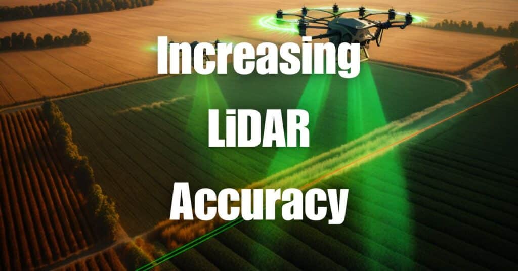
One of the most significant benefits of a drone orthomosaic is the exceptional image resolution it provides. Drones are capable of flying at lower altitudes compared to traditional aerial survey methods, such as manned aircraft or satellites, which allows them to capture images with a much higher level of detail. With resolutions as fine as 1 cm per pixel, drone orthomosaics offer unparalleled clarity and detail, enabling users to identify and analyze even the smallest features on the ground. This high-resolution imagery is crucial for applications like precision agriculture, environmental monitoring, and urban planning, where accurate and detailed data is essential for making well-informed decisions.
Cost-effective Alternative
Drone orthomosaics offer a cost-effective alternative to traditional aerial survey methods, such as manned aircraft or satellite imagery. The initial investment in drone technology can be quickly offset by the savings in time, labor, and resources associated with data collection and processing. Drone orthomosaics require fewer personnel, less equipment, and shorter data acquisition times, making them an attractive option for businesses and organizations looking to optimize their budgets while maintaining high-quality data.
Time Efficiency
Another significant advantage of drone orthomosaics is the time efficiency they offer in data collection and processing. Drones can cover large areas in a relatively short amount of time, making them ideal for applications where time-sensitive data is required. Faster data acquisition allows for more frequent updates to orthomosaics, providing up-to-date information essential for monitoring changes in land use, vegetation, and infrastructure. Moreover, advances in photogrammetry software have streamlined the process of creating orthomosaics, further reducing the time it takes to generate actionable data.
Enhanced Accuracy
Drone orthomosaics are known for their exceptional accuracy, with georeferenced images providing precise measurements of distance, area, and elevation. By correcting for distortions caused by camera perspective, terrain variations, and the drone’s flight path, orthomosaics present an accurate representation of the Earth’s surface, allowing for more reliable decision-making and analysis. This enhanced accuracy is particularly valuable in industries such as construction, mining, and engineering, where precise measurements are crucial for project planning and execution.
Easy Data Acquisition and Processing
Drone orthomosaics simplify the process of data acquisition and processing, making it more accessible to users with varying levels of technical expertise. Modern drones are equipped with user-friendly flight planning software, enabling operators to quickly define flight paths and capture the necessary images for orthomosaic creation. Additionally, advances in photogrammetry software have streamlined the process of stitching together and correcting individual images, making it easier than ever to generate high-quality orthomosaics.
Versatile Applications
The versatility of drone orthomosaics is another key benefit, with a wide range of applications across multiple industries. Here are a few examples of how drone orthomosaics are being used to drive innovation and efficiency:
Agriculture
In agriculture, drone orthomosaics help farmers monitor crop health, identify areas of stress or disease, and optimize irrigation and fertilization strategies. High-resolution orthomosaics can also be used to create variable rate prescription maps for precision agriculture, allowing farmers to apply inputs more efficiently and sustainably.
Environmental Monitoring
Drone orthomosaics play a crucial role in environmental monitoring, enabling researchers to track changes in land cover, assess habitat quality, and monitor the impacts of climate change. Orthomosaics can also be used to support conservation efforts, such as identifying and mapping invasive species or tracking the progress of habitat restoration projects.
Urban Planning and Infrastructure
In urban planning and infrastructure management, drone orthomosaics provide invaluable data for assessing the condition of roads, bridges, and other assets, helping to prioritize maintenance and repair efforts. Orthomosaics also support city planning and development by providing accurate data on land use, zoning, and the built environment.
Disaster Response and Recovery
Drone orthomosaics are a valuable tool in disaster response and recovery efforts, providing up-to-date, high-resolution imagery that enables emergency managers to assess damage, identify areas of need, and plan effective response strategies. Additionally, orthomosaics can be used to monitor recovery efforts and inform long-term planning for disaster resilience.
Facilitates Collaboration
Drone orthomosaics facilitate collaboration among teams, stakeholders, and even across different organizations. The georeferenced and accurate nature of orthomosaics makes them an ideal tool for sharing data, discussing plans, and making informed decisions. By providing a common visual reference, orthomosaics help to improve communication and ensure that everyone involved in a project has access to the same high-quality information.
Safe and Minimally Invasive Data Collection
Collecting data using drones for orthomosaic creation is a safer and less invasive alternative to traditional data collection methods. Drones can be operated remotely, reducing the risk to personnel working in hazardous or hard-to-reach areas. Additionally, drone flights have a minimal environmental impact compared to manned aircraft, making them a more sustainable option for data collection, especially in sensitive ecosystems or protected areas.
Customizable and Scalable Solutions
Drone orthomosaics offer customizable and scalable solutions to meet the specific needs of various industries and applications. With the ability to tailor flight plans, sensor payloads, and image resolutions, drones can capture data that is highly relevant and targeted to the project at hand. Furthermore, drone technology can be easily scaled up or down depending on the size and scope of a project, making it a flexible solution for organizations of all sizes.
Rapid Data Update and Change Detection
Drone orthomosaics enable rapid data updates and change detection, providing users with the most current information available. As drones can be deployed quickly and efficiently, orthomosaics can be created and updated more frequently than with traditional aerial survey methods. This allows for real-time monitoring of changes in land use, infrastructure, and environmental conditions, enabling organizations to respond proactively to emerging issues and make data-driven decisions.
In conclusion, the benefits of a drone orthomosaic are numerous and span across multiple industries. From high-resolution imagery and cost-effectiveness to enhanced accuracy and versatile applications, drone orthomosaics have become an indispensable tool for businesses and organizations looking to make better-informed decisions. To learn more about drone applications and photogrammetry, we highly recommend reading our Ultimate Guide to Drone Photogrammetry and Orthomosaics.
If you need any drone services or have questions about how orthomosaics can benefit your operations, don’t hesitate to contact Blue Falcon Aerial. Our team of experts is ready to assist you in harnessing the power of drone technology to transform your business or organization.