Multispectral imaging has revolutionized precision agriculture by offering a comprehensive view of crop health and enabling farmers to optimize their resources. In this in-depth guide, we’ll explore how multispectral drones work and discuss their impact on the agriculture industry.
What is Multispectral Imaging?
Multispectral imaging is a technology that captures images at different wavelengths, allowing for a detailed analysis of various aspects of the environment. In agriculture, multispectral imaging can help farmers identify crop stress, assess soil quality, and track the growth of plants.
The Benefits of Multispectral Imaging in Agriculture
Multispectral imaging offers several benefits for farmers, including:
- Improved Crop Health Monitoring: By detecting subtle differences in plant coloration, multispectral imaging can identify areas of crop stress before they become visible to the naked eye.
- Efficient Resource Management: Multispectral imaging helps farmers optimize the use of fertilizers, water, and pesticides by pinpointing problem areas in their fields.
- Increased Yield: By addressing crop stress early, farmers can improve overall crop health and potentially increase their yields.
How Multispectral Drones Work
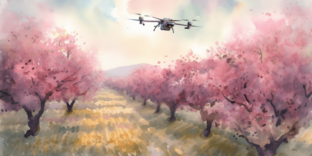
Multispectral drones are equipped with specialized cameras that capture images at different wavelengths. These images are then processed and analyzed to provide valuable insights about crop health and soil conditions. Here’s a closer look at how multispectral drones work:
Multispectral Cameras
Multispectral cameras capture images in specific bands of the electromagnetic spectrum, typically including visible light and near-infrared (NIR) wavelengths. These cameras can detect changes in plant coloration and reflectance, which are indicators of crop health and stress.
Image Processing
After capturing the images, software algorithms process the data to create a visual representation of the field. These visualizations highlight differences in plant health, allowing farmers to quickly identify problem areas.
Data Analysis
Once the images are processed, farmers can analyze the data to determine the most effective course of action. This may include adjusting irrigation schedules, applying targeted fertilizers, or using pesticides more efficiently.
Multispectral Imaging Applications in Precision Agriculture
Multispectral imaging has a wide range of applications in precision agriculture:
- Crop Health Monitoring: By detecting changes in plant reflectance, multispectral imaging can help farmers identify nutrient deficiencies, diseases, and pest infestations.
- Soil Analysis: Multispectral imaging can provide insights into soil composition, helping farmers understand the impact of soil quality on crop health.
- Irrigation Management: By identifying areas of water stress, multispectral imaging can help farmers optimize their irrigation systems.
- Yield Prediction: Multispectral imaging can be used to estimate crop yields, allowing farmers to make more informed decisions about resource allocation.
Delving Deeper: How Multispectral Drones Work
To gain a more in-depth understanding of how multispectral drones work, we need to explore the key components involved in their operation, including the multispectral camera, the drone platform, and the software used for data processing and analysis.
Multispectral Camera Technologies
Multispectral cameras are the heart of multispectral drones. These cameras capture images in several discrete spectral bands, each corresponding to a specific range of wavelengths. In agriculture, the most commonly used bands include:
- Blue (450-490 nm): Useful for analyzing vegetation and water resources.
- Green (540-580 nm): Helps identify chlorophyll absorption in plants and detect plant stress.
- Red (630-680 nm): Useful for estimating plant biomass and tracking plant growth stages.
- Near-Infrared (NIR) (750-950 nm): Provides insights into plant health and water content, as well as vegetation indices.
Multispectral cameras use filters to isolate the desired spectral bands, and advanced sensors detect the intensity of light in each band. These sensors then convert the light into digital data, which is processed and analyzed by specialized software.
Drone Platforms
The drone platform carries the multispectral camera and provides the necessary stability for capturing high-quality images. Key factors that determine the efficiency of a drone platform for multispectral imaging include:
- Flight endurance: Longer battery life allows drones to cover larger areas in a single flight.
- Payload capacity: A higher payload capacity enables the drone to carry more advanced multispectral cameras and additional sensors.
- GPS accuracy: Accurate GPS systems ensure precise geolocation of the captured images, allowing for better data analysis.
- Stability and wind resistance: These factors are essential for capturing sharp, high-resolution images.
Data Processing and Analysis Software
Once the multispectral camera has captured images, specialized software processes and analyzes the data. This software can perform several functions:
- Stitching individual images together to create a composite image of the entire field.
- Correcting for any distortions or inconsistencies in the images.
- Calculating vegetation indices, such as the Normalized Difference Vegetation Index (NDVI), which provide a quantitative measure of crop health.
- Generating visualizations, such as heatmaps, to highlight areas of concern within the field.
Farmers can then use these visualizations and data insights to make informed decisions about irrigation, fertilizer application, and pest management.
In summary, multispectral drones operate by integrating advanced camera technologies, efficient drone platforms, and specialized software to provide farmers with invaluable insights into their fields. As these technologies continue to advance, we can expect even greater capabilities from multispectral drones in the future.
The Future of Multispectral Imaging in Agriculture
As drone technology continues to advance, multispectral imaging is likely to become even more essential in precision agriculture. With improvements in image resolution, battery life, and data processing capabilities, multispectral drones will be able to provide even more valuable insights to farmers.
Additionally, integrating multispectral imaging with other technologies like satellite imagery, machine learning, and the Internet of Things (IoT) will further enhance the capabilities of precision agriculture.
Conclusion
Multispectral imaging is a game-changing technology that has revolutionized precision agriculture. By providing valuable insights into crop health and soil conditions, multispectral drones empower farmers to make well-informed decisions and optimize their resources. As we continue to explore how multispectral drones work, we can expect further advancements in drone technology and data analysis, which will undoubtedly strengthen the agriculture industry.
To dive deeper into the world of drone technology and its applications in various industries, including agriculture, we highly recommend visiting Soaring High: A Comprehensive Guide to Building and Growing Your Drone Business. This resource will provide you with a wealth of information on the expanding capabilities of drones and how they can benefit your business.
If you require any drone services or have questions about multispectral imaging, don’t hesitate to contact Blue Falcon Aerial. Our team of experts is always ready to help you harness the power of drone technology. To get in touch, visit our contact page and reach out to us today.