Riding the wind, exploring the sky, and capturing breathtaking views, drones have unlocked an entirely new perspective of the world around us. With technology that’s as innovative as it is accessible, anyone can take to the skies. Whether you’re an enthusiastic hobbyist or a budding professional, this complete guide will help you fly drones in Bartlesville in a way that’s both fun and responsible. We’ll cover everything from local laws and regulations to the best drone-flying locations. So, strap in and get ready to unleash your drone into the Bartlesville sky.
The Rising Popularity of Drones
Drones, or unmanned aerial vehicles (UAVs), have surged in popularity over the past decade. Once a niche technology reserved for military applications, drones have now found their way into the mainstream, becoming a staple in various industries and hobbies alike.
Drone Uses and Applications
From aerial photography to precision agriculture, drones have a multitude of uses. They’ve revolutionized how we capture moments and memories, allowing for stunning aerial shots that were previously possible only with expensive helicopter rides.
In agriculture, drones equipped with specialized sensors can monitor crop health, optimize irrigation, and manage pests, leading to improved yield and sustainability. Meanwhile, in the real estate sector, drones offer a unique perspective, providing potential buyers with a bird’s-eye view of properties.
Drones are also used extensively in surveying and mapping. With the advent of advanced technologies like LiDAR and orthomosaic services, drones can create accurate, high-resolution maps and 3D models, proving invaluable in industries like construction, mining, and archaeology.
Growth of the Drone Industry
The drone industry has seen substantial growth over recent years. According to a report by Grand View Research, the global drone services market size was valued at USD 4.4 billion in 2019 and is expected to grow at a compound annual growth rate (CAGR) of 60.9% from 2020 to 2027.
This growth is driven by increasing demand across various sectors, favorable regulatory scenarios, and technological advancements. As a result, more and more people are exploring the possibilities of drone technology, whether as a hobby or a profession.
Understanding the Basics of Drone Flying
Before you can start to fly drones in Bartlesville, it’s crucial to understand the basics of drone flying. This includes familiarizing yourself with drone components and understanding how to operate them.
Drone Components
A typical drone consists of various components, each serving a specific purpose. Here are the key parts of a drone:
- Propellers: These are the spinning blades that provide lift and enable the drone to fly. Most consumer drones have four propellers, hence being referred to as ‘quadcopters’.
- Motors: These power the propellers. They need to be powerful enough to lift the drone and any additional payload, like a camera.
- Battery: This is what powers your drone. Battery life can vary greatly, but most consumer drones can fly for around 20 to 30 minutes on a single charge.
- Camera: Many drones come with a built-in camera for capturing photos and videos. Some drones also allow you to attach your own camera.
- Controller: This is how you control your drone. It can take a bit of practice to master, but most drone controllers are designed to be intuitive.
Basic Drone Operation
Operating a drone involves understanding the controls and knowing how to maneuver it safely. Here are some essential operations:
- Takeoff and Landing: These are crucial skills to master. Most drones have a one-touch takeoff and landing feature. Make sure your drone is on a flat surface before takeoff and that the landing area is clear of obstacles.
- Hovering: This is the ability to maintain your drone at a steady altitude. It’s a fundamental skill for capturing stable photos and videos.
- Rotation and Movement: Learn how to rotate your drone (yaw) and move it forwards and backwards (pitch), and side to side (roll).
Remember, practice makes perfect. Start in an open, obstacle-free area, and gradually build up your skills. Soon, you’ll be ready to fly drones in Bartlesville.
Local Laws and Regulations for Flying Drones in Bartlesville
Before unleashing your drone into the Bartlesville sky, it’s crucial to understand and follow the local laws and regulations. The drone landscape is governed by both federal and local laws, designed to ensure the safety, privacy, and respect of all citizens.
FAA Regulations
The Federal Aviation Administration (FAA) is the governing body that regulates airspace and the use of drones in the United States. Here are some key rules you should be aware of:
- Drone Registration: If your drone weighs between 0.55 lbs (250 grams) and 55 lbs (25 kg), you must register it with the FAA.
- Fly Below 400 Feet: To avoid interfering with manned aircraft, you should fly your drone below 400 feet.
- Keep Drone in Sight: Always keep your drone within your visual line of sight.
- Avoid Airports: Unless you have special permission, avoid flying within five miles of an airport.
For a more comprehensive understanding, consider visiting the FAA’s website for detailed drone rules and regulations.
Specific Bartlesville Rules
In addition to federal laws, you should also be aware of any local ordinances in Bartlesville. It’s always a good idea to check with the local city hall or law enforcement agency for specific rules about flying drones in the area.
Best Locations to Fly Drones in Bartlesville
Bartlesville offers a plethora of locations that provide not only a safe flying environment but also visually stunning landscapes. Here are some of the best places to fly your drone:
Scenic Areas
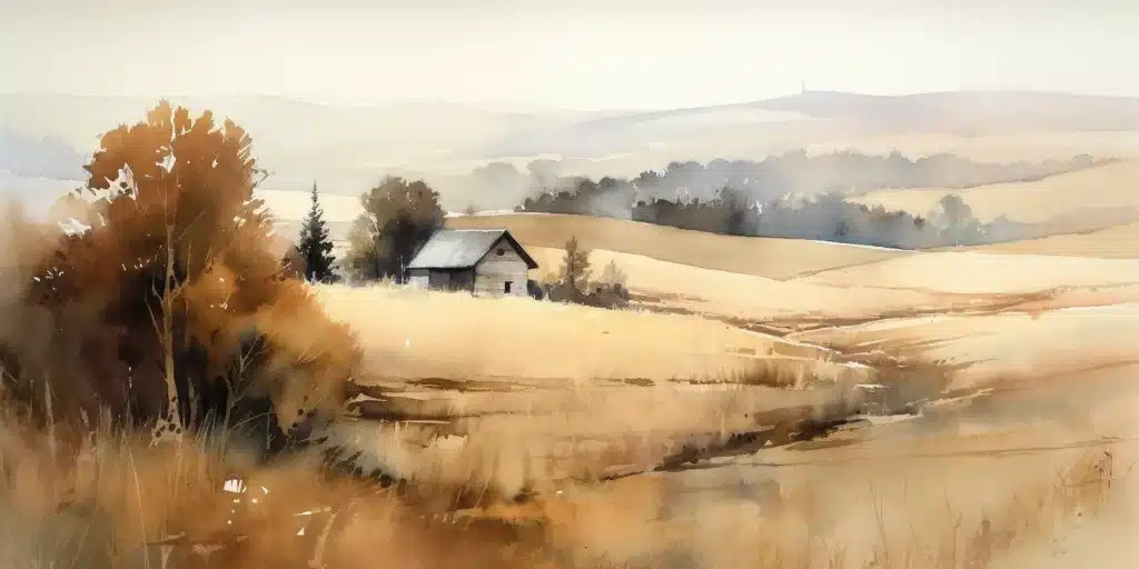
Osage Hills State Park: With its rolling hills, lush forests, and sparkling water bodies, Osage Hills State Park offers a perfect backdrop for capturing stunning aerial footage.
Tallgrass Prairie Preserve: Home to free-ranging bison, the Tallgrass Prairie Preserve offers a unique opportunity to capture the unspoiled beauty of the native tallgrass prairie.
Parks and Recreational Areas
Sooner Park: With its sprawling green space, Sooner Park is an excellent location for beginner drone pilots to practice their skills.
Johnstone Park: This park’s open spaces make it a safe place for drone flying, while its proximity to downtown offers a unique blend of nature and cityscape views.
Always remember to respect the privacy of others and abide by all local and federal regulations while enjoying your drone flying experience in Bartlesville.
Advantages of Using Professional Drone Services
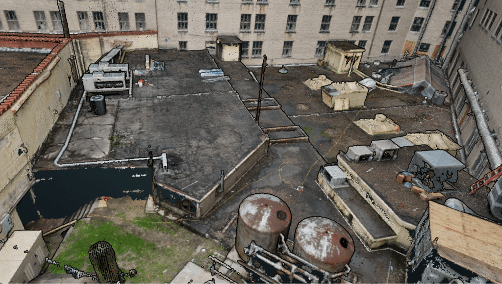
While flying a drone can be a thrilling experience, there are situations and projects where professional drone services stand head and shoulders above DIY drone operations. These services leverage advanced technologies like Aerial LiDAR and Orthomosaic services to deliver detailed, accurate data and imagery.
Aerial LiDAR
LiDAR, which stands for Light Detection and Ranging, is a remote sensing method used to examine the surface of the Earth. When mounted on a drone, LiDAR units emit rapid pulses of laser light at a surface, and a sensor on the instrument measures the amount of time it takes for each pulse to bounce back. This information is used to create detailed three-dimensional information about the shape of the Earth and its surface characteristics.
Professional drone services using Aerial LiDAR provide several benefits:
- High Precision: Aerial LiDAR can provide highly accurate elevation data, which can be used for creating topographic maps and 3D models.
- Efficiency: LiDAR can cover larger areas more quickly compared to traditional surveying methods.
- Versatility: LiDAR can penetrate vegetation and capture data under the canopy, making it suitable for a wide range of applications including forestry, environmental research, and infrastructure development.
Orthomosaic Services
An orthomosaic is a detailed, accurate photo representation of an area, created out of many photos that have been stitched together and geometrically corrected (“orthorectified”) so that it is as accurate as a map.
Using drones for orthomosaic services comes with its own set of advantages:
- High Resolution: Orthomosaics created from drone-captured images offer high-resolution details, providing valuable insights for industries like agriculture, construction, and real estate.
- Time and Cost Efficiency: Using drones for orthomosaic services can save significant time and reduce costs compared to traditional surveying methods.
- Flexible Data Analysis: Orthomosaics can be used in Geographic Information Systems (GIS) for further analysis, including measurements and change detection.
By leveraging these advanced technologies, professional drone services like those offered by Blue Falcon Aerial can provide valuable data and insights, whether you’re a farmer looking to monitor crop health, a real estate agent showcasing a property, or a city planner mapping out a new infrastructure project.
In conclusion, drones have revolutionized the way we interact with our environment, providing access to unique perspectives and valuable data. Flying a drone in Bartlesville is not only a thrilling hobby but can also be a tool for various professional applications, especially when equipped with sophisticated technology like Aerial LiDAR and Orthomosaic services.
We’ve discussed the key aspects of drone flying, including the basics, local laws and regulations, and the best locations to fly your drone. Yet, there’s so much more to learn and explore. We encourage you to visit our website for more information and insights on drone technology and services. As a local Oklahoma business, Blue Falcon Aerial is ready to assist you with all your drone needs, whether it’s capturing the perfect aerial shot or conducting a detailed survey of your property.
If you have any questions or if you need professional drone services, don’t hesitate to reach out to us at Blue Falcon Aerial. Together, let’s explore the sky in a new light.