Oklahoma’s infrastructure plays a vital role in the state’s economic growth and the daily lives of its residents. Ensuring its safety and efficiency is crucial, and that’s where drones for infrastructure inspection in OK come in. Blue Falcon Aerial, a local Oklahoma company, has been at the forefront of this innovative approach, utilizing cutting-edge drone technology to inspect and maintain the state’s infrastructure. In this article, we’ll explore the benefits of aerial drone inspections and why choosing a local company like Blue Falcon Aerial makes a difference.
The Growing Importance of Infrastructure Inspections
The Current State of Oklahoma’s Infrastructure
Oklahoma’s infrastructure, like that of many other states in the United States, faces numerous challenges. According to the American Society of Civil Engineers’ 2021 Infrastructure Report Card, Oklahoma received an overall grade of C- for its infrastructure. This grade indicates the urgent need for improvements in various sectors, including roads, bridges, and water systems.
The Need for Regular Inspections and Maintenance
Regular inspections and maintenance are essential to ensure the safety, efficiency, and longevity of any infrastructure. These activities help identify potential issues, such as structural deficiencies, corrosion, or damage, before they become critical and lead to catastrophic failures. Timely inspections and maintenance can also minimize the need for expensive and disruptive repairs, ultimately saving taxpayers money.
Traditional Methods of Infrastructure Inspection
Limitations and Challenges
Traditional infrastructure inspection methods often involve human inspectors using specialized equipment such as ropes, harnesses, and lifts to access hard-to-reach areas. While these methods have served their purpose for many years, they come with several limitations and challenges:
- Safety risks: Inspectors working at heights or in dangerous conditions are exposed to various hazards, such as falls, accidents, or electrocution.
- Time-consuming: Manual inspections can take a significant amount of time, particularly when inspecting large structures or areas.
- Expensive: The cost of equipment, labor, and potential downtime during inspections can add up quickly.
- Limited accessibility: Some areas may be difficult or impossible to access using traditional methods, leading to incomplete inspections.
- Subjectivity: Human inspectors may interpret data differently or miss critical issues, leading to inconsistent results.
These challenges highlight the need for alternative methods that can improve efficiency, reduce risks, and provide more accurate and consistent results.
The Role of Drones in Infrastructure Inspection
How Drones Work for Infrastructure Inspections
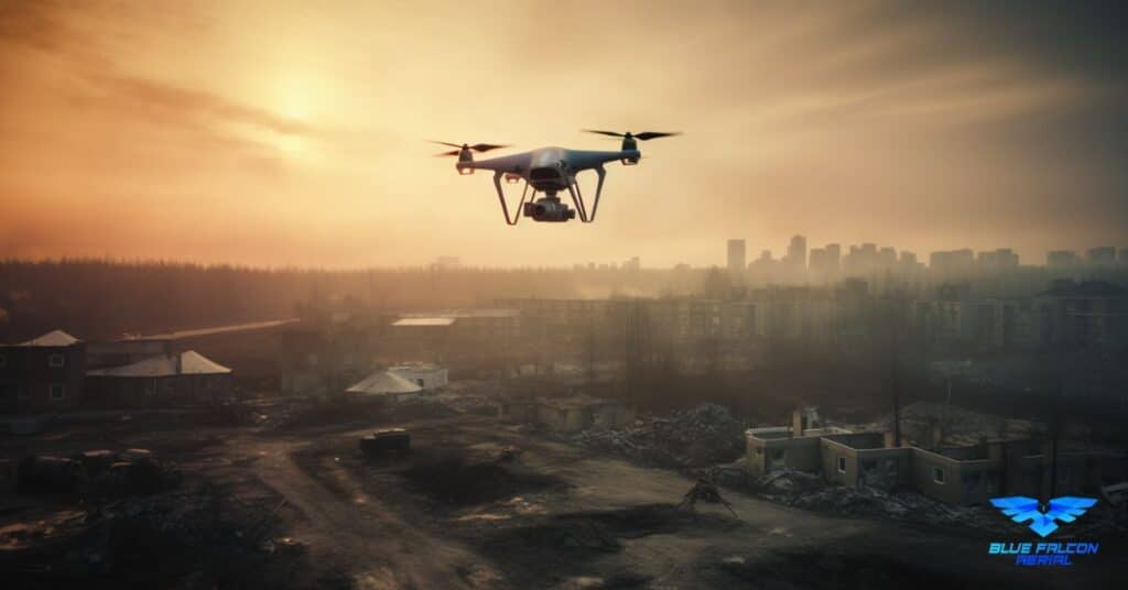
Drones, also known as Unmanned Aerial Vehicles (UAVs), are remotely piloted aircraft equipped with cameras, sensors, and other advanced technology. They can be flown close to structures, capturing high-resolution images and collecting data that can be analyzed to identify potential issues. Drones offer a faster, safer, and more efficient alternative to traditional inspection methods.
Key Advantages of Using Drones
Drones offer several advantages for infrastructure inspections, including:
- Safety: By eliminating the need for human inspectors to work at heights or in hazardous environments, drones significantly reduce the risk of accidents and injuries.
- Efficiency: Drones can cover large areas and capture detailed data much faster than human inspectors, reducing the time required for inspections.
- Cost savings: Drones can help lower inspection costs by reducing labor, equipment, and downtime expenses.
- Accessibility: Drones can easily access hard-to-reach or dangerous areas, ensuring more comprehensive inspections.
- Consistency: Drones can capture precise, high-resolution images and data, minimizing subjectivity and human error.
Types of Infrastructure that Can Be Inspected Using Drones
Drones can be used to inspect a wide range of infrastructure, including:
- Bridges
- Roads
- Utility infrastructure (power lines, pipelines, etc.)
- Buildings and structures
- Dams and levees
- Flood control and stormwater management systems
Comparison of Drone Inspections and Traditional Methods
Drone inspections offer a more accurate, efficient, and safer alternative to traditional methods. While traditional inspections rely on human expertise and judgment, drones can capture high-resolution images and data with minimal risk to inspectors. Moreover, drones can access hard-to-reach areas, ensuring more comprehensive inspections.
The Use of Drones for Maintenance Inspections and Initial Inspections
Drones can be used for both maintenance and initial inspections. For maintenance inspections, drones can help identify wear and tear, corrosion, or structural damage that may require repair or replacement. For initial inspections, drones can provide valuable data for assessing the overall condition of a new infrastructure project, ensuring it meets safety and quality standards.
Types of Sensors and Cameras Used in Drone Inspections
Various sensors and cameras can be used for drone inspections, including:
- High-resolution RGB cameras for detailed visual inspections
- Thermal cameras for detecting temperature anomalies and potential issues
- LiDAR sensors for creating accurate 3D models and maps
- Multispectral cameras for assessing vegetation and environmental factors
Drone Accuracy in Inspections and Surveys
Drones offer high accuracy in inspections and surveys, often surpassing traditional methods. High-resolution cameras and advanced sensors enable drones to capture detailed, accurate data that can be analyzed using specialized software. This level of precision allows for better decision-making and more targeted maintenance efforts.
Specific Use Cases of Drones for Infrastructure Inspection in OK
Bridge Inspections
Drones can quickly and safely inspect bridges for structural issues, corrosion, or damage. By capturing high-resolution images and data, drones enable engineers to make informed decisions about maintenance and repairs, ultimately prolonging the lifespan of these critical structures.
Road Inspections
Drones can be used to inspect roads for cracks, potholes, and other signs of wear and tear. They can also assess drainage systems and traffic patterns, providing valuable data for road maintenance and improvement efforts.
Utility Inspections (Power Lines, Pipelines, etc.)
Drones can inspect utility infrastructure such as power lines, pipelines, and telecommunications towers for signs of damage or wear. By identifying issues early, utilities can minimize disruptions and ensure the safe and efficient delivery of essential services.
Flood Control and Stormwater Management
Drones can be utilized for inspecting flood control systems and stormwater management infrastructure, including dams, levees, and retention ponds. By capturing detailed images and data, drones can help identify potential weaknesses or areas of concern, allowing for more effective management of flood risks and water resources.
Drone Laws and Regulations in Oklahoma
Federal Drone Regulations
While Oklahoma does not have specific state-level drone laws, drone operators must comply with federal regulations set by the Federal Aviation Administration (FAA). The FAA has established specific rules and guidelines for commercial drone operations, including infrastructure inspections. Some key regulations include:
- Drone operators must obtain a Part 107 Remote Pilot Certificate by passing a knowledge test.
- Drones must be registered with the FAA and display a registration number.
- Drones must weigh less than 55 lbs (including payload) and be operated within visual line-of-sight.
- Drone flights must take place during daylight hours or civil twilight (with appropriate lighting), below 400 feet above ground level, and not exceed 100 mph.
- Drone operators must obtain airspace authorizations for controlled airspace operations through the FAA’s LAANC system or by applying for a Part 107 waiver.
Obtaining a Commercial Drone License in Oklahoma
To obtain a commercial drone license in Oklahoma, operators must follow these steps:
- Review the FAA’s Part 107 regulations and ensure compliance with all requirements.
- Prepare for the Part 107 Remote Pilot Certificate knowledge test by studying the FAA’s test prep materials and/or attending a training course.
- Schedule and take the knowledge test at an FAA-approved testing center. The test consists of 60 multiple-choice questions, and a score of 70% or higher is required to pass.
- Complete the FAA Form 8710-13 for the Remote Pilot Certificate using the FAA’s IACRA system and pass the TSA security background check.
- Receive the Remote Pilot Certificate from the FAA, which will be valid for two years. To renew the certificate, operators must pass a recurrent knowledge test.
Best Drones for Infrastructure Inspections
Factors to Consider When Selecting a Drone
When choosing a drone for infrastructure inspections, consider the following factors:
- Payload capacity: Ensure the drone can carry the necessary cameras and sensors for your inspection requirements.
- Flight time: Opt for a drone with a longer flight time to minimize the need for battery changes during inspections.
- Stability and wind resistance: Choose a drone with good stability and wind resistance to ensure accurate data collection in various weather conditions.
- GPS accuracy: Select a drone with high GPS accuracy to ensure precise data collection and mapping.
Top Drones for Infrastructure Inspections
Some of the best drones for infrastructure inspections include:
- DJI Matrice 300 RTK: A versatile enterprise drone with a 55-minute flight time, multiple payload configurations, and advanced obstacle sensing.
- DJI Phantom 4 RTK: A reliable drone with high-precision RTK GNSS for accurate mapping and inspections.
- senseFly eBee X: A fixed-wing drone with a flight time of up to 90 minutes and the ability to carry various sensors and cameras.
- Parrot Anafi USA: A compact and portable drone with a 32-minute flight time, 32x zoom capabilities, and thermal imaging.
By selecting the right drone and partnering with an experienced service provider like Blue Falcon Aerial, you can have the right tools for successful completion of any project.
Choosing a Drone Service for Infrastructure Inspections
Key Factors to Consider
When selecting a drone service for infrastructure inspections, consider the following factors:
- Experience and expertise: Look for a drone service provider with a proven track record in infrastructure inspections, preferably with experience in your specific industry or project type.
- Certifications and licenses: Ensure the drone service provider has the necessary FAA certifications, such as the Part 107 Remote Pilot Certificate, and complies with all relevant regulations.
- Equipment and technology: Choose a provider that uses advanced drone technology, including high-resolution cameras and sensors, to ensure accurate and comprehensive inspections.
- Data processing and analysis: Opt for a drone service provider that offers data processing and analysis capabilities, helping you make informed decisions based on the inspection results.
- Insurance and safety: Verify that the drone service provider has adequate insurance coverage and prioritizes safety during inspections.
Blue Falcon Aerial Services for Infrastructure Inspections
Blue Falcon Aerial, a local Oklahoma company, offers a range of drone services tailored to infrastructure inspections and construction projects. With a commitment to quality, safety, and accuracy, Blue Falcon Aerial provides a comprehensive solution for your inspection needs.
Deliverables Offered by Blue Falcon Aerial
Blue Falcon Aerial offers a variety of deliverables to cater to different project requirements:
- High-resolution aerial imagery
- 3D modeling and point clouds
- Digital surface models and contour maps
- Orthomosaic maps
- Thermal imaging
- Volumetric measurements and stockpile analysis
- Progress monitoring and reporting
Services for Civil Engineers
Blue Falcon Aerial offers services tailored to civil engineers, including:
- Site feasibility studies
- Environmental assessments
- Infrastructure inspections and assessments
- Floodplain analysis and mapping
- Earthwork and grading calculations
- Construction progress monitoring
Services for Construction Projects
For construction projects, Blue Falcon Aerial offers a range of services designed to streamline processes and improve efficiency:
- Site surveys and mapping
- Quality control and inspection
- Progress monitoring and reporting
- Resource management and logistics
- Safety inspections and hazard identification
In summary, aerial drone inspections are revolutionizing the way we approach infrastructure maintenance and safety in Oklahoma. By leveraging drone technology, we can overcome the limitations of traditional inspection methods, improving efficiency, reducing costs, and enhancing safety. Blue Falcon Aerial, as a local Oklahoma business, understands the unique challenges and needs of the state’s infrastructure and offers tailored drone solutions for various inspection use cases.
If you’re interested in learning more about how drones can help improve infrastructure inspection in Oklahoma, visit Blue Falcon Aerial and explore their range of services. Don’t hesitate to contact them if you need any drone services to ensure the safety and longevity of Oklahoma’s infrastructure.