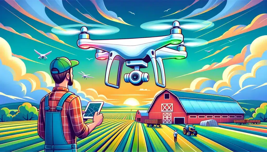
Drones have revolutionized the way we capture data and images from the sky, providing valuable insights to various industries. With the advent of drone orthomosaics, a seamless and accurate representation of large areas can be generated, opening new possibilities for data analysis and decision-making. In this article, we’ll dive into the most prominent Orthomosaic Industries that can benefit from these technological advancements, including agriculture, environmental conservation, construction, mining, and emergency services.
Understanding Orthomosaics
What is an Orthomosaic?
An orthomosaic is a georeferenced, high-resolution aerial image created by stitching together multiple overlapping drone-captured images. These images are corrected for distortions and discrepancies, resulting in a seamless, distortion-free, and true-to-scale representation of the terrain, allowing for accurate measurements and analysis.
How is an Orthomosaic created?
Creating an orthomosaic involves several steps:
- Capturing images: A drone equipped with a high-resolution camera flies over the area of interest, capturing multiple overlapping images at a consistent altitude and angle.
- Image processing: Using specialized software, the captured images are processed to correct for geometric distortions, differences in perspective, and variations in lighting and color.
- Stitching and georeferencing: The processed images are stitched together to create a seamless mosaic, while georeferencing ensures that the orthomosaic aligns with real-world coordinates, allowing for precise measurements and analysis.
How does Orthomosaic technology work?
Orthomosaic technology combines advanced drone capabilities with sophisticated image processing algorithms to create large-scale, high-resolution, and georeferenced aerial images. By correcting for distortions and discrepancies inherent in individual images, orthomosaics provide an accurate representation of the terrain, enabling precise measurements and detailed analysis.
What software is used for creating Orthomosaics?
Several software solutions are available for creating orthomosaics, including:
- Pix4Dmapper
- Agisoft Metashape
- DroneDeploy
- Global Mapper
- Esri Drone2Map
These software tools use advanced photogrammetry algorithms and techniques to process and stitch together drone-captured images, resulting in high-quality orthomosaics suitable for various applications.
Benefits and Advantages of Orthomosaics
What are the benefits of using Orthomosaics in industries?
Orthomosaics offer numerous benefits to various industries, including:
- Accuracy: Orthomosaics provide a true-to-scale representation of the terrain, enabling precise measurements, such as distances, areas, and volumes.
- High resolution: The high-resolution nature of orthomosaics allows for detailed analysis and the identification of small features and changes over time.
- Efficiency: Drone-captured orthomosaics can cover large areas quickly and efficiently, reducing the time and resources required for traditional ground-based surveying methods.
- Versatility: Orthomosaics can be used in various industries and applications, from agriculture and construction to environmental management and disaster response.
How can Orthomosaics improve mapping accuracy?
Orthomosaics improve mapping accuracy by correcting for distortions and discrepancies in individual images, providing a seamless, distortion-free, and true-to-scale representation of the terrain. This allows for accurate measurements, such as distances, areas, and volumes, and ensures that features and changes can be identified and analyzed with confidence. By combining high-resolution imagery with precise georeferencing, orthomosaics offer a level of mapping accuracy not achievable with traditional aerial photography or satellite imagery.
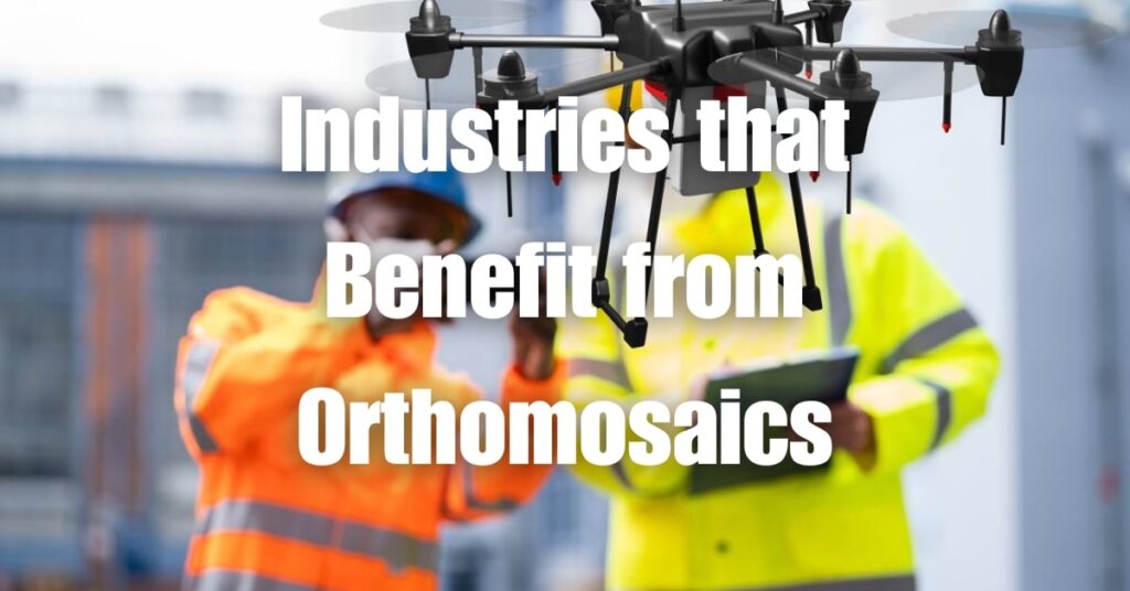
Industries Benefiting from Orthomosaics
Which industries benefit the most from Orthomosaics?
Various industries benefit from the use of orthomosaics, as they provide accurate, high-resolution aerial imagery that can be utilized for diverse applications. Some of the most prominent industries include agriculture, construction, mining and quarrying, environmental and wildlife conservation, emergency services and disaster management, infrastructure inspection, real estate development, and archaeology.
Which industries use Orthomosaics for surveying?
Orthomosaics are widely used for surveying purposes across multiple industries, including:
- Agriculture
- Construction
- Mining and Quarrying
- Environmental and Wildlife Conservation
- Infrastructure Inspection
- Real Estate Development
- Archaeology
These industries leverage the accuracy and efficiency of orthomosaics to obtain detailed, true-to-scale representations of large areas, enabling better decision-making, resource allocation, and overall project management.
Orthomosaic Applications in Different Industries
Agriculture
Orthomosaic applications for agriculture include:
- Crop monitoring and management: High-resolution orthomosaics enable farmers to monitor crop health, identify issues such as pest infestations or nutrient deficiencies, and apply targeted treatments to improve crop yields.
- Irrigation planning: Orthomosaics can be used to analyze topography and drainage patterns, helping farmers optimize irrigation systems for better water management and conservation.
Construction
Orthomosaic mapping for construction sites includes:
- Site planning and progress monitoring: Orthomosaics provide accurate, up-to-date information on construction site conditions, enabling better planning, progress tracking, and communication among stakeholders.
- Inspection and maintenance: High-resolution orthomosaics allow for the identification of potential issues, such as structural defects or material degradation, enabling timely corrective actions and reducing the risk of accidents or delays.
Mining and Quarrying
Benefits of orthomosaic mapping for the mining industry include:
- Resource estimation: Orthomosaics can be used to map and analyze geological features, aiding in the identification and estimation of mineral resources.
- Environmental impact assessment: High-resolution orthomosaics enable the monitoring of mining operations’ impact on the environment, helping companies comply with regulations and implement sustainable practices.
Environmental and Wildlife Conservation
Orthomosaic solutions for environmental management and wildlife conservation include:
- Habitat monitoring: Orthomosaics provide a detailed, accurate view of habitats, enabling the monitoring of ecosystem health and the identification of threats such as deforestation, pollution, or invasive species.
- Species population assessment: High-resolution orthomosaics can be used to count and track wildlife populations, aiding in the development and implementation of effective conservation strategies.
- Forestry management: Orthomosaics allow for the assessment of forest health, growth, and biomass, supporting sustainable forestry practices and resource management.
Emergency Services and Disaster Management
Using orthomosaics for disaster response includes:
- Search and rescue operations: Orthomosaics provide up-to-date, high-resolution aerial imagery, aiding emergency responders in locating and reaching people in need of assistance.
- Damage assessment and recovery planning: Orthomosaics enable the rapid and accurate assessment of damage caused by natural disasters or accidents, supporting efficient resource allocation and recovery planning efforts.
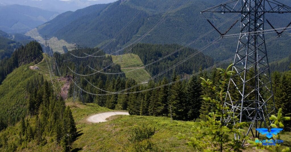
Infrastructure Inspection
Orthomosaic drone technology for infrastructure inspection involves:
- Bridge, dam, and building inspections: High-resolution orthomosaics allow for the identification of structural issues or maintenance needs, enabling timely corrective actions and reducing the risk of accidents or failures.
- Utility and transportation network monitoring: Orthomosaics can be used to assess the condition of power lines, pipelines, roads, and railways, supporting proactive maintenance and minimizing service disruptions.
Real Estate Development
Orthomosaic surveying for real estate development includes:
- Site selection and analysis: Orthomosaics provide accurate, detailed information on land features and topography, aiding developers in selecting and analyzing potential sites for new projects.
- Marketing and visualization: High-resolution orthomosaics can be used to create engaging visual representations of properties, attracting potential buyers and investors.
- Regulatory compliance: Orthomosaics enable developers to demonstrate compliance with zoning regulations and environmental requirements, streamlining the permitting process.
Archaeology
Orthomosaic solutions for archaeology include:
- Site mapping and documentation: Orthomosaics provide a detailed, accurate record of archaeological sites, preserving information on structures, artifacts, and landscape features for future study and analysis.
- Remote sensing and analysis: High-resolution orthomosaics enable archaeologists to identify and analyze potential sites of interest from the comfort of their offices, reducing the need for time-consuming and costly fieldwork.
- Cultural heritage preservation: Orthomosaics can be used to monitor and document changes in cultural heritage sites over time, helping to guide conservation efforts and inform public policy.
Renewable Energy
Orthomosaic applications in the renewable energy industry include:
- Site selection and analysis: Orthomosaics provide accurate, detailed topographic information, helping companies identify optimal locations for wind turbines, solar farms, and other renewable energy infrastructure.
- Inspection and maintenance: High-resolution orthomosaics enable the monitoring of renewable energy installations, identifying any potential issues or maintenance needs to ensure optimal performance and longevity.
- Environmental impact assessment: Orthomosaics can be used to assess the impact of renewable energy projects on the surrounding environment, aiding companies in implementing sustainable practices and meeting regulatory requirements.
Coastal and Marine Management
Orthomosaic applications for coastal and marine management include:
- Shoreline monitoring and erosion assessment: Orthomosaics provide a detailed view of coastal areas, allowing for the monitoring of shoreline changes, erosion, and sedimentation patterns, which can help inform coastal management strategies.
- Habitat mapping and conservation: High-resolution orthomosaics enable the identification and monitoring of sensitive marine habitats, such as seagrass beds and coral reefs, supporting conservation efforts and sustainable resource management.
- Disaster response and mitigation: Orthomosaics can be used to assess the impact of coastal hazards, such as storm surges and tsunamis, and develop mitigation strategies to protect coastal communities and infrastructure.
Urban Planning and Development
Orthomosaic applications in urban planning and development include:
- Land use planning and zoning: Orthomosaics provide accurate, up-to-date information on urban landscapes, aiding planners in making informed decisions about land use, zoning, and infrastructure development.
- Transportation and mobility planning: High-resolution orthomosaics can be used to analyze traffic patterns, identify congestion areas, and develop strategies for improving transportation efficiency and accessibility.
- Green space and recreational planning: Orthomosaics enable urban planners to assess the distribution and quality of green spaces and recreational areas, supporting the development of healthy, livable communities.
Blue Falcon Aerial: Your Partner for Orthomosaic and LiDAR Projects
For organizations seeking expert assistance in capturing and processing orthomosaics or LiDAR data, Blue Falcon Aerial is the ideal partner. As a leader in the drone services industry, Blue Falcon Aerial has extensive experience in providing high-quality orthomosaic and LiDAR solutions for various industries.
How Blue Falcon Aerial Can Help
Blue Falcon Aerial’s team of professionals is equipped with the latest drone technology and advanced software tools to ensure the delivery of accurate, high-resolution orthomosaics and LiDAR data for your projects. Whether you require detailed imagery for agriculture, construction, environmental management, or any other industry, Blue Falcon Aerial can tailor their services to meet your specific needs.
Comprehensive Deliverables
Blue Falcon Aerial is committed to providing exceptional value by offering a comprehensive range of deliverables to ensure your project’s success. Some of the deliverables they provide include:
- Orthomosaics
- Digital Surface Models (DSM)
- Digital Elevation Models (DEM)
- Contour maps
- Point clouds
- 3D models
- Volumetric calculations
- Thermal imaging
Discover the full range of Blue Falcon Aerial’s deliverables here.
Contact Blue Falcon Aerial
If you’re looking for expert guidance and support for your orthomosaic or LiDAR project, don’t hesitate to contact Blue Falcon Aerial. Their team of experienced professionals is ready to help you achieve the best possible outcomes for your project.
To get in touch with Blue Falcon Aerial, visit their contact page.
In conclusion, drone orthomosaics offer remarkable benefits to various industries, helping them improve efficiency, reduce costs, and make more informed decisions. If you’re interested in learning more about how drone photogrammetry and orthomosaics work, we highly recommend visiting Blue Falcon Aerial’s Ultimate Guide to Drone Photogrammetry and Orthomosaics. As you’ve seen, the potential applications for orthomosaics are vast, and by leveraging this technology, businesses can gain a competitive edge in their respective fields.