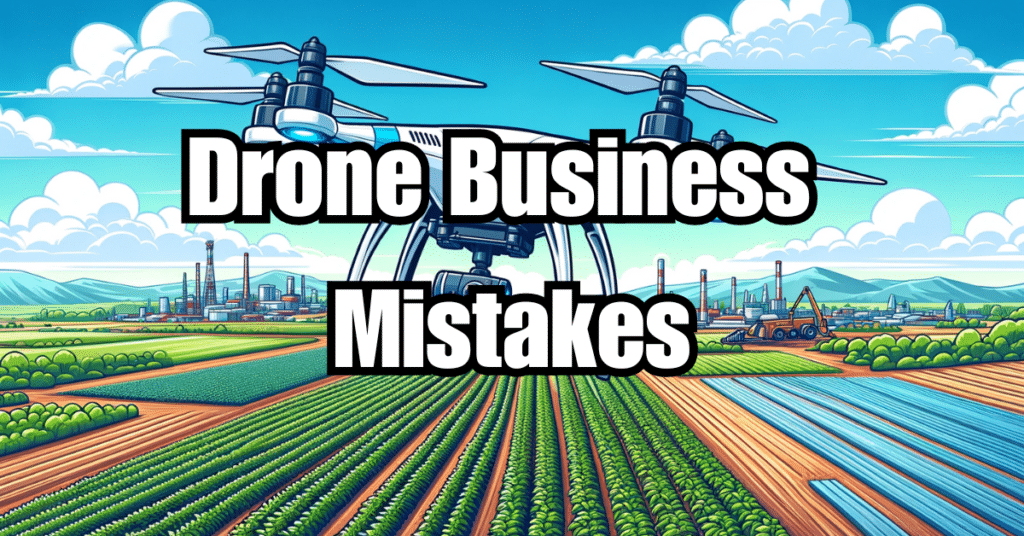
Drones have revolutionized the way we approach various industries, and their rapid development has opened up a world of opportunities. The commercial use of drones is on the rise, as businesses seek innovative and cost-effective solutions to tackle challenges and improve operations. In this article, we will delve into the benefits, requirements, and types of drones used for commercial purposes, as well as explore creative commercial applications for drones, unlocking their full potential to transform industries and make a lasting impact.
What is considered commercial use for a drone?
Commercial use of drones refers to the operation of unmanned aerial vehicles (UAVs) for business purposes or monetary gain. This includes, but is not limited to, activities such as:
- Aerial photography and videography for marketing, events, or real estate
- Infrastructure inspection and maintenance
- Agricultural monitoring and management
- Environmental conservation and research
- Search and rescue operations
- Delivery services
- Geographic information systems and mapping
In contrast, recreational or hobbyist drone use involves flying drones for personal enjoyment without any intent to make a profit.
Benefits of using drones for commercial purposes
Drones offer numerous advantages for businesses across various industries. These benefits stem from their versatility, ease of use, and cost-effectiveness. Here are some of the key benefits of using drones for commercial purposes:
Increased Efficiency and Productivity
Drones can perform tasks much faster than traditional methods, such as manual inspections or ground-based equipment. This increased speed translates to reduced labor costs, improved productivity, and faster turnaround times for projects.
Access to Hard-to-Reach Areas
Drones can easily access areas that are difficult or dangerous for humans to reach, such as high-altitude locations, hazardous environments, or remote areas. This ability significantly reduces the risks associated with certain tasks, ensuring worker safety and preventing accidents.
Enhanced Data Collection and Analysis
Equipped with advanced sensors and cameras, drones can collect high-quality data, images, and videos in real-time. This information can be used for various purposes, such as monitoring crop health, assessing structural integrity, or tracking wildlife populations.
Cost Savings
Drones often provide a more cost-effective solution compared to traditional methods, particularly when it comes to labor-intensive tasks or activities that require specialized equipment. By utilizing drones, businesses can lower their operational expenses and improve their bottom line.
Improved Safety and Risk Management
Drones can perform tasks without putting human workers in harm’s way. This reduces the potential for accidents and injuries, leading to a safer work environment and lower insurance costs.
Environmental Friendliness
Drones have a smaller environmental footprint compared to traditional methods, such as ground-based vehicles or manned aircraft. Their electric propulsion systems produce fewer emissions, and their minimal noise levels reduce disturbance to wildlife and communities.
| Benefits of Using Drones | Examples |
|---|---|
| Increased Efficiency and Productivity | Faster inspections, reduced labor costs |
| Access to Hard-to-Reach Areas | Inspecting high-altitude structures or remote locations |
| Enhanced Data Collection and Analysis | High-quality imagery for crop monitoring, wildlife tracking, or structural assessments |
| Cost Savings | Lower operational expenses compared to traditional methods |
| Improved Safety and Risk Management | Reduced risk of accidents and injuries |
| Environmental Friendliness | Lower emissions and noise levels |
Overall, the commercial use of drones presents a multitude of benefits that can help businesses streamline their operations, enhance their capabilities, and maintain a competitive edge.
Requirements for obtaining a commercial drone license
To operate a drone for commercial purposes in most countries, including the United States, you need to obtain a commercial drone license or certification. In the U.S., this certification is called the Part 107 Remote Pilot Certificate, issued by the Federal Aviation Administration (FAA). Here are the key requirements for obtaining a commercial drone license:
Age and Citizenship
- You must be at least 16 years old.
- You must be a citizen or legal resident of the country where you’re applying for the license.
Knowledge and Testing
- You must pass an initial aeronautical knowledge test at an FAA-approved knowledge testing center.
- The test covers topics such as airspace classification, flight restrictions, aviation weather, emergency procedures, and drone maintenance.
Background Check
- You must undergo a background check by the Transportation Security Administration (TSA) to ensure you don’t pose a security threat.
Recertification
- In the U.S., you’re required to pass a recurrent knowledge test every two years to maintain your Part 107 Remote Pilot Certificate.
It’s essential to familiarize yourself with local regulations and requirements in your country, as they may differ from the U.S. standards.
Types of drones used for commercial purposes
There are various types of drones available in the market, each with unique features and capabilities to suit different commercial applications. Here, we’ll discuss some of the most common types of drones used for commercial purposes:
Multirotor Drones
Multirotor drones, also known as quadcopters, hexacopters, or octocopters, are the most popular type of drones for commercial use. They are characterized by multiple propellers that provide lift and stability, making them ideal for aerial photography, videography, and inspection tasks. Multirotor drones are easy to maneuver, can hover in place, and provide a stable platform for high-quality imaging.
Pros
- Easy to operate
- Excellent stability and maneuverability
- Can hover in place
- Ideal for aerial photography and videography
Cons
- Limited flight time (usually 15-30 minutes)
- Limited payload capacity
Fixed-Wing Drones
Fixed-wing drones have a more traditional aircraft design, featuring wings for lift and a single propeller for forward thrust. These drones can cover long distances and stay airborne for extended periods, making them ideal for tasks such as mapping, surveying, and environmental monitoring.
Pros
- Longer flight times (up to several hours)
- Larger payload capacity
- Can cover vast distances
Cons
- More challenging to operate
- Requires a runway or launcher for takeoff and landing
- Not suitable for hovering or precise maneuvering
Hybrid Drones
Hybrid drones combine the best features of multirotor and fixed-wing drones. They can take off and land vertically like a multirotor drone, yet have the extended flight time and range of a fixed-wing drone. Hybrid drones are suitable for tasks that require both precision and endurance, such as large-scale mapping, agricultural monitoring, or search and rescue operations.
Pros
- Vertical takeoff and landing (VTOL) capabilities
- Longer flight times than multirotor drones
- Can cover significant distances
Cons
- More expensive than other types of drones
- May require more maintenance due to their complex design
When selecting a drone for commercial use, it’s essential to consider factors such as flight time, payload capacity, ease of use, and the specific requirements of your intended applications.
Rules and regulations for commercial drone use
As the commercial use of drones continues to grow, so does the need for regulations to ensure safety and privacy. Rules and regulations for commercial drone use vary by country, but there are some common themes and principles that apply in most jurisdictions. Below are some general guidelines that apply to commercial drone operations:
Registration and Certification
- Register your drone with the appropriate authority, such as the FAA in the United States.
- Obtain a commercial drone license or certification, like the Part 107 Remote Pilot Certificate in the U.S.
Operational Rules
- Fly below a specific altitude, usually around 400 feet (120 meters) above ground level.
- Maintain a visual line of sight with your drone at all times.
- Do not fly over people or moving vehicles unless you have a specific waiver or permission.
- Do not fly within a certain distance of airports, heliports, or other restricted airspace zones.
- Obtain permission before flying in controlled airspace or over private property.
- Avoid flying at night or in adverse weather conditions, unless you have specific authorization.
Reporting and Record-Keeping
- Report accidents or incidents involving your drone to the relevant authorities.
- Keep records of your drone operations, maintenance, and any required certifications.
It’s essential to familiarize yourself with the specific rules and regulations that apply to commercial drone operations in your country or region. Consult your local aviation authority for the most up-to-date and accurate information.
Drone insurance for commercial use
Drone insurance is an essential consideration for any commercial drone operation. It provides financial protection in case of accidents, damage, or liability claims arising from your drone activities. There are two main types of drone insurance for commercial use:
Liability Insurance
Liability insurance covers potential claims from third parties resulting from bodily injury or property damage caused by your drone operations. This type of insurance is usually required by law for commercial drone operators and can range from $500,000 to several million dollars in coverage, depending on the nature and scale of your operations.
Hull Insurance
Hull insurance covers the cost of repairing or replacing your drone if it’s damaged or lost during your operations. This type of insurance is optional, but it can be a wise investment, especially for expensive drones or those carrying valuable payloads.
When considering drone insurance for your commercial operations, keep the following factors in mind:
- The nature and scale of your operations
- The value of your drone and equipment
- The level of risk associated with your specific activities
- The legal requirements in your country or region
By obtaining appropriate drone insurance coverage, you can protect your business from potential financial losses and ensure that you operate within the bounds of the law.
How much does it cost to operate a commercial drone?
Operating a commercial drone involves various costs, which can vary depending on factors such as the type of drone, the scale of operations, and the specific industry or application. Here are some of the primary expenses associated with operating a commercial drone:
Initial Investment
- Drone and equipment purchase: The cost of the drone itself can range from a few hundred to several thousand dollars, depending on the make, model, and features.
- Accessories and spare parts: Additional costs may include extra batteries, chargers, carrying cases, replacement propellers, and other accessories.
- Training and certification: Obtaining a commercial drone license or certification typically involves a fee for the knowledge test and any necessary training courses.
Operational Expenses
- Maintenance and repairs: Regular maintenance, such as replacing worn-out parts, and occasional repairs are essential to keep your drone in optimal condition.
- Battery replacement: Drone batteries have a limited lifespan, and you’ll need to replace them periodically to maintain flight performance.
- Software subscriptions: Some commercial drones require software subscriptions for flight planning, data processing, or other specialized applications.
Insurance and Regulatory Costs
- Liability insurance: As mentioned earlier, commercial drone operators are typically required to carry liability insurance, which can be an ongoing expense.
- Registration and certification renewal: In some countries, drone registration and commercial drone certifications require periodic renewal, which may involve additional fees.
Here’s a rough breakdown of the costs associated with operating a commercial drone:
| Cost Category | Estimated Cost Range |
|---|---|
| Initial Investment | $500 to $10,000+ |
| Operational Expenses | $100 to $1,000+ per year |
| Insurance and Regulatory Costs | $500 to $2,000+ per year |
It’s crucial to evaluate your specific needs, budget, and industry requirements when determining the overall cost of operating a commercial drone.
Uses of drones for real estate marketing
Drones have revolutionized the way real estate properties are marketed, providing a unique and engaging perspective that was previously inaccessible. Here are some of the key applications of drones in real estate marketing:
Aerial Photography and Videography
Drones can capture high-quality aerial photos and videos of properties, showcasing their features, layouts, and surroundings from a bird’s-eye view. This visual content can be used in marketing materials, online listings, or virtual tours, providing potential buyers with a comprehensive understanding of the property.
3D Mapping and Modeling
Using specialized software, drones can generate accurate 3D maps and models of properties and their surroundings. These digital assets can be used to create interactive experiences for potential buyers, allowing them to explore the property virtually and better understand its dimensions, layout, and features.
Property Inspections
Drones can be used to inspect various aspects of a property, such as roof conditions, structural integrity, or surrounding landscaping. These inspections can help identify potential issues or maintenance needs, providing valuable information for both sellers and buyers.
Neighborhood Overview
Drones can provide an aerial overview of the neighborhood, showcasing nearby amenities, schools, parks, and other points of interest. This information can help potential buyers understand the property’s location and its relationship to the surrounding community.
By leveraging the capabilities of drones, real estate professionals can enhance their marketing efforts, attract more potential buyers, and ultimately close deals more efficiently.
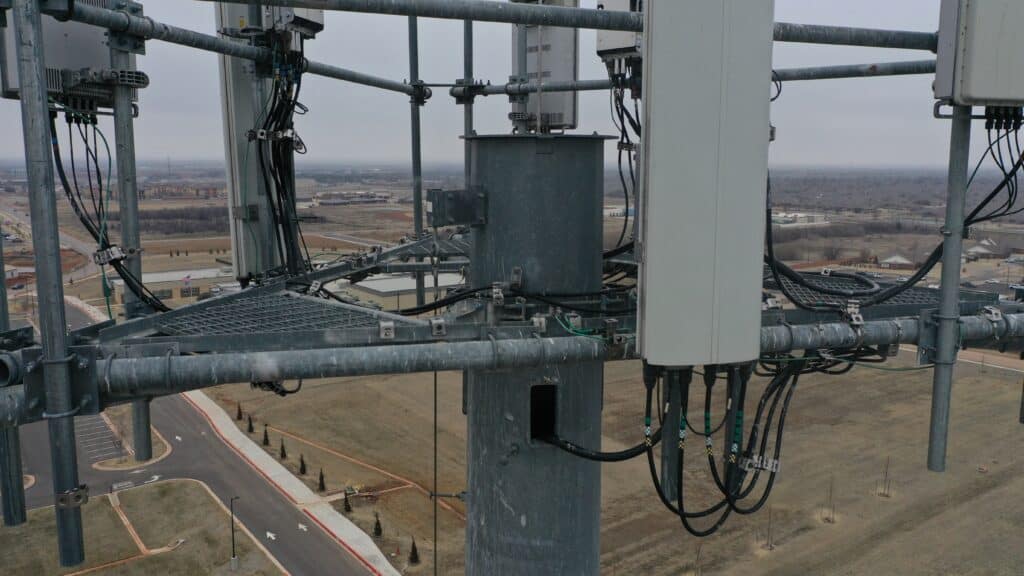
Benefits of using drones for energy inspection
Drones have become a valuable tool for inspecting energy infrastructure, such as power lines, solar panels, and wind turbines. By using drones for energy inspection, companies can improve efficiency, reduce costs, and enhance safety. Here are some of the primary benefits of using drones for energy inspection:
Improved Safety
Conducting inspections of energy infrastructure can be dangerous, especially when it involves climbing towers or navigating challenging terrain. Drones can perform inspections remotely, minimizing the risk to human inspectors and reducing the likelihood of accidents.
Faster Inspections
Drones can cover large areas quickly, allowing for more efficient inspections compared to traditional methods. This can help energy companies identify issues sooner and reduce the time required for maintenance or repairs.
Reduced Costs
By using drones for inspections, energy companies can save money on labor, equipment, and transportation costs. Additionally, drones can help prevent costly downtime by identifying issues before they lead to more significant problems.
High-Quality Data Collection
Drones equipped with high-resolution cameras, thermal imaging, and other sensors can capture detailed data during inspections. This information can help energy companies make more informed decisions about maintenance and repairs, ultimately improving the efficiency and lifespan of their infrastructure.
Minimized Environmental Impact
Drones can perform inspections with minimal environmental impact, as they do not require the use of heavy equipment or the construction of access roads. This can help energy companies reduce their environmental footprint while maintaining their infrastructure.
Advantages of using drones for mining surveys
Drones have become increasingly popular in the mining industry for conducting surveys and collecting data. Here are some of the key advantages of using drones for mining surveys:
Enhanced Safety
Mining operations can pose significant safety risks to workers, particularly when it comes to surveying and data collection. Drones can carry out these tasks remotely, reducing the risk of accidents and keeping workers out of harm’s way.
Increased Efficiency
Drones can cover large areas quickly and easily, collecting data at a faster rate than traditional surveying methods. This can help mining companies make more informed decisions and optimize their operations.
Detailed Data Collection
Drones can be equipped with various sensors, such as LiDAR, multispectral cameras, and thermal imaging, to collect detailed and accurate data about the terrain, mineral deposits, and environmental conditions. This data can be invaluable for mine planning, exploration, and environmental monitoring.
Cost Savings
By using drones for mining surveys, companies can save money on labor, equipment, and transportation costs. Additionally, the timely and accurate data collected by drones can help prevent costly mistakes and improve overall operational efficiency.
Reduced Environmental Impact
Drones can conduct surveys with minimal disturbance to the environment, making them an eco-friendly alternative to traditional surveying methods. This can help mining companies meet their sustainability goals and minimize their environmental impact.
In conclusion, drones offer numerous advantages for mining surveys, from improved safety and efficiency to detailed data collection and reduced environmental impact. By incorporating drone technology into their operations, mining companies can stay competitive and maintain a sustainable approach to resource extraction.
Agricultural Monitoring and Management
Drones have become an essential tool in modern agriculture, offering a range of applications that help farmers monitor and manage their crops more effectively. By utilizing drone technology, farmers can make more informed decisions, optimize resource usage, and ultimately increase their yields.
Crop monitoring
Crop monitoring is a crucial aspect of agricultural management, and drones offer several advantages in this area:
- Early detection of issues: Drones equipped with high-resolution cameras and multispectral sensors can identify issues such as pests, diseases, or nutrient deficiencies early on, allowing farmers to take corrective action before problems escalate.
- Precision agriculture: Drones can collect detailed data on crop health, soil conditions, and other factors, enabling farmers to apply fertilizers, pesticides, and water more efficiently and accurately.
- Irrigation management: By capturing thermal images of fields, drones can help farmers identify areas that require more or less water, allowing them to optimize their irrigation systems and conserve water resources.
- Plant counting and yield estimation: Drones can be used to count plants and estimate yields, providing valuable data that can help farmers plan for harvests and make better-informed decisions about their crops.
Environmental Conservation and Research
In addition to agricultural monitoring and management, drones are also being used for environmental conservation and research. Here are some key applications in this area:
- Habitat mapping and monitoring: Drones can quickly and efficiently survey large areas of land, capturing detailed images and data that can be used to map and monitor habitats, track changes over time, and identify threats to biodiversity.
- Wildlife observation and tracking: Drones can be used to observe and track wildlife without disturbing their natural behavior, providing valuable insights into animal populations, migration patterns, and habitat use.
- Forest management and conservation: Drones can be used to monitor forest health, identify signs of illegal logging or encroachment, and assess the effectiveness of conservation efforts.
- Disaster assessment and recovery: Drones can provide rapid assessments of natural disasters such as floods, wildfires, or landslides, helping to guide response efforts and evaluate the effectiveness of recovery strategies.
In summary, drones have become a valuable asset in both agricultural monitoring and management as well as environmental conservation and research. By leveraging the capabilities of drones, farmers and conservationists can make more informed decisions, optimize resource usage, and protect the environment for future generations.
Search and Rescue Operations
Drones have emerged as a valuable tool in search and rescue (SAR) operations, enabling teams to cover large areas quickly, efficiently, and safely. By incorporating drone technology into SAR efforts, responders can locate and assist individuals in distress more effectively.
Enhanced Situational Awareness
Drones can provide real-time aerial views of the search area, giving responders an improved understanding of the terrain and potential hazards. This information can help SAR teams plan their approach and allocate resources more efficiently.
Faster Response Times
Drones can be deployed rapidly and cover large areas quickly, significantly reducing the time it takes to locate missing persons or assess the extent of a disaster. In many cases, drones can reach remote or hard-to-access areas more quickly than ground-based teams, increasing the chances of a successful rescue.
Reduced Risk to SAR Personnel
Drones can be used to perform dangerous tasks or navigate hazardous environments, minimizing the risk to SAR personnel. By using drones to assess situations and gather information, responders can avoid unnecessary exposure to hazards and focus on providing assistance where it’s needed most.
Thermal Imaging and Night Vision Capabilities
Equipped with thermal imaging and night vision cameras, drones can locate individuals in low-visibility conditions or during nighttime operations. These capabilities can be critical for locating missing persons or assessing the extent of a disaster when traditional search methods are limited.
Delivery Services
Drones are also transforming the way goods are delivered, offering faster, more efficient, and eco-friendly alternatives to traditional delivery methods. Here are some of the key applications and benefits of drone delivery services:
Last-Mile Delivery
Drones can be used for last-mile delivery, transporting packages from local distribution centers to their final destinations. This can help reduce traffic congestion, lower emissions, and shorten delivery times, ultimately improving customer satisfaction and reducing the overall environmental impact of deliveries.
Medical Supplies and Emergency Aid
Drones can deliver essential medical supplies, such as blood, medications, and vaccines, to remote or hard-to-reach locations. In disaster situations, drones can be used to transport emergency aid, such as food, water, and medical supplies, to affected areas quickly and efficiently.
Rural and Remote Deliveries
Drones can be particularly beneficial for deliveries to rural or remote areas, where traditional delivery methods can be slow, expensive, or unreliable. By using drones to transport goods, companies can reach customers in these areas more quickly and cost-effectively.
Reduced Emissions and Energy Usage
Drones are generally more energy-efficient than ground-based delivery vehicles, producing fewer emissions and consuming less fuel. By incorporating drone technology into their delivery operations, companies can reduce their environmental impact and work towards more sustainable practices.
In conclusion, drones offer numerous advantages for search and rescue operations and delivery services, from improved safety and efficiency to reduced environmental impact. By embracing drone technology, organizations in these sectors can enhance their capabilities, streamline their operations, and better serve their communities.
Geographic Information Systems (GIS) and Mapping
Drones are increasingly being used in Geographic Information Systems (GIS) and mapping applications, providing high-resolution aerial imagery and data that can be used for various purposes, such as urban planning, environmental monitoring, and infrastructure management.
Aerial Surveys
Drones can be used to conduct aerial surveys, collecting detailed images and data that can be used to create accurate maps and 3D models. These surveys can be carried out quickly and efficiently, providing up-to-date information that can help guide decision-making and resource allocation.
Environmental Monitoring
Drones can be used to monitor environmental conditions, such as water quality, air pollution, and vegetation health. By collecting data on these factors, GIS professionals can better understand the impacts of human activities and natural processes on the environment and develop strategies to mitigate potential issues.
Infrastructure Management
Drones can be used to inspect and monitor infrastructure, such as roads, bridges, and utility networks. By providing detailed, real-time data on the condition of these assets, drones can help identify potential issues before they become critical, enabling more efficient maintenance and reducing the risk of failures.
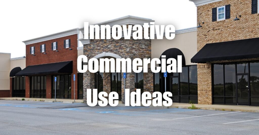
Industry-specific applications
In addition to their general use in GIS and mapping applications, drones are also being used for industry-specific applications, such as real estate marketing, construction, and more.
Real estate marketing
Drones are increasingly being used in real estate marketing to capture stunning aerial photos and videos of properties. This high-quality imagery can help showcase properties from unique perspectives, highlighting key features and providing potential buyers with a better understanding of the property’s layout and surroundings.
Construction
Drones can be used in construction to monitor progress, inspect hard-to-reach areas, and identify potential issues before they become costly problems. By capturing high-resolution images and data, drones can help construction professionals make better-informed decisions, improve safety, and optimize their workflows.
Popular commercial drone models available in the market
There are several popular commercial drone models available in the market, each offering a range of features and capabilities to suit different applications and industries. Some of the top models include:
DJI Phantom 4 RTK: This drone is designed for high-precision mapping and surveying applications, offering centimeter-level accuracy and advanced flight planning features.
DJI Matrice 300 RTK: The Matrice 300 RTK is a versatile, heavy-duty drone suitable for a wide range of commercial applications, including aerial inspections, mapping, and search and rescue operations.
Parrot Anafi USA: This lightweight, portable drone is ideal for professional users who require high-quality imaging capabilities in a compact package. The Anafi USA features a 32x zoom, thermal imaging, and advanced flight planning features.
SenseFly eBee X: The eBee X is a fixed-wing drone designed for long-range mapping and surveying applications, offering a flight time of up to 90 minutes and the ability to cover large areas in a single flight.
Yuneec H520: The H520 is a hexacopter designed for commercial applications such as inspections, surveying, and mapping. It features a modular payload system, allowing users to swap out cameras and sensors to suit their specific needs.
By selecting the right commercial drone model for their specific needs, businesses can unlock the full potential of drone technology and gain a competitive advantage in their respective industries.
In conclusion, the commercial use of drones has the potential to revolutionize a wide array of industries, from agriculture to entertainment. As technology continues to advance, we can expect even more innovative and groundbreaking applications for these versatile machines. This article has covered various aspects of commercial drone use, including licensing requirements, popular drone models, and industry-specific applications.
If you’re interested in learning more about building and growing your drone business, we encourage you to visit Soaring High: A Comprehensive Guide to Building and Growing Your Drone Business. This resource will provide you with valuable insights and guidance on taking your drone venture to new heights.
If you require any drone services, don’t hesitate to contact Blue Falcon Aerial – your go-to experts for all things drone-related. We are here to help you harness the power of drones and transform your operations, delivering the best results possible.