As drones continue to revolutionize various industries, one of their most powerful applications is in aerial thermography. This non-contact, non-invasive technique utilizes thermal imaging cameras mounted on drones to capture temperature data from the ground or objects, providing invaluable insights across a range of sectors. In this aerial thermography overview, we will explore the technology, its importance, applications, and how to master the art of aerial thermography with drones.
Introduction to Aerial Thermography
Aerial thermography is a cutting-edge technology that combines the use of drones with infrared imaging to gather temperature data from objects or the ground. This non-destructive and non-invasive technique provides a bird’s-eye view of various landscapes, structures, and systems, revealing thermal patterns and anomalies that may not be visible to the naked eye. As an increasingly valuable tool in a wide range of industries, understanding the principles of aerial thermography is crucial for professionals looking to leverage this technology to its full potential.
In this section, we will provide an overview of aerial thermography, discussing its importance and benefits in a variety of applications. We will also explore the basics of thermography and infrared imaging, as well as the different types of thermal cameras available for drone use. With this foundation, you will be better prepared to dive deeper into the world of aerial thermography and unlock the full potential of this powerful technology.
Principles of Thermography and Infrared Imaging
To master aerial thermography, it is essential to understand the principles of thermography and infrared imaging. In this section, we will delve into the science behind these technologies and explore how they differ from other imaging methods.
Thermography Basics
Thermography is a technique that captures the heat emitted by objects in the form of infrared radiation. All objects with a temperature above absolute zero emit thermal radiation, and thermography allows us to visualize these temperature differences. Infrared thermography, a subset of thermography, specifically focuses on the infrared range of the electromagnetic spectrum, which lies between visible light and microwave radiation.
Infrared Imaging vs. Thermal Imaging
While the terms “infrared imaging” and “thermal imaging” are often used interchangeably, there is a subtle difference between the two. Infrared imaging captures a broader range of the infrared spectrum, which may include both thermal and non-thermal radiation. On the other hand, thermal imaging focuses solely on the heat emitted by objects, providing a more targeted view of temperature variations.
Types of Thermography
There are several types of thermography techniques, each with its unique applications and advantages. These include:
- Active thermography: This method involves heating the object or surface being inspected and monitoring the temperature changes over time. This technique is particularly useful for detecting subsurface defects in materials.
- Passive thermography: In contrast to active thermography, passive thermography relies on naturally occurring temperature differences in the environment. This technique is widely used in aerial thermography, where the drone-mounted camera captures temperature variations in buildings, landscapes, and other structures.
Advantages and Disadvantages of Infrared Thermography
Infrared thermography offers several advantages over other methods, such as its non-contact and non-invasive nature, the ability to cover large areas quickly, and its effectiveness in detecting hidden issues. However, there are some disadvantages, including the potential for false positives or negatives, the need for skilled interpretation of thermal images, and the influence of external factors such as weather conditions on the accuracy of the results.
Applications of Aerial Thermography
Aerial thermography has revolutionized several industries, providing valuable insights and data to enhance decision-making, improve efficiency, and reduce costs. In this section, we will discuss some of the key applications of aerial thermography using drones.
Building Inspections and Energy Audits
Aerial thermography is highly effective in detecting heat loss and insulation deficiencies in buildings. By identifying areas where energy is being wasted, property owners can make informed decisions on improving insulation, sealing leaks, and ultimately reducing energy costs.
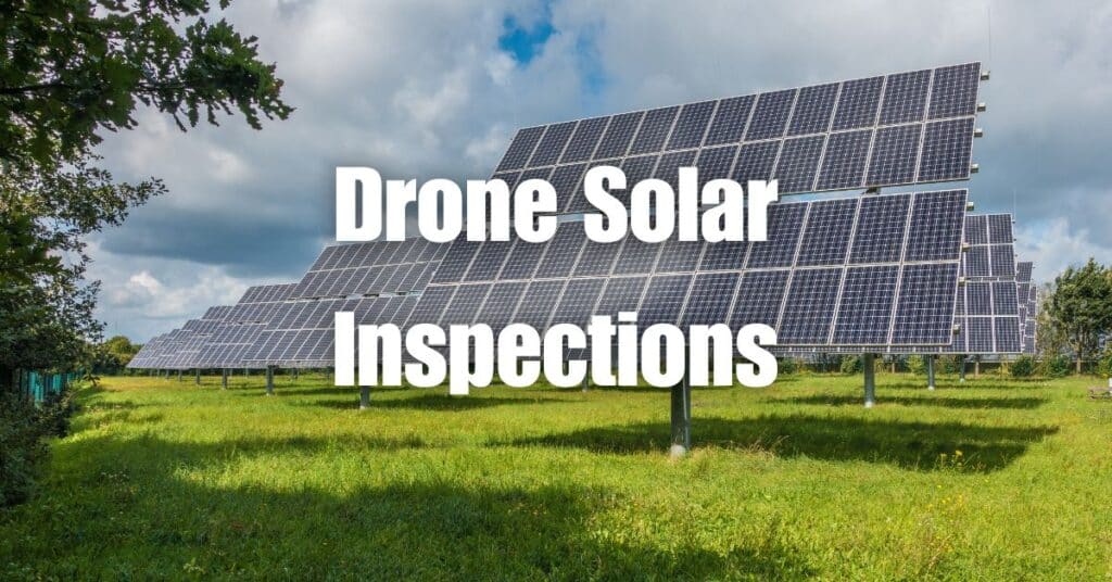
Solar Panel Inspections
Drones equipped with thermal imaging cameras can quickly and accurately inspect solar panels for defects, hotspots, and malfunctioning cells. By detecting these issues early, maintenance teams can address problems and optimize the efficiency of solar installations.
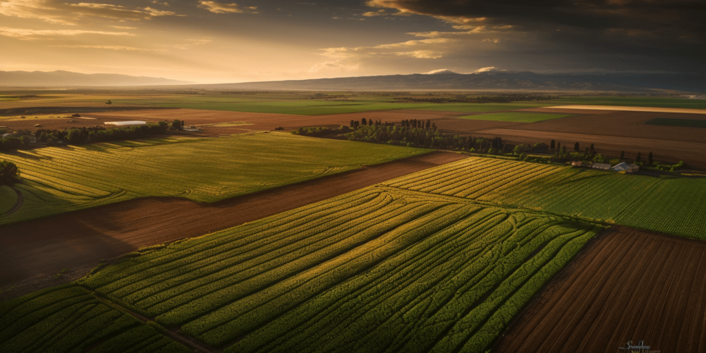
Agriculture and Crop Management
In agriculture, aerial thermography can provide critical information about crop health, irrigation needs, and pest infestations. By analyzing the thermal images, farmers can optimize water usage, identify stressed plants, and target treatment efforts to improve crop yields and overall productivity.
Wildlife Monitoring and Conservation
Aerial thermography is a valuable tool in wildlife monitoring and conservation efforts. By detecting the heat signatures of animals, researchers can track and observe wildlife populations without disturbing their natural habitats. This information can be used to develop conservation strategies, protect endangered species, and study the effects of climate change on various ecosystems.
Industrial Inspections
Aerial thermography can be used to inspect various industrial structures and equipment, such as power lines, pipelines, and cooling towers. By identifying hotspots or other signs of wear and tear, maintenance teams can address potential issues before they lead to costly failures or accidents.
Search and Rescue Operations
In search and rescue situations, time is of the essence. Aerial thermography can help locate missing persons or stranded animals by detecting their heat signatures, even in challenging environments or low-visibility conditions. This technology has been instrumental in saving lives and ensuring the safety of both rescue teams and those in need.
Preparing for an Aerial Thermography Mission
Before embarking on an aerial thermography mission, there are several important factors to consider in order to ensure accurate and reliable results. In this section, we will discuss the steps to take prior to conducting aerial thermography with drones.
Choosing the Right Equipment
Selecting the appropriate drone and thermal imaging camera is crucial for a successful aerial thermography mission. Factors to consider include the camera’s resolution, sensitivity, and field of view, as well as the drone’s flight time, payload capacity, and stability. It is also essential to select a drone that is compatible with the chosen thermal imaging camera.
Understanding Environmental Conditions
Environmental conditions, such as ambient temperature, humidity, and wind, can significantly impact the accuracy of thermal images. It is important to understand how these factors influence the thermal data and make adjustments accordingly. For instance, conducting aerial thermography missions in the early morning or late evening may help minimize the effects of solar radiation on the thermal images.
Preparing the Flight Plan
Creating a detailed flight plan is an essential step in the preparation process. The flight plan should include the mission’s objectives, the desired altitude and speed, and any necessary waypoints. It is also important to consider any potential obstacles or hazards in the flight path, such as power lines or buildings, and plan accordingly to ensure the safety of the drone and the surrounding environment.
Obtaining Necessary Permissions
Before conducting an aerial thermography mission, it is essential to obtain the necessary permissions and comply with local regulations. This may include acquiring permits, notifying relevant authorities, and adhering to specific guidelines and restrictions, such as maximum altitude limits or no-fly zones.
Calibrating the Thermal Imaging Camera
Proper calibration of the thermal imaging camera is crucial for obtaining accurate thermal data. Calibration should be performed in accordance with the manufacturer’s instructions and may include adjusting parameters such as emissivity, reflected temperature, and distance to the target. Additionally, it is essential to regularly check and update the camera’s firmware to ensure optimal performance.
Conducting the Aerial Thermography Mission
Once all preparations are complete, it is time to conduct the aerial thermography mission. In this section, we will discuss the steps involved in successfully executing the mission and collecting accurate thermal data.
Launching the Drone
Before launching the drone, ensure that all equipment is functioning properly and the camera settings are correctly configured. Choose a safe and suitable launch site, free from obstacles and interference, and ensure that the drone’s GPS system is working correctly. Launch the drone and carefully monitor its altitude, speed, and position throughout the mission.
Monitoring the Flight
During the mission, it is crucial to maintain a clear line of sight with the drone and continuously monitor its flight parameters. Ensure that the drone remains within the designated flight path, and make any necessary adjustments to avoid obstacles or hazards. It is also essential to monitor the drone’s battery life and be prepared to land the drone safely when the battery level is low.
Capturing Thermal Images
As the drone flies along the predetermined flight path, it will capture thermal images of the target area. Ensure that the thermal imaging camera is properly focused and aligned to capture clear and accurate images. It is also important to capture images at regular intervals and from multiple angles to ensure comprehensive coverage of the target area.
Analyzing the Data
Once the aerial thermography mission is complete, the captured thermal images must be analyzed to extract valuable information. This may involve using specialized software to process the thermal data and identify areas of interest, such as temperature anomalies, heat loss, or moisture infiltration. Additionally, the thermal images can be combined with other data sources, such as visual or multispectral imagery, to provide a more comprehensive understanding of the target area.
Reporting and Communicating Results
Finally, it is important to effectively communicate the results of the aerial thermography mission to relevant stakeholders. This may involve creating detailed reports, presentations, or visualizations that clearly convey the findings and their implications. It is also important to provide recommendations for further action, such as maintenance or repairs, based on the results of the aerial thermography mission.
Aerial Thermography Applications
Aerial thermography offers a wide range of applications across various industries, allowing professionals to detect and analyze temperature differences remotely and non-invasively. In this section, we will explore some of the most common and impactful uses of aerial thermography.
Building and Infrastructure Inspections
Aerial thermography is widely used in building and infrastructure inspections to identify heat loss, moisture infiltration, and other thermal anomalies. By detecting these issues early, property owners and managers can take corrective action to improve energy efficiency, prolong the lifespan of the structure, and reduce maintenance costs.
Agriculture
In the agricultural sector, aerial thermography helps farmers monitor crop health, detect irrigation issues, and identify areas of stress or disease. By providing early warning of potential problems, farmers can take proactive measures to protect their crops and optimize yields.
Solar Panel Inspections
Aerial thermography is an invaluable tool for inspecting solar panel installations, as it can quickly and accurately identify malfunctioning or underperforming panels. By pinpointing these issues, operators can maintain peak efficiency and maximize the return on investment for their solar energy systems.
Environmental Monitoring
Aerial thermography is also used in environmental monitoring, allowing researchers to track and analyze temperature changes in natural ecosystems. This can provide valuable insights into the impacts of climate change, habitat loss, and other environmental stressors on ecosystems and wildlife populations.
Emergency Services and Search and Rescue
Aerial thermography can aid emergency services and search and rescue teams by providing real-time information on the location of fires, hotspots, or missing persons. The thermal imaging capabilities of drones can help locate individuals or animals, even in low-visibility conditions, greatly improving the chances of a successful rescue.
Industrial Inspections
In industrial settings, aerial thermography can be used to detect equipment malfunctions, such as overheating motors or leaking pipes, which could lead to costly downtime or pose safety risks. By identifying these issues early, companies can take preventive action to maintain operational efficiency and protect their employees.
Overall, aerial thermography offers a versatile and powerful tool for professionals in a variety of industries. By combining the convenience and mobility of drones with advanced thermal imaging technology, aerial thermography provides a unique and effective method for monitoring and analyzing temperature differences in a wide range of applications.
Challenges and Limitations of Aerial Thermography
While aerial thermography offers numerous advantages and applications, it is important to recognize the challenges and limitations associated with this technology. In this section, we will discuss some of the most significant challenges and provide tips on how to overcome them.
Weather Conditions
Weather conditions can significantly impact the quality of aerial thermography data. For example, heavy cloud cover, rain, and fog can all affect the accuracy of temperature measurements. To mitigate these issues, it is essential to plan flights during optimal weather conditions and ensure that the drone’s sensors are calibrated correctly.
Image Resolution and Distance
The resolution of thermal images captured by drones is often lower than that of handheld cameras, which can make it challenging to identify small or subtle temperature differences. To overcome this limitation, operators should carefully select the appropriate camera and lens for the specific application and maintain the optimal distance from the target for the best possible image quality.
False Positives and Interpretation
Aerial thermography can sometimes produce false positives, leading to misinterpretations of the data. For example, reflections from shiny surfaces, such as metal or glass, can create the appearance of hotspots that do not actually exist. To minimize the risk of false positives, it is essential to carefully analyze the thermal data and, when possible, corroborate findings with other sources of information, such as visual inspections or ground-based measurements.
Regulations and Privacy Concerns
The use of drones for aerial thermography is subject to various regulations, which may vary depending on the country or region. Operators must ensure they comply with all relevant regulations, such as obtaining proper permits, maintaining safe flight altitudes, and respecting privacy guidelines. To avoid legal and ethical issues, always stay informed about the latest regulations and best practices related to drone usage.
Despite these challenges, aerial thermography remains a valuable tool in a wide range of applications. By understanding the limitations and adopting best practices, operators can make the most of this technology and continue to unlock new possibilities for data collection and analysis.
In conclusion, aerial thermography is a powerful tool that has a wide range of applications in various industries. By understanding the basics of thermal imaging, selecting the right drone and camera, and following proper data collection and processing procedures, professionals can unlock the full potential of this technology.
If you’re interested in learning more about how drones can benefit your business, we encourage you to visit Soaring High: A Comprehensive Guide to Building and Growing Your Drone Business. This resource will provide you with the knowledge and strategies necessary to succeed in the growing drone industry.
For any drone services you may need, don’t hesitate to contact Blue Falcon Aerial for professional assistance. Our team of experts is ready to help you take your operations to new heights with advanced drone solutions.