Welcome to the fascinating world of drones and Oklahoma real estate! As technology continues to evolve, drones are becoming an indispensable tool in the real estate industry, particularly in Oklahoma. By providing faster property assessments, stunning aerial photography, and cost-effective marketing, drones are changing the way properties are bought and sold. In this article, we’ll explore the incredible impact of drones on the real estate market and how Blue Falcon Aerial, a local Oklahoma company, is at the forefront of this revolution.
The Impact of Drones on Oklahoma Real Estate
Faster Property Assessments
Drones have revolutionized the way property assessments are conducted in Oklahoma. They allow real estate agents and appraisers to quickly and efficiently gather information on a property’s condition, size, and surroundings. Aerial images captured by drones provide a comprehensive view of the property, making it easier to identify any potential issues or unique features that may impact the property’s value.
High-Quality Aerial Photography and Videography
Aerial photography and videography have become essential marketing tools in Oklahoma real estate. Drones can capture stunning, high-resolution images and videos that showcase a property’s best features from unique angles. This bird’s-eye view helps potential buyers get a better understanding of the property’s layout, topography, and proximity to nearby amenities. As a result, properties with aerial imagery tend to generate more interest and often sell faster.
Cost-Effective Marketing
Drones have made aerial photography and videography more accessible and affordable for real estate professionals in Oklahoma. Traditional methods, such as hiring a helicopter or using a crane, were often costly and time-consuming. In contrast, drones can quickly capture aerial images at a fraction of the cost. This allows agents to create compelling marketing materials without breaking the bank.
Legal Aspects of Using Drones in Oklahoma Real Estate
Are Drones Legal for Use in Real Estate in Oklahoma?
Yes, drones are legal for use in real estate in Oklahoma, provided they are operated in compliance with Federal Aviation Administration (FAA) regulations and any local laws or restrictions that may apply. Real estate professionals using drones for photography or videography must ensure they are operating within the legal framework to avoid potential fines or penalties.
FAA Regulations for Drones Used in Real Estate Photography
The FAA has established regulations for the commercial use of drones, including real estate photography and videography. Key FAA regulations for real estate drone use in Oklahoma include:
- Obtaining a Remote Pilot Certificate under Part 107 by passing a knowledge test
- Registering the drone with the FAA
- Flying the drone at or below 400 feet above ground level
- Avoiding controlled airspace or obtaining necessary airspace authorizations
- Not flying over people or moving vehicles
- Maintaining visual line-of-sight with the drone at all times
- Operating the drone only during daylight hours or civil twilight with appropriate lighting
How to Get a Drone License for Real Estate Photography in Oklahoma
To obtain a drone license for real estate photography in Oklahoma, you must:
- Be at least 16 years old
- Pass the FAA Part 107 knowledge test at an approved testing center
- Complete the FAA’s online application (form 8710-13) and receive your Remote Pilot Certificate
Once you have your Remote Pilot Certificate, you can legally operate a drone for commercial purposes, including real estate photography and videography, in Oklahoma. It’s essential to stay up-to-date with any changes in regulations to ensure compliance at all times.
Benefits of Using Drones in Real Estate Marketing
Enhanced Property Visualization
Drones can capture impressive aerial images and videos that provide potential buyers with a unique perspective of the property. This enhanced visualization helps create an emotional connection with the property, allowing buyers to envision themselves living there. Aerial footage is particularly effective for showcasing large estates, waterfront properties, and properties with unique landscaping or architectural features.
Increased Buyer Interest
Properties with high-quality aerial imagery are more likely to generate interest from potential buyers. The stunning visuals captured by drones make the property stand out among the competition, attracting more views and inquiries. In turn, this can lead to quicker sales and potentially higher offers from interested buyers.
Streamlined Property Inspections
Drones can be used to perform thorough property inspections, identifying potential issues that may be difficult to spot from the ground. By providing detailed images of rooftops, chimneys, and other hard-to-reach areas, drones enable real estate agents and inspectors to quickly assess the property’s condition without the need for time-consuming and costly manual inspections.
How Can Real Estate Agents Market Drone Photography in Oklahoma?
Real estate agents can leverage drone photography in their marketing efforts by:
- Including aerial images and videos in online listings, social media, and print materials
- Creating virtual tours that incorporate drone footage to provide an immersive experience for potential buyers
- Highlighting unique property features, such as pools, gardens, or scenic views, using aerial shots
- Showcasing the property’s neighborhood and proximity to local amenities, such as schools, parks, or shopping centers
Selecting the Best Drones and Drone Pilots for Real Estate in Oklahoma
Best Drones for Real Estate Photography and Videography
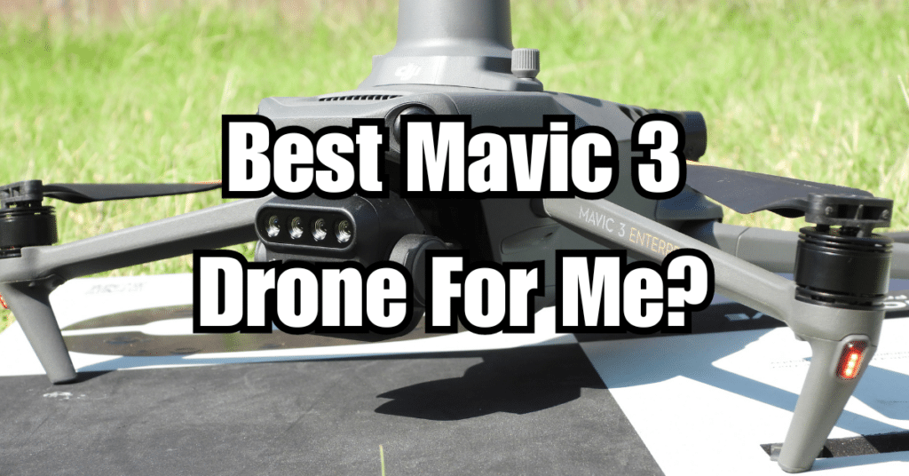
When choosing a drone for real estate photography and videography, it’s essential to consider factors such as image quality, flight stability, and ease of use. Some of the best drones for real estate in Oklahoma include:
- DJI Phantom 4 RTK: Known for its high-resolution camera and precise positioning capabilities, this drone is ideal for capturing stunning aerial images and videos.
- DJI Mavic 2 Pro: With its Hasselblad camera and 1-inch CMOS sensor, the Mavic 2 Pro delivers impressive image quality in a compact, easy-to-use package.
- Autel Robotics EVO Lite+: This drone boasts a 4/3-inch CMOS sensor and 6K video resolution, making it a solid choice for professional real estate photography.
Top-Rated Drone Pilot for Real Estate Photography
When looking for a drone pilot for real estate photography in Oklahoma, it’s crucial to hire a licensed, experienced professional with a proven track record. A top-rated drone pilot should:
- Hold a current Remote Pilot Certificate from the FAA
- Have a portfolio of high-quality aerial images and videos specific to real estate
- Be familiar with local laws and regulations governing drone use
- Offer competitive pricing and a clear, transparent quote for their services
How Much Does It Cost to Hire a Licensed Drone Pilot for Real Estate Photography in Oklahoma?
The cost of hiring a licensed drone pilot for real estate photography in Oklahoma varies depending on factors such as the size and complexity of the property, the number of images or videos required, and the pilot’s experience and reputation. On average, you can expect to pay between $150 and $500 for a standard real estate drone photography package. It’s essential to obtain multiple quotes and compare services to ensure you’re getting the best value for your investment.
Drones in Property Inspection, Appraisal, and Surveying
Can Drones Be Used for Inspecting Roofs in Real Estate in Oklahoma?
Yes, drones can be used for inspecting roofs in real estate in Oklahoma. In fact, they have become an invaluable tool for roof inspections, as they can access hard-to-reach areas and provide high-resolution images of a roof’s condition without the need for ladders or scaffolding. This not only saves time and resources but also minimizes the risk of accidents during the inspection process.
Drones and Property Inspection in Oklahoma
Drones are increasingly being used for property inspections in Oklahoma, as they offer a quick and efficient way to assess the condition of various aspects of a property. In addition to roof inspections, drones can also be used to:
- Inspect gutters, chimneys, and other exterior features
- Identify potential foundation issues or drainage problems
- Examine large trees or landscaping features for potential hazards
By providing detailed images and videos, drones enable inspectors to make more accurate assessments and provide comprehensive reports to real estate agents and buyers.
Drones and Real Estate Appraisal in Oklahoma
Drones can also play a vital role in the real estate appraisal process in Oklahoma. Aerial imagery captured by drones can provide appraisers with valuable information about a property’s size, layout, and overall condition, as well as the surrounding neighborhood and local amenities. This comprehensive perspective can help appraisers make more accurate valuations, ultimately leading to a smoother and more efficient sales process.
Drones and Property Surveying in Oklahoma
Drones have transformed the way property surveys are conducted in Oklahoma. They can quickly and accurately collect data on property boundaries, topography, and other relevant features. This information can then be used to create detailed maps and 3D models, streamlining the surveying process and providing valuable insights for real estate agents, buyers, and sellers.
Safety, Insurance, and Privacy Considerations
What Are the Safety Concerns of Using Drones for Real Estate Photography in Oklahoma?
There are several safety concerns associated with using drones for real estate photography in Oklahoma, including:
- Collision with other aircraft or obstacles, such as trees or power lines
- Loss of control due to technical issues, signal interference, or operator error
- Potential injury to people or damage to property in the event of a crash
To minimize these risks, it’s crucial to hire a licensed drone pilot who follows FAA regulations and adheres to best practices for safe drone operation.
What Type of Insurance Should a Real Estate Agent Have When Using Drones for Photography in Oklahoma?
When using drones for real estate photography in Oklahoma, it’s essential to ensure that both the drone pilot and the real estate agent have appropriate insurance coverage. Drone pilots should carry liability insurance to cover potential damages or injuries resulting from drone operation. Additionally, real estate agents should consider adding a drone endorsement to their existing errors and omissions (E&O) insurance policy, which can provide coverage for claims related to drone use in their business.
Moreover, it’s essential to respect the privacy of neighbors and others in the vicinity when capturing aerial images and videos. To avoid privacy issues, always obtain permission from property owners before conducting drone flights, and ensure that the drone pilot follows FAA regulations and local laws related to flying over private property.
How Blue Falcon Aerial Can Help with Orthomosaic and LiDAR Projects
Leveraging Advanced Drone Technology in Real Estate
As the real estate industry continues to adopt innovative drone technologies, advanced techniques such as orthomosaic mapping and LiDAR have become increasingly relevant. These cutting-edge methods allow for the creation of highly accurate, detailed maps and 3D models, providing valuable insights for property assessments, appraisals, and land development projects.
Orthomosaic Mapping and LiDAR Services by Blue Falcon Aerial
Blue Falcon Aerial is a local Oklahoma company specializing in drone services, including orthomosaic mapping and LiDAR projects. Their team of experts uses state-of-the-art drone technology to generate high-resolution, georeferenced maps, and 3D models that can be instrumental in making informed decisions in the real estate market. To learn more about the deliverables offered by Blue Falcon Aerial, visit their Deliverables page.
Conclusion
Drones have revolutionized the Oklahoma real estate market, offering numerous benefits in marketing, property assessment, appraisal, and surveying. As the industry continues to evolve, it’s crucial for real estate professionals to stay updated on the latest drone technologies and regulations to stay competitive in the market.
If you need any drone services for your real estate business, consider partnering with a local Oklahoma company like Blue Falcon Aerial. Their expertise in orthomosaic mapping, LiDAR, and other advanced drone technologies can provide you with valuable insights and compelling marketing materials to help you succeed in the industry. Don’t hesitate to visit their website and reach out to them for all your drone service needs.